


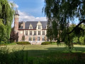
The Maison du Canal and the former border post, the ruins of Château de la Royère, and the churches in the villages of Leers and Leers-Nord.
The Maison du Canal and the two Leers


This is a lovely countryside route, straddling the border between Leers in France and Leers-Nord in Belgium. The route starts at the "Maison du Canal", a former lock-keeper’s house on the banks of the Canal de l’Espierres, which links the Canal de Roubaix to the Scheldt.
Details
Creation:
Last update:
Last review:
-
 Activity: Walking
 -
 Distance: 6.30 mi
 -
 Average duration: 2h 55
 -
 Difficulty: Moderate
 -
-
 Back to start: Yes
 -
 Ascent: + 26 ft
 -
 Descent: - 26 ft
 -
-
 Highest point: 85 ft
 -
 Lowest point: 52 ft
-
 Country:
Belgium
Country:
Belgium
-
 City:
Estaimpuis
City:
Estaimpuis -
 Start/End: N 50.690518° / E 3.257131°
 -
 IGN map(s): Ref. 2504E
 -


 Hour-by-hour weather
Waypoints
- S/E : mi 0 - alt. 59 ft - Maison du Canal
- 1 : mi 0.81 - alt. 59 ft - Leers-Nord
- 2 : mi 1.35 - alt. 62 ft - Chapel
- 3 : mi 3.03 - alt. 72 ft - Border
- 4 : mi 4.04 - alt. 82 ft - Leers
- 5 : mi 5.49 - alt. 66 ft - Roubaix Canal
- S/E : mi 6.3 - alt. 59 ft - Maison du Canal
Worth a visit
Reviews and comments
5 / 5
Based on 1 review
Ease of following the route
5 / 5
5 / 5
Route interest
5 / 5
5 / 5

laetv
Overall rating : 5 / 5
Date of your route : Jul 05, 2026
Ease of following the route : ★★★★★ Very good
Route interest : ★★★★★ Very good
Very busy route : No
A lovely flat cycle route through the countryside. Along the water’s edge, through the fields, and past little villages.
And the bar and restaurant at the finish is brilliant, especially when it’s hot.
Machine-translated
Other walks in the area
From Willems to Parc du Héron
 Visorando Member
 7.98 mi
+56 ft
-56 ft
3h 45
Moderate
7.98 mi
+56 ft
-56 ft
3h 45
Moderate
 Departure from Willems (Nord)
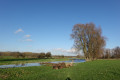
Loop passing Lac du Héron in Villeneuve-d'Ascq and Forest-sur-Marque. This walk goes along the Marque river for a while and follows part of the GR® 121B.
The Ramegnies-Chin circular route
 Association / Club / Walk leader6.68 mi
+39 ft
-43 ft
3h 05
Association / Club / Walk leader6.68 mi
+39 ft
-43 ft
3h 05
 Easy
Departure from Pecq (Hainaut)
Easy
Departure from Pecq (Hainaut)
This circular route takes you through the Scheldt plain between the two villages of Esquelmes and Ramegnies-Chin. It is a rural route along paths and small country roads. Take care when crossing the Tournai road. You will discover the pretty church of Esquelmes near the Scheldt, lined with trees, and the many calvaries and chapels. You will walk along paths lined with hedges and take small passages. At the edge of the Scheldt, you will see Mont Saint-Aubert on the other bank.
Nature around Mouscron
 8.70 mi
+230 ft
-249 ft
4h 10
Moderate
Departure from Mouscron (Hainaut)
8.70 mi
+230 ft
-249 ft
4h 10
Moderate
Departure from Mouscron (Hainaut)
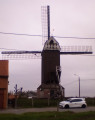
A nature walk with footpaths accessible all year round.
Le Bois Fichaux
6.17 mi
+194 ft
-177 ft
3h 00
Easy
Departure from Mouscron (Hainaut)
This is a lovely nature walk close to the town of Mouscron. It is a countryside route on small tarmac roads with little traffic and on footpaths. You will discover the Château des Comtes, surrounded by moats, and the Martine Museum. You will stroll through the Bois Fichaux on the slopes of the Mouscron hill.
Circular Forest Loop: Marque-Baisieux-Willems
 6.11 mi
+13 ft
-13 ft
2h 50
Easy
Departure from Forest-sur-Marque (Nord)
6.11 mi
+13 ft
-13 ft
2h 50
Easy
Departure from Forest-sur-Marque (Nord)
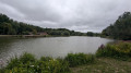
Circular loop of 10 km that is quiet and picturesque, with easy access. Car park. A lovely walk with a dog. Very little road. An easy path through beautiful, peaceful countryside.
Pecq – Tournai
 7.19 mi
+115 ft
-30 ft
3h 25
Moderate
Departure from Pecq (Hainaut)
7.19 mi
+115 ft
-30 ft
3h 25
Moderate
Departure from Pecq (Hainaut)
The fifth stage is short and straightforward to describe. Starting from Pecq, it runs to Tournai, following the Scheldt. It is by no means monotonous, however, as the river lies on one side, whilst the scenery on the other side is ever-changing. And the centre of Tournai is well worth a visit.

For more walks, use our search engine .
The GPS track and description are the property of this route's author. Please do not copy them without permission.

