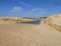
The Bénémola Fountain circular loop along the river

Discover the Algarve from the inside – the Algarve of hills and rivers – by following this short circular walk along the River Bénémola. An ideal walk for exploring the local flora.

Details

n°48363988
Creation:
Last update:
Last review:
  • Walking
    Activity: Walking
  • ↔
    Distance: 2.58 mi
  • ◔
    Average duration: 1h 20 
  • ▲
    Difficulty: Easy

  • ⚐
    Back to start: Yes
  • ↗
    Ascent: + 151 ft
  • ↘
    Descent: - 138 ft

  • ▲
    Highest point: 525 ft
  • ▼
    Lowest point: 443 ft

Description of the walk

Park in the car park right next to the M524 road, which runs from Benafim to Querença, at the start of the walk.

(S/E) Walk to the road from the car park. Follow the road to the right and head down to the bridge over the River Bénémola.

(1) Cross the bridge over the river. On the other side, immediately turn right onto a path that climbs up a hill dotted with cork oaks.

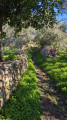
(2) At a fork in the road, take the path on the right which leads back down. Further on, rejoin the river and follow it along a shaded path. Cross the river via a ford and you’ll immediately come to a T-junction.

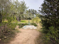
(3) Turn right here and follow thePR®16signposting, which is shared with the ‘Seven Fountains’ walk. You’ll soon reach the resurgence of the Fontaine Bénémola.

(4) Continue along the path beside the river. After passing near some old granaries, the path moves away from the river. Continue east-north-east.

(5) At the next junction, turn right. Follow thePR®16signposted path southwards, ignoring any side paths. This will take you back to the starting car park (S/E).


Waypoints

  1. S/E : mi 0 - alt. 495 ft - Car park
  2. 1 : mi 0.24 - alt. 449 ft - Bridge over the Bénémola
  3. 2 : mi 0.41 - alt. 525 ft - Fork
  4. 3 : mi 1.5 - alt. 495 ft - T-junction after a ford
  5. 4 : mi 1.58 - alt. 499 ft - Bénémola Fountain
  6. 5 : mi 1.99 - alt. 476 ft - Junction
  7. S/E : mi 2.58 - alt. 495 ft - Car park

Notes

Near point (3), there is a comfortable picnic area by the water’s edge.

An easy walk to follow along clearly signposted paths.

Worth a visit

Walk and visit to the villages of Salir and Querença.

Always be cautious and plan ahead when you're outdoors. Visorando and the author of this route cannot be held responsible for any accidents occurring on this route.

The GR® and PR® markings are the intellectual property of the Fédération Française de Randonnée Pédestre.

Reviews and comments

3.6 / 5
Based on 3 reviews

Reliability of the description
3.7 / 5
Ease of following the route
3.7 / 5
Route interest
3.3 / 5
User 19410381

Overall rating : 3 / 5

Date of your route : Jun 09, 2025
Reliability of the description : ★★★☆☆ Average
Ease of following the route : ★★★☆☆ Average
Route interest : ★★★☆☆ Average
Very busy route : No

There is hardly any shade on the path. Don't do it if it's too hot because it's stifling in the middle of the vegetation and you're not near the river for coolness.

Machine-translated

Durand-Omarjee
Durand-Omarjee

Overall rating : 4.7 / 5

Date of your route : Jun 09, 2025
Reliability of the description : ★★★★★ Very good
Ease of following the route : ★★★★★ Very good
Route interest : ★★★★☆ Good
Very busy route : Yes

An easy walk along the river. It’s a very well-signposted circular route. At one point, you can even take a dip
A pleasant walk

Machine-translated

Other walks in the area

For more walks, use our search engine .

The GPS track and description are the property of this route's author. Please do not copy them without permission.