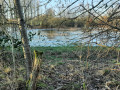
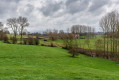
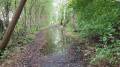
The Dendre and the Marcq at the start of the route in Deux-Acren

Come and discover this pleasant walk around Deux-Acren, in the heart of the countryside, along the Dendre or the Marcq, passing through the woods to explore a nature reserve

Details

43037637
Creation:
Last update:
Last review:
  • Walking
    Activity: Walking
  • ↔
    Distance: 5.86 mi
  • ◔
    Average duration: 2h 45 
  • ▲
    Difficulty: Moderate

  • ⚐
    Back to start: Yes
  • ↗
    Ascent: + 102 ft
  • ↘
    Descent: - 102 ft

  • ▲
    Highest point: 148 ft
  • ▼
    Lowest point: 43 ft

Photos

Description of the walk

Parking is readily available around the church in Deux-Acren.
Note: it is also possible to travel by train. Acren station is 200 m from the church.

(S/E) Walk past the church and take the alleyway running parallel to the Grand-Rue d’Acren. After a left-hand bend, cross this street, then head for the left bank of the Dendre. Continue along the Dendre until you reach the lock.

(1) Carry on and then take the Route des Moulins d’Acren to reach the Boureng Bridge.

(2) Turn right onto it to cross the Dendre, then stay on Rue de Boureng until you reach a crossroads.

(3) Turn right to reach the right bank of the Marcq. Follow this bank to reach the Prés Rosières Nature Reserve.

(4) Leave the banks of the Marcq and continue to the left. Cross the nature reserve and you will then arrive at the nature reserve’s visitor centre.

(5) Turn left onto the small path, then left again onto Rue de Boureng. You will reach the junction you passed earlier.

(3) Continue right along Rue de Boureng to return to the Pont de Boureng, which you crossed earlier.

(2) Twenty metres further on, turn left, go under the bridge and follow the left bank of the Dendre again along Rue des Moulins d’Acren. You will reach a narrow lane between the woods.

(6) Turn left onto it, then find Rue de Wangrose. Continue to the right, following the edge of the woods, then turn almost 180°, continuing in a straight line to reach the junction with Rue des Ames.

(7) Turn left here, then at the next Y-junction, keep left onto Chemin d’Acren à Grammont. Carry on until you reach a T-junction at a small lane.

(8) Take the small lane on the right. Cross Rue Bonne Nuit and then Rue de la Station d’Acren in turn. Turn left at a 90° angle along the path to return to the car park at Acren Church (S/E).


Waypoints

  1. S/E : mi 0 - alt. 82 ft - Car park - Eglise saint-martin de Deux-acren
  2. 1 : mi 0.51 - alt. 52 ft - Lock - Dendre (rivière) - Belgique - Affluent de l'Escaut
  3. 2 : mi 1.13 - alt. 56 ft - Boureng Bridge. Junction of the first circular loop - Marcq (rivière) - Belgique - Affluent de la Dendre
  4. 3 : mi 1.35 - alt. 79 ft - Boureng. Junction of the second circular loop
  5. 4 : mi 2.21 - alt. 56 ft - Réserve naturelle des prés rosières
  6. 5 : mi 2.73 - alt. 125 ft - Reception at the - Réserve naturelle des prés rosières
  7. 6 : mi 3.96 - alt. 52 ft - Wangrose
  8. 7 : mi 4.55 - alt. 69 ft - Rue des Ames
  9. 8 : mi 5.16 - alt. 66 ft - Narrow lane
  10. S/E : mi 5.86 - alt. 82 ft - Car park

Notes

Wear sturdy shoes.
Watch out for cyclists along the River Dendre.
In Deux-Acren there is a restaurant: Le Moulin.

Reviews and comments

4.4 / 5
Based on 3 reviews

Reliability of the description
4.7 / 5
Ease of following the route
4.3 / 5
Route interest
4.3 / 5
DevosTof
DevosTof

Overall rating : 4.3 / 5

Date of your route : Jun 22, 2024
Reliability of the description : ★★★★★ Very good
Ease of following the route : ★★★★☆ Good
Route interest : ★★★★☆ Good
Very busy route : No

Don’t attempt this in shorts, as a section along the water’s edge in the second part can be busy and overgrown with brambles and stinging nettles

Machine-translated

jacques urbain
jacques urbain

Overall rating : 5 / 5

Date of your route : Mar 25, 2024
Reliability of the description : ★★★★★ Very good
Ease of following the route : ★★★★★ Very good
Route interest : ★★★★★ Very good
Very busy route : No

a beautiful and varied route

Machine-translated

danicau
danicau

Overall rating : 4 / 5

Date of your route : Jan 15, 2024
Reliability of the description : ★★★★☆ Good
Ease of following the route : ★★★★☆ Good
Route interest : ★★★★☆ Good
Very busy route : No


Easy with the GPX file,

Had to change direction (the road was flooded),
apart from that, a lovely walk and stunning scenery.

Machine-translated

Other walks in the area

For more walks, use our search engine .

The GPS track and description are the property of this route's author. Please do not copy them without permission.