Circular route around Deux-Acren

The walk begins at Saint-Martin’s Church in Deux-Acren; this church was an oratory in the 7th century and has also yielded evidence of settlement dating back to the Merovingian period.
Deux-Acren is a village in Hainaut near the River Dendre, formed in 1804 from the merger of the two parishes of Acren; it has been part of the town of Lessines since 1977.

Details

42540366
Creation:
Last update:
Last review:
  • Walking
    Activity: Walking
  • ↔
    Distance: 2.62 mi
  • ◔
    Average duration: 1h 15 
  • ▲
    Difficulty: Easy

  • ⚐
    Back to start: Yes
  • ↗
    Ascent: + 43 ft
  • ↘
    Descent: - 43 ft

  • ▲
    Highest point: 102 ft
  • ▼
    Lowest point: 43 ft

Description of the walk

Park in the church car park, where it is easy to find a space. It is also possible to reach the church from Acren station by train; the station is located approximately 250 m from the church.

(S/E) Take the small alley a little way along and to the right of the war memorial

(1) Cross it and continue straight ahead along Rue de la Couture Trohelle. At the T-junction, carry on straight ahead along a lane, then reach a three-way junction. Cross this junction and stay straight ahead in the lane to reach the junction where the Chemin d’Acren meets Grammont.

(2) Turn left onto it and quickly turn right onto a small path. At the edge of the woods, join Route de Wangrose.

(3) Turn left onto this road, follow it alongside the woodland, then turn right at thefirst junction to reach the left bank of the Dendre.

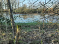
(4) Turn right to follow a pleasant stretch along the Dendre, reaching the confluence with the Marcq on the opposite right bank.

(5) Stay along the banks of the Dendre, pass the lock and continue to the junction with the Grand Rue d’Acren.

(6) Turn right onto it, then immediately left into a small alleyway. Walk past the sports grounds and then St Martin’s Church before returning to the car park (S/E).

Waypoints

  1. S/E : mi 0 - alt. 85 ft - Church car park
  2. 1 : mi 0.26 - alt. 92 ft - Rue de la Station d’Acren
  3. 2 : mi 0.69 - alt. 69 ft - The Acren to Grammont path
  4. 3 : mi 0.88 - alt. 62 ft - Route de Wangrose
  5. 4 : mi 1.2 - alt. 52 ft - Dendre (rivière) - Belgique - Affluent de l'Escaut
  6. 5 : mi 1.54 - alt. 52 ft - Confluence of the Dendre and - Marcq (rivière) - Belgique - Affluent de la Dendre
  7. 6 : mi 2.38 - alt. 59 ft - Grand Rue d’Acren
  8. S/E : mi 2.62 - alt. 85 ft - Church car park

Notes

Easy and free parking.
Easy access by train; get off at Acren station, 200 metres away.
Please note: cyclists use the path along the River Dendre

Worth a visit

Other walks in the area

For more walks, use our search engine .

The GPS track and description are the property of this route's author. Please do not copy them without permission.