The Cuesta de Belfort and the Étang de la Forge

The ‘Chemins stratégiques de la Justice’ and ‘Chemins stratégiques de la Miotte’ trails, which run along the plateaus of the same names, followed by a loop around the Forges and La Roselière nature reserve, and back to the starting point.

Details

n°14826193
Creation:
Last update:
Last review:
  • Walking
    Activity: Walking
  • ↔
    Distance: 5.18 mi
  • ◔
    Average duration: 2h 45 
  • ▲
    Difficulty: Easy

  • ⚐
    Back to start: Yes
  • ↗
    Ascent: + 384 ft
  • ↘
    Descent: - 384 ft

  • ▲
    Highest point: 1,476 ft
  • ▼
    Lowest point: 1,181 ft
  • ⚐ Country: France
  • ⚐ City: Belfort (90000)
  • ⚑
    Start/End: N 47.640175° / E 6.866773°
  • ❏
    IGN map(s): Ref. 3520ET, 3621OT
  • Hour-by-hour weather

Photos

Description of the walk

Park in the Cité des Associations car park.

(S/E) Walk to the junction, then turn right onto Avenue du Capitaine De La Laurencie, which climbs for 150 metres.

(1) Turn left onto the Chemin du Fort de la Justice and follow it for 1 km. Cross the footbridge over the D83 at the Porte du Vallon. Walk past the SPA on the Miotte ramparts, then go through the small underpass near the tower.

(2) Continue along the path which descends towards the Étang des Forges.

(3) Cross the Chemin de la Tour and head for the water sports centre.

(4) Turn right to walk all the way round the lake and return to the water sports centre. Back at the water sports centre, retrace your steps in the opposite direction along the route you took on the way out until you reach the junction with the Chemin de la Tour.

(3) Turn right and head straight on towards the allotments (200 m). Turn right and follow the track for 1 km.

(5) Turn left towards the crossroads and the Atria Hotel,
towards the Old Town, and continue to the junction with Rue sous les Remparts.

(6) Turn left for 200 m, then right at the junction to reach the Cité des Associations car park (S/E).

Waypoints

  1. S/E : mi 0 - alt. 1,207 ft - Cité des Associations car park. Near the - Citadelle de Belfort
  2. 1 : mi 0.18 - alt. 1,250 ft - Chemin du Fort de la Justice
  3. 2 : mi 1.11 - alt. 1,463 ft - Tour et Fort de la Miotte
  4. 3 : mi 1.37 - alt. 1,302 ft - Chemin de la Tour
  5. 4 : mi 1.53 - alt. 1,204 ft - Water sports centre and protected nature reserve (Roselière) - Étang des Forges (Belfort)
  6. 5 : mi 4.72 - alt. 1,184 ft - Monument to those executed by firing squad. Place Anne Franck - Savoureuse (rivière)
  7. 6 : mi 4.96 - alt. 1,181 ft - Former quay, northern entrance to the Old Town
  8. S/E : mi 5.18 - alt. 1,207 ft - Cité des Associations car park

Reviews and comments

4.7 / 5
Based on 1 review

Reliability of the description
5 / 5
Ease of following the route
4 / 5
Route interest
5 / 5
bouledjouidja rabah
bouledjouidja rabah

Hello
I’m delighted that you enjoyed this walk through the outer foothills of the Belfort Jura. The Étang des Forges marks the boundary with the start of the Vosges Piedmont (Offemont-Vétrigne).
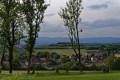
It also offers views of the Doubs department (the Lomont range) to the south-west.
These two geological areas make the Territoire de Belfort one of Europe’s richest regions in terms of plant and mushroom diversity, and it boasts a long history of mining exploration and the Industrial Revolution.
Finally, it forms a linguistic boundary between the ‘Germanic’ speakers to the north and the ‘Latin’ speakers to the south.

All the best

Machine-translated

jean-jacques.rysak
jean-jacques.rysak

Overall rating : 4.7 / 5

Date of your route : Jan 01, 2022
Reliability of the description : ★★★★★ Very good
Ease of following the route : ★★★★☆ Good
Route interest : ★★★★★ Very good
Very busy route : Yes

A pleasant walk with lovely views of Belfort and the Vosges; an easy hike suitable for families

Machine-translated

Other walks in the area

For more walks, use our search engine .

The GPS track and description are the property of this route's author. Please do not copy them without permission.