Around Glorianes

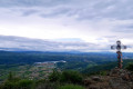
Glorianes is a small village in the Conflent region, tucked away in the mountains, and the road ends here. This fairly strenuous hike will take us to a summer pasture, with the Canigou range, Vinca and its lake as a backdrop; Glorianes is known for its old gold mines.

Details

72531224
Creation:
Last update:
Last review:
  • Walking
    Activity: Walking
  • ↔
    Distance: 8.06 mi
  • ◔
    Average duration: 6h 00 
  • ▲
    Difficulty: Moderate

  • ⚐
    Back to start: Yes
  • ↗
    Ascent: + 2,631 ft
  • ↘
    Descent: - 2,641 ft

  • ▲
    Highest point: 4,419 ft
  • ▼
    Lowest point: 2,057 ft

Description of the walk

From Vinça, take the D36 towards Rigarda. In the hamlet, follow the D36a towards Glorianes.
 Park next to the rubbish bins, near the town hall (792m); there isn’t much space for several vehicles.

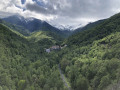
(S/E) Walk past the town hall and take the path on the left towards Coll de les Arques (yellow and white markings). The climb is quite steep, and you can catch your breath whilst admiring the scenery with Mont Canigou in the background, especially if it is snow-capped.

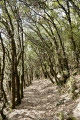
(1) After going round a house, continue climbing to the right through the woods and go through thefirst gate, making sure to close it behind you.

(2) Take the signposted path on the left and follow it to the Coll de les Arques (elevation 1022).

(3) Go through a second gate, cut across the dirt track and continue straight ahead on a wide, almost flat path. Much further on, you’ll reach a third gate.

(4) Without going through it, turn off onto the track on the right, which climbs along the ridge to Roca Deruna (elevation 1201). Fence on your left.
You can make a round trip to Coll de les Arques by going through the third gate and turning left. Signpost.

(5) The track continues to climb, moving away from the ridge, to Les Agulles (elevation 1278).

(6) When you reach a gate locked with a padlock, turn left and follow the south-eastern fence until you reach two large gates. Without going through them, turn due south along the ridge.

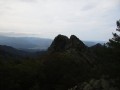
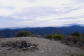
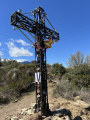
(7) Go through the small gate; there is a map post on the right. The Canigou range lies directly ahead. You will reach the ruins of the Santa Anna Chapel (elevation 1348). 

(8) Head downwards to the south-west, with the fence on your left for 100m.

(9) Pass a gate on your left. Follow the fence. Join the track via the Serrat del Ginebres.

(10) Go through a large gate, then pass through the Cortal del Pou area (elevation 1194). Continue to the track junction (elevation 1142).

(11) Turn right onto the track, which climbs slightly before beginning to descend to a path on the right (alt. 100 m).

(12) Turn right onto this path, heading broadly east, and begin the steeper descent towards the north-east. Follow this grassy track, which is overgrown in places. Beautiful scenery. The GPX track may prove useful in some of the overgrown sections.

(13) Pass the ruins of Cortal del Mig, overgrown with brambles and broom, and turn right towards the south-east, then north-east. The rest of the path is heavily overgrown and barely visible; it includes two sections where you’ll need to be careful. At the very bottom, you’ll rejoin a path marked in yellow and white (Tour de Santa Anna).

(14) Take the path on the right, which is marked in yellow and white. Cross the River Rigarda and climb very steeply up towards the hamlet. Be sure to follow the yellow and white markings. When you reach the track, turn left onto it and follow it to the village of Glorianes (S/E).

Waypoints

  1. S/E : mi 0 - alt. 2,598 ft - Small square near the town hall
  2. 1 : mi 0.12 - alt. 2,743 ft - First gate
  3. 2 : mi 0.31 - alt. 3,012 ft - Fork in the path
  4. 3 : mi 0.57 - alt. 3,363 ft - 2nd gate
  5. 4 : mi 1.42 - alt. 3,346 ft - Les Arques Pass
  6. 5 : mi 2.19 - alt. 3,891 ft - Roca Durena
  7. 6 : mi 3.1 - alt. 4,193 ft - Les Agulles
  8. 7 : mi 3.49 - alt. 4,409 ft - Gate
  9. 8 : mi 3.54 - alt. 4,416 ft - Santa Anna dels Quatre Termes (1348 m)
  10. 9 : mi 3.61 - alt. 4,377 ft - Fork in the path
  11. 10 : mi 4.13 - alt. 3,930 ft - Two large gates
  12. 11 : mi 5.05 - alt. 3,750 ft - Junction at elevation 1142
  13. 12 : mi 5.92 - alt. 3,606 ft - Eastern fork
  14. 13 : mi 6.98 - alt. 2,598 ft - Cortal del Mig ruins
  15. 14 : mi 7.32 - alt. 2,064 ft - Fork in the path
  16. S/E : mi 8.06 - alt. 2,598 ft - Small square near the town hall

Notes

Please note: you may encounter Patou dogs and sheep between the Coll de les Arques (4) and the ruins of Santa Anna (8). In this case, it is advisable to climb up to Sant-Anna with the fence on your right, always following the ridge.

Do not attempt this walk in very hot weather or strong winds. There is no water.

If you are setting off alone, let a friend or family member know your route and how long you expect to be away.

Walking boots, walking poles, GPS, a map of the walk showing the route, first-aid kit.

Bring plenty of water and snacks (dried fruit, cereal bars, etc.)

Depending on the season: a hat, gloves, warm clothing, a cap, sunglasses, sun cream.

Reviews and comments

4.1 / 5
Based on 4 reviews

Reliability of the description
4 / 5
Ease of following the route
3.8 / 5
Route interest
4.5 / 5
tkc224
tkc224

Overall rating : 3.7 / 5

Date of your route : May 18, 2026
Reliability of the description : ★★★★☆ Good
Ease of following the route : ★★★☆☆ Average
Route interest : ★★★★☆ Good
Very busy route : No

A lovely walk offering a beautiful view from its highest point. The path becomes unclear in a few places, so you’ll need to follow your GPS. The final downhill section below the village is uninteresting and can be a bit dangerous in the undergrowth. The view of the little stream below is idyllic but does not justify this finale, which involves a very steep climb back up to the village. There is no doubt a way, just past the signposts at the summit, to find another route leading back to the village.

Machine-translated

User 7573539

Overall rating : 4 / 5

Date of your route : Dec 30, 2025
Reliability of the description : ★★★★☆ Good
Ease of following the route : ★★★★☆ Good
Route interest : ★★★★☆ Good
Very busy route : No

Very beautiful hike

Machine-translated

Frédéric66
Frédéric66

Overall rating : 4 / 5

Date of your route : May 01, 2025
Reliability of the description : ★★★☆☆ Average
Ease of following the route : ★★★★☆ Good
Route interest : ★★★★★ Very good
Very busy route : No

A lovely walk with magnificent views of Mont Canigou, the Roussillon plain and the Vinça dam. It really gives you a sense of the great outdoors.
It’s more challenging than it looks in terms of elevation gain, as the ascent is split into three fairly steep sections; the climb back up to the village through the forest at the end of the walk really takes its toll. The descent is also quite steep. All the paths were well cleared of undergrowth.
The route on the app is essential, as I didn’t always fully understand the description.
I did this walk in the company of sheep, cows… and llamas.

Machine-translated

Amrando66
Amrando66

Overall rating : 4.7 / 5

Date of your route : May 01, 2025
Reliability of the description : ★★★★★ Very good
Ease of following the route : ★★★★☆ Good
Route interest : ★★★★★ Very good
Very busy route : No

Well done to whoever described this magnificent walk in such wonderful detail!

Machine-translated

Other walks in the area

For more walks, use our search engine .

The GPS track and description are the property of this route's author. Please do not copy them without permission.