Country:

 City:
City:


Park in the gravel car park opposite Wolschwiller Town Hall.
Yellow Diamond markings
(S/E) With your back to the car park and the fountain on your right, walk past it and follow the street to Montée de l’Église.
No markings
Then turn right onto this slope. Follow the street to the right of the church of the same name. At the end, turn left onto Rue de l’École.
Yellow Diamond markings
At the fork at the bottom, take the road on the right, called Rue de l'Église. Follow this road to the bend and Boersegraben.
(1) After the stream, take the path on the right. Go to the end of the path and continue along the track. At the junction, ignore the path on the right. Do the same at the next fork. Pass in front of the Oratory of Mary Magdalene to reach the Chapel of Saint John of Nepomuk.
(2) Continue along the track. Ignore a crossroads immediately after the chapel, then another with a path leading to a large building. Do not take the rutted and muddy track on the right.
Blue Diamond markings
At the Y-junction, turn left onto a gently sloping path. Do not take the next path coming from this direction, but take the second one. Further on, ignore a fork to the right and then another to the left. Then go straight on at each junction to exit the forest and reach a crossroads at a reservoir.
(3) Continue downhill opposite to reach a second four-way junction.
No signposting
Turn sharply right. At the end of the path, continue straight ahead along Rue du Réservoir to cross the Birsig stream and reach the D23.5. Follow this road to the right up to the stream. Then turn left onto the path that climbs up the Biederthal Canyon. At the end of the path, follow the stream upstream for a few metres. At the confluence of the rivers, follow the one on the left to reach a small waterfall and its pool.
(4) Return to the road.
Red Ring markings
Take the path on the left, which starts with steps. Afterwards, do not take the overgrown track that runs straight ahead, but veer slightly to the left. Cross a slightly muddy track and a second junction.
Yellow Diamond markings
At the T-junction, turn right to reach the road and the French-Swiss border.
(5) Follow this road down. Once at the bottom, take the path on the left, which leads to Burg. This marks the start of the climb, which is sometimes difficult, up the Remel massif. Continue to the second junction.
(6) Turn right at a right angle. At the next junction, take the path on the left, which continues as a track; follow this until you reach the road.
(7) Continue up the road on the left. After the first fairly sharp right-hand bend, take another right-hand bend and then continue left to reach the hamlet of Rittimatte. Continue to the benches and the junction.
(8) Stay on the ridge path along the border, with France on your right and Switzerland on your left. The climb is steep in places. Ignore a path on the right. At the flat section, first turn left then right to reach the summit ridge. At the junctions, stay on the ridge to reach the Raemelspitz and its observation mast.
(9) Continue along the ridge.
No markings
At Raemelsberg and its rocky outcrop, leave the marked path and head left to admire the view (look out for the Franco-Swiss border marking on the ground as you go).
(10) Continue along the path at the edge of the cliff and take care not to fall. Then rejoin the official path.
Yellow Diamond markings
Stay along the ridge until the next junction.
Yellow Saltire marker
(11) Turn right. Further on, ignore a path on the right and you’ll come to a wide white track. Follow this track to the left. At the next fork, keep right and follow the track to the hairpin bend. Take the bend without taking the path on the left. Turn left and ignore a junction. You’ll arrive at a large crossroads.
(12) Stay on the ridge path. Keep going straight at every junction until you reach the road.
(13) Head down the road to the left until, at a bend, you find a wide track on the right. Follow this for a few metres to the right before taking the first path on the left, which will alternate between ascents and descents until the next road. At the first junction, take a path on the left to reach another junction at Blauenberg.
(14) Stay on the ridge.
No signposting
After the final hill, ignore all the paths on the left to reach the main road.
Red Saltire
(15) Cross it carefully and continue along the track that climbs up the other side. Cross a wood and head to the fork with the Canadian crossing.
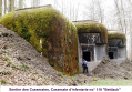
(16) Turn right to cross the passage. At the hairpin bend, where there is a broken barrier, go round the barrier on the right and take the path, which quickly descends into the forest and leads to a bunker and a junction.
(17) Continue along the path straight ahead. When you reach the white track, follow it down and round the bend to reach a large crossroads.
(18) Take the path on the right behind the logs and turn right. Return to the road.
Signpost: Red Rectangle with a white cross
(19) Cross it carefully and take the path opposite. At the crossroads, follow the marked path to the right. Please note: the IGN maps are out of date at this point. Do not take the two paths on the left. When you rejoin the track, turn right. Then continue again on the path on the right. Ignore three track junctions on the left and one on the right (tracks in varying condition) to reach the pass.
Blue Triangle markings
(20) Keep left before climbing up to the right. On the climb, ignore the path on the left, and once at the top, veer left to cross the pass. At the pass, head down the slope opposite. On the slope, turn right twice. Reach a third junction.
Blue Cross markings
(21) Take the path furthest to the right. Go straight ahead at each junction until you reach the Equestrian Lodge.
(22) Continue along the track, which turns into a narrow lane. At the end, turn left onto Rue de Kiffis.
No signposting
At the first junction, turn right onto Rue de la Scierie and head towards the Ruisseau de Lutter.
Red Triangle Signpost
(23) Cross it and continue right onto the D23. Head towards the village exit. After the ‘end of built-up area’ sign, take the track on the right. This turns into a farm track, which you should follow until the junction.
(24) Walk down Alte Strasse.
Yellow Diamond markings
At the end of this, continue left onto Rue de Kiffis to return to the car park (S/E).


 Visorando Member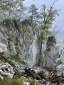
 Moderate
 Easy
Easy