La Chaubasse

Discovering the summer pastures and the origins of the people of Saint-Floret.

Details

n°45501925
Creation:
Last update:
Last review:
  • Walking
    Activity: Walking
  • ↔
    Distance: 6.00 mi
  • ◔
    Average duration: 3h 45 
  • ▲
    Difficulty: Moderate

  • ⚐
    Back to start: Yes
  • ↗
    Ascent: + 1,158 ft
  • ↘
    Descent: - 1,161 ft

  • ▲
    Highest point: 2,746 ft
  • ▼
    Lowest point: 1,601 ft

Photos

Description of the walk

Access: from Issoire, take the D996 towards Besse. After Perrier, at the Fork in the road, turn left onto the D26 towards Besse. In Saint-Floret, park at the Pont de la Pède: if there are no spaces available, cross the bridge, take the first street on the left and continue to the town hall car park.
The walk starts at the Pont de la Pède: please note that a Blue-marked walk also starts at this point; do not follow it.

Yellow markings

(S/E) Cross the Pont de la Pède over the Couze Pavin, walk past the wooden shrine to the Virgin Mary on the bridge and head up along the D627 towards the last house in the village.

(1) Take a path on the left that climbs into the woods and continue until it joins the D627. Turn right onto the D627 and follow it for 100 m, leaving the RD628 on your left.

(2) At the three-way junction, take the path on the left, which continues in line with the road, and carry on until you reach the D628.

(3) Carry on along the departmental road for about a hundred metres, then turn left following the signposts and head towards the entrance to the village of Orphange.

(4) At the drinking troughs, turn right towards the village centre and carry on to Le Montel.

(5) Turn left, take the path leading uphill, cross a track and carry on towards the Chaubasse plateau. Reach Chazeras.

(6) Turn left to cross the hamlet and, at the three-way junction, turn right. You’ll reach a crossroads by an iron cross.

(7) Then turn right, passing under the high-voltage power line.

(8) Once you are near the D627, take the path on the left which leads further on to a car park near the road and the Chastel site.

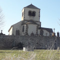
(9) Cross the departmental road, then turn left to take a detour via the cemetery and the church. Return to the D627, then take the path on the left which leads down to Saint-Floret.

(10) At the bottom, take the road on the right towards a footbridge over the Couze Pavin, cross it, then turn left and head back up to the car park (S/E).

Waypoints

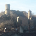
  1. S/E : mi 0 - alt. 1,608 ft - Pont de la Pède - Château de Saint-Floret
  2. 1 : mi 0.11 - alt. 1,663 ft - Fork in the path
  3. 2 : mi 0.31 - alt. 1,814 ft - Three-way junction
  4. 3 : mi 1.05 - alt. 2,070 ft - D628
  5. 4 : mi 1.61 - alt. 2,323 ft - Entrance to the village of Orphange
  6. 5 : mi 1.94 - alt. 2,306 ft - Montel
  7. 6 : mi 3.39 - alt. 2,454 ft - Chazeras
  8. 7 : mi 4.36 - alt. 2,356 ft - Crossroads, cross
  9. 8 : mi 4.94 - alt. 2,034 ft - Turn-off, to the left
  10. 9 : mi 5.39 - alt. 1,854 ft - Le Chastel site
  11. 10 : mi 5.79 - alt. 1,647 ft - Saint-Floret
  12. S/E : mi 6 - alt. 1,608 ft - Pont de la Pède

Worth a visit

(9) At the Chastel site, in the cemetery, tombs are carved directly into the rock (anthropomorphic tombs).
They are thought to date from the Merovingian period.

At the top of the cemetery, a building covers a well over 5 metres deep, filled with human bones.
This pyramid-shaped building dates from the 9th century.
A Gallo-Roman village existed on this site long before that of Saint-Floret.

Reviews and comments

5 / 5
Based on 1 review

Reliability of the description
Not used
Ease of following the route
5 / 5
Route interest
5 / 5
Mo63
Mo63

Overall rating : 5 / 5

Date of your route : Aug 12, 2024
Reliability of the description : Not used / Not applicable
Ease of following the route : ★★★★★ Very good
Route interest : ★★★★★ Very good
Very busy route : No

Impeccable GPX
Poles are recommended, particularly for the descent at the end

Machine-translated

Other walks in the area

For more walks, use our search engine .

The GPS track and description are the property of this route's author. Please do not copy them without permission.