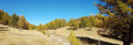
The Cabane des Lauzes

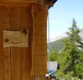
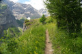
On the way to the Cabane des Lauzes via the forest track at the Col d’Anon.

Details

5560
Creation:
Last update:
Last review:
  • Walking
    Activity: Walking
  • ↔
    Distance: 4.84 mi
  • ◔
    Average duration: 3h 35 
  • ▲
    Difficulty: Moderate

  • ⚐
    Back to start: Yes
  • ↗
    Ascent: + 1,522 ft
  • ↘
    Descent: - 1,522 ft

  • ▲
    Highest point: 5,774 ft
  • ▼
    Lowest point: 4,436 ft

Photos

Description of the walk

At L'Argentière-la Bessée, take the road to the Vallon du Fournel. Cross the silver mine car park to park at the water intake car park.

(S/E) Take the Col d’Anon forest road (signposted) to reach the junction with theGR®50.

(1) Leave this path on your right; you will take it on the way back. Continue south-east along the road, which winds for about 5 km and serves the chalets in this area. Via long straights interspersed with numerous hairpin bends, reach the Chalet des Rousses.

(2) Ignore the paths to the right and left, and keep following the road.
At the third hairpin bend after this chalet, take the road on the right to reach the Cabane des Lauzes.

(3) Then descend via theGR®50-541(Tour du Dauphiné and link to theGR®54), which starts on the right opposite the large sheepfold. Pass above the refuge and enter the forest, reaching the future refuge currently under construction.

(4) Stay on theGR® until you reach the junction with the uphill road.

(1) Turn left here, heading in the opposite direction to the outward journey, to return to the car park (S/E).


Waypoints

  1. S/E : mi 0 - alt. 4,577 ft - Water intake car park. Vallon de la - Fournel (rivière}
  2. 1 : mi 0.49 - alt. 4,514 ft - Crossroads: GRP Route
  3. 2 : mi 2.58 - alt. 5,456 ft - Chalet des Rousses
  4. 3 : mi 3.28 - alt. 5,774 ft - Chalet des Lauzes
  5. 4 : mi 3.88 - alt. 5,312 ft - Refuge under construction
  6. S/E : mi 4.84 - alt. 4,577 ft - Water intake car park

Notes

(2) A spring flows above the piste at the Chalet des Rousses.
(3) A few hundred metres away, the Refuge de Coueiman welcomes hikers.

Worth a visit

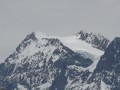
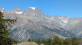
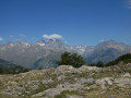
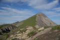
This walk above the Fournel valley offers a glimpse into the Ecrins National Park. When the weather is fine (and it often is here), the view of the Pelvoux is breathtaking. Further south, the Pointe de Dormillouse stands out, and opposite, the Pendine reveals the very discreet ski lifts of the Puy-Saint-Vincent resort.

Always be cautious and plan ahead when you're outdoors. Visorando and the author of this route cannot be held responsible for any accidents occurring on this route.

The GR® and PR® markings are the intellectual property of the Fédération Française de Randonnée Pédestre.

Reviews and comments

4.1 / 5
Based on 5 reviews

Reliability of the description
4.2 / 5
Ease of following the route
4 / 5
Route interest
4 / 5
migar
migar

Overall rating : 4.3 / 5

Date of your route : Jul 08, 2017
Reliability of the description : ★★★★★ Very good
Ease of following the route : ★★★★★ Very good
Route interest : ★★★☆☆ Average

A nice walk if you don’t mind a long climb along the road. It’s shaded and might be suitable for mountain biking, but it’s not great for walking. The downhill section is much better. As a previous reviewer said, I would have preferred to go up via the GR 50 and come back down through the Bois du Simon de l’Aigle.
Same comment regarding the Patou dogs near La Cabanne. Be sure to follow the shepherd’s advice. Don’t rush them and don’t be afraid, despite their impressive teeth.

Machine-translated

Chris3084
Chris3084

Thank you for your kind reply, and above all for your advice.
I shall certainly follow them.
But rest assured, this ‘ordeal’ was only temporary, and that’s what keeps me enjoying the pleasure of hiking.
Kind regards

Machine-translated

bernardino
bernardino ★

Good evening
I am truly sorry that you had such a hard time on this route. But honestly, I really don’t see what else I can add to clarify this outing. The starting car park is indeed located at the coordinates you mention first. It is particularly easy to reach. And from this car park, as stated, you must take the road leading to the hut. Furthermore, with the guidebook and the map, the directions are clearly marked.
You mention the coordinates in decimal degrees. That’s fine, but now with the UTM grid, it’s better to use those coordinates. They’re much simpler than longitudes and latitudes. In fact, with these coordinates, you’ll find the exact point very easily on an IGN map, whereas with coordinates in degrees, it’s much more complicated. Admittedly, these coordinates in degrees need to be entered into car sat-navs (for example, mine doesn’t have the option to set it to UTM), which allows you to reach the starting point without any trouble. Then, for the hike, the UTM coordinates should be entered into your profile by selecting WGS84.
Enjoy your hikes using the routes on the site, and above all, thank you for your feedback.

Machine-translated

Chris3084
Chris3084

Overall rating : 3.3 / 5

Date of your route : May 08, 2016
Reliability of the description : ★★★★☆ Good
Ease of following the route : ★★☆☆☆ Disappointing
Route interest : ★★★★☆ Good

This comment should be taken with a pinch of salt, as I’m not exactly the best with directions!
In my opinion, it is better to rely on the comments at the start rather than the GPS coordinates. In fact, I don’t understand why the starting point is marked as: N 44.791445 E 6.513466 with an altitude of 1,388 metres, which suggests a starting point much higher than the car park and, more importantly, in the opposite direction to the walk, which is actually headed south-east at the start.
For my part, I parked in front of the Sapey forest house (N 44.79182 E 6.51771). I then walked back along the tarmac road to the junction with the forest track (N 44.79050 E 6.51902), which you should take on the right (heading north-west). At the hairpin bend, do not follow the GR trail marks straight ahead, which lead back towards the Fournel stream. Continue south-east to the signpost marked “Le Sapey 1370 metres”. From there, follow the sign indicating “Col des Lauzes 2 hours, Col d’Anon 2 hours 30 minutes”. Above all, ignore the path on the right that climbs (also signposted Col d’Anon but with a time of 2 hours 40 minutes).
Warm regards from a hiker who has never struggled so much to figure out the route.

Machine-translated

gazok54
gazok54 ★

You're well equipped. With this Oregon, no more getting lost in the wild – you'll get straight to your destination
At your service, jdobagne.

Machine-translated

gazok54
gazok54 ★

Thank you, jdobagne, for your comment.
I just wanted to let you know that if you need any advice on how to get started with describing a hike, our team is here to help you get going. Contact the moderator of your choice via PM (private message) and they’ll be happy to assist you.

Machine-translated

douardouin
douardouin

Overall rating : 4.7 / 5

Date of your route : Sep 01, 2013
Reliability of the description : ★★★★☆ Good
Ease of following the route : ★★★★★ Very good
Route interest : ★★★★★ Very good

A lovely walk – we just took a wrong turn on the way up; we ended up taking the GR50, so make sure you take the road/path for a gentler climb!!

Machine-translated

Other walks in the area

For more walks, use our search engine .

The GPS track and description are the property of this route's author. Please do not copy them without permission.