The Marsan circular loop

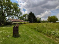
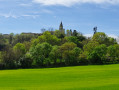
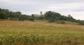
Marsan’s Short Walk (PR®) route, offering a chance to explore the village. Saint-Pierre Church was once an outbuilding of the castle. It features a bell tower and an arcaded wall, with one of its bells bearing Gothic inscriptions, and is listed as a Historic Monument. The castle, built in 1750 on the foundations of a former12th-century fortress, has been listed as a Historic Monument since 1991, but is not open to the public (private property).

Details

n°107947736
Creation:
Last update:
Last review:
–
  • Walking
    Activity: Walking
  • ↔
    Distance: 9.46 mi
  • ◔
    Average duration: 5h 05 
  • ▲
    Difficulty: Average

  • ⚐
    Back to start: Yes
  • ↗
    Ascent: + 840 ft
  • ↘
    Descent: - 850 ft

  • ▲
    Highest point: 853 ft
  • ▼
    Lowest point: 548 ft
  • ⚐ Country: France
  • ⚐ City: Marsan (32270)
  • ⚑
    Start/End: N 43.656377° / E 0.720692°
  • ❏
    IGN map(s): Ref. 1843SB
  • Hour-by-hour weather

Description of the walk

(S/E) From the town hall, walk past the school, follow the edge of the castle grounds, and you’ll come to a fork in the path.

(1) Turn right towards the community hall. Turn right onto the Sentier piétonnier de la Boubée. Walk downhill, pass under the railway bridge to reach a road: turn right.

(2) Continue straight on along Chemin d’en Sarraguet for 1.2 km until you reach a junction with a dirt track.

(3) Turn right and head downhill. Cross the railway line (take care), then head up the hillside to the D509.

(4) Turn left towards the Maupas crossroads (opposite the campsite).

(5) Follow the road down to the right, which leads to the Parriagués farm. Go round the farm and head up the stony track on the left alongside the D1124.

(6) Cross the bridge that passes under the road and head for the restaurant car park. Cross the car park to reach the D1124.

(7) Follow the cycle path to the right for 600 metres.

(8) Turn left onto a path leading down to En Clément. At the entrance to the property, carry on straight ahead along the dirt track. Cross the Ruisseau de Dagnan and head back up to the road.

(9) Turn right onto the road to reach a crossroads. Turn left and continue to a junction at Gébra.

(10) Turn right onto Chemin de Lestagnères. Continue straight on for 2.8 km until you reach a road.

(11) Turn right and carry on, passing under the road bridge; at the junction, cross over and join the cycle path.

(12) Turn right, towards Marsan.

(13) At the crossroads, turn left up the Chemin du Cap du Prat.

(14) At the Stop sign, turn right towards Marsan until you reach the entrance to the transport company.

(15) Turn left, taking the path that runs alongside the company’s fence. After 20 metres, the path enters the hedge. Follow it until you reach a small road.

(16) Head off to the right. Walk past the village hall and carry on straight ahead to rejoin the footpath you took on the way there.

(1) At the fork, turn left and head for the town hall (S/E).

Waypoints

  1. S/E : mi 0 - alt. 715 ft - Town hall car park
  2. 1 : mi 0.19 - alt. 719 ft - Junction
  3. 2 : mi 1.12 - alt. 709 ft - T-junction on the road
  4. 3 : mi 1.84 - alt. 663 ft - Dirt track
  5. 4 : mi 2.43 - alt. 682 ft - D509
  6. 5 : mi 2.74 - alt. 669 ft - Maupas crossroads
  7. 6 : mi 3.55 - alt. 620 ft - Passing under the motorway
  8. 7 : mi 3.83 - alt. 696 ft - Restaurant car park
  9. 8 : mi 4.21 - alt. 686 ft - Path towards En Clément
  10. 9 : mi 4.84 - alt. 705 ft - Road
  11. 10 : mi 5.62 - alt. 771 ft - At Le Gébra
  12. 11 : mi 7.4 - alt. 722 ft - Road
  13. 12 : mi 8 - alt. 728 ft - Cycle path
  14. 13 : mi 8.12 - alt. 735 ft - Chemin du Cap
  15. 14 : mi 8.54 - alt. 761 ft - Stop
  16. 15 : mi 8.6 - alt. 751 ft - Fence
  17. 16 : mi 8.82 - alt. 663 ft - Road
  18. S/E : mi 9.46 - alt. 715 ft - Town hall car park

Worth a visit

Always be cautious and plan ahead when you're outdoors. Visorando and the author of this route cannot be held responsible for any accidents occurring on this route.

The GR® and PR® markings are the intellectual property of the Fédération Française de Randonnée Pédestre.

Other walks in the area

For more walks, use our search engine .

The GPS track and description are the property of this route's author. Please do not copy them without permission.