Country:

 City:
City:


The start and finish are at the car park opposite the former town hall of Saint-Laurent-de-Vaux. Before setting off on your walk, you can consult the ‘circular’ information boards, located in the car park.
(S/E) Take the steps leading down towards the church, which are next to the large information board for the ‘Circular Route of the Black Valley’. At the bottom of the steps, turn left onto the tarmac road leading uphill. Keep the church on your left and take the path uphill on your right.
A little further on, at the ‘La Pommeraie’ sign, continue along the road to the left until you reach the Mitonnière crossroads, marked by a White Cross.
(1) Carry on straight ahead to continue the Saint Laurent Circular (you’ll also join the Val Noir Circular). You’ll come to a crossroads after the glass recycling point.
(2) At La Plantée, turn off onto the path on the right and head uphill towards the Bois du Faix. The tarmac road turns into a stony track leading up to the dolmen. The climb is steep but steady. Carry on straight ahead, ignoring the two paths branching off to the left, then the one on the right, until you reach the signpost marked ‘Le dolmen’.
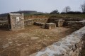
(3) Follow the path, turning left. A little further on, the dolmen and its lectern will be on your left. Carry on to the junction, 310 metres further on, and turn right. Continue due south until you reach a tarmac road.
(4) Cross it diagonally, then take the road leading uphill just to the right, then veer off to the right again. Walk past the goat shed. After 200 m, you’ll rejoin the tarmac road; take it on the left, then carry on straight ahead for 360 m until you reach the Route du Cholly. Take in the lovely views of the surrounding area, including the village of Vaugneray and the Clinique de l’Ouest Lyonnais.
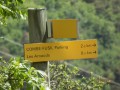
(5) At the signpost marked ‘Le Plat de Saint-Romain’, at the fork, take the left-hand road towards Le Plat de Saint-Romain and carry on straight ahead until you reach the Croix du Plat de Saint-Romain.
(6) At this junction, for the Saint-Laurent-de-Vaux circular route, carry on straight ahead along the tarmac road to the left of the cross. Along the way, enjoy the panoramic view of Vaugneray and, a little further on, Lyon. Continue along this road for about 1 km.
(7) At the junction with a track on the left, carry on along the road for a further 30 metres. Then leave the tarmac road and turn right onto the stony Piragoy track (altitude 532 m), which leads downhill. At the end of this track, straight ahead and slightly to the right, you’ll see the Messimy orientation table. Turn left onto the tarmac road, heading towards “Vaugneray Le Montus”.
80 metres further on, at the fire hydrant, turn off onto the dirt track on the right and walk for 500 metres. “Along the way, enjoy the view over Messimy, the Boiron premises, La Duchère, the Alps and, on the other side, Vaugneray.
You’ll also find a noticeboard on the chestnut tree. You’ll arrive at the “Le Montus” signpost.
(8) Further down, 30 metres past the ‘Le Montus’ signpost, at the fork, take the path leading down to your left to continue the Saint-Laurent-de-Vaux circular route.
Then turn left onto the tarmac road. At the bend in the road, turn left onto the Chemin de l’Évêque, heading towards L’Évêque, until you reach a junction.
(9) Stay on the path leading downwards, then, 310 m further on, veer right towards Les Black Drops. Continue for 550 m along the path, which crosses a stream, and you’ll arrive at the hamlet of Les Black Drops.
(10) Turn left towards the Chemin de Chantemerle. Follow the road, which becomes a track, for 350 m. When you reach a bend, take the road that descends for 120 m, then cross the bridge over the Yzeron. Carry on straight ahead until you reach the D128.
(11) Turn left and follow the departmental road on the left-hand side. Pass the bridge on your left and carry on straight ahead until you reach the next bridge.
(12) Turn left and head up the Chemin de la Chicane, which is a dirt track.
When you reach the junction with the church opposite you, turn left and then, further down, take the steps on your right to return to the car park (S/E).

 Visorando Member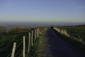

 Easy
Easy