Country:

 City:
City:


At the Mont-Louis (66) roundabout, where a large stone monument stands, head towards Les Angles, Matemale and Formiguères via the D118. Leave Les Angles on your left and continue along the D118 towards Formiguères. Before entering the village, turn left towards the ski resort. Then carry on straight ahead, heading uphill past the cluster of houses. The road widens and winds its way uphill through numerous bends.
Just as you reach the flat section, 100 m before the resort’s large car park, turn right uphill. Park before the two wooden half-barriers (at car park No. 4).
(S/E) Go through the wooden half-barriers and continue for 50 m, then turn immediately right, heading uphill along a stony track. Very soon, turn left into the forest along a wide, straight, cairn-marked path which cuts across five bends of this track and leads to a relatively flat, grazed area.
(1) Turn left onto this wide, stony track, with a sheep paddock on your left. Then follow the power line on your left as you head uphill. You’ll need to leave this track after about 600 m.
(2) At the underground water tank on the right, continue a little further along the track and turn right, heading slightly downhill along another narrower, grassy track, which runs parallel to the main track at the start.
Go through a scrap metal gate. Pass two steel manhole covers in the middle of the track. From this point, after 200 m, you will need to leave this track. You’ll arrive at an open area: a large scree slope on the left, with a water intake at elevation 1909. On the right, there are two cairns which I reinforced during my visit on 21 June 2020.
(3) Head slightly down to the right along a path that remains almost level. This path is clearly marked on the ground with several prominent cairns. Ignore all the small paths on your right and emerge into a grazing area, at around 1960 m.
(4) The path makes a first turn left then right and begins to climb steeply in this open area. The fork at around 2,060 m, shown on the IGN base map, is no longer present on the ground. Continue south-south-west along the correct path.
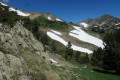
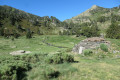
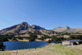
You’ll emerge into a magnificent area of natural mountain lagoons with a beautiful ‘orri’ in perfect condition at around 2,100 m. It’s a lovely spot for a break.
(5) Cross the numerous streams. There is a former slate quarry on the right-hand side and a fork at the foot of a pile of slates where two fir trees stand. Turn right, following the cairns.
Ignore the path on the left which climbs up into the valley.
The clearly visible path branches off to the right, heading north-west, and then turns to head roughly north, remaining almost level. It then descends slightly before emerging into an area of rocks and scree with a small valley on the right-hand side.
(6) Keep to the left, heading due west, following the well-marked path which crosses this area as it enters the forest. The path remains almost level. Take care to spot and follow the numerous cairns. This path alternates between forest and pasture and turns westwards, finally emerging into a clear area at the edge of the forest.
Cross the small streams coming from the left at around 2075 m. The path then turns sharply to the right, heading north-west, climbing only slightly, before turning left to emerge into another marshy area.
At this point, crossing the Rec de la Peira Escrita (the ‘engraved stone’ stream) can be tricky due to the water level, but it is by no means a dangerous spot.
Head due north after crossing the stream and join the GRP® Tour du Capcir trail. Head left for a few metres to find the start of a path on the right.
(7) Head straight north, then very quickly due west along a good path, clearly marked on the ground. Join another path at a fork. Continue left, climbing up through the pasture.
(8) Carry on, keeping to the left bank of the stream, crossing all the small streams flowing in from the right. The path is poorly marked but presents no difficulty.
(9) At around 2310 m, at the cairn which I have reinforced, head completely to the right, due north, climbing steeply. The path is once again clearly marked on the ground. Follow the cairns. Emerge above the pond and head left. The pond comes into view at the very last moment at the end of the well-marked path at around 2350 m.
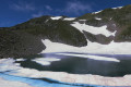
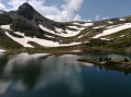
(10) Estany del Diable (elevation 2332). Access from below is often difficult due to snow and ice (21 June 2020). A low stone wall has been built to provide shelter from the wind, which is often strong at this spot. But it is a lovely spot for a break.
Turn back to the previous junction.
(9) This time, for the descent, stay on the right bank of the stream. You’ll reach a flat area strewn with large, flat stones.
(11) From the small sign fixed to a rock, continue down towards another, larger information sign fixed to a rock face.
It is possible to cross the Rec de la Peira Escrita, which is narrow and shallow at this point. Otherwise, stay on the right bank and, further down, you must cross the Rec to rejoin the fork from the outward journey.
(8) Carry on straight ahead in the opposite direction. At the next small fork, keep to the left. This will take you back onto the GRP® as you descend steeply through the grazing land.
(12) Continue to the left along theGRP® Tour du Capcir. The path descends rapidly.
Option: at around 1,800 m, turn right for a short round trip to climb up to the memorial stone, which offers a stunning view over the El Galba valley.
Otherwise, continue the descent along theGRP® towards the footbridge.
(13) After crossing this footbridge over a tributary of the El Galba, continue to the right.
;;14;; Pass the huts at Jaça de la Llosa and La Jaceta. Parking at La Jaceta is prohibited. Proceed to the designated car park at the Pont dels Plans de l’Orriet. Wooden barrier.
(15) Turn right over this road bridge (at around 1,630 m). Pass a fountain on your left. The route continues uphill along this track.
(16) At around 1,600 m, before the track begins to descend, turn right onto a well-maintained grassy path through the forest.
After a right-hand bend due west and a left-hand bend to the south-east, you’ll reach a large junction of grassy tracks.
(17) Continue straight ahead along a track suitable for vehicles, which starts on level ground. There is a signpost for Formiguères. The trees are marked with snowshoe signs. You will reach the car park (S/E).


 Visorando Member

 Moderate