


Refine your search for walks in Refuge de la Jaceta
Refuge de la Jaceta walks


 The Galbe Valley
 Visorando Member
 8.05 mi
 +883 ft
 -860 ft
 4h 30
4h 30
 Moderate
 Departure from Fontrabiouse (Pyrénées-Orientales)
This route takes you through one of the most beautiful valleys in the Eastern Pyrenees, namely the Galbe Valley and its breathtaking landscapes in Capcir, starting from the typical and authentic village of Fontrabiouse.
Point S/E moved - Route modified on 02/03/2023.
Pic de Mortiers - Les Camporells from Formiguères station
 12.48 mi
+3,855 ft
-3,848 ft
9h 05
12.48 mi
+3,855 ft
-3,848 ft
9h 05
 Difficult
Departure from Formiguères (Pyrénées-Orientales)
Difficult
Departure from Formiguères (Pyrénées-Orientales)
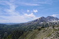
Fairly long route with a significant elevation gain.
It is possible to shorten this hike at two points.
It can be done in two days with an overnight stay at the Camporells refuge.
Torrential streams, huts, lakes, peaks, mountain huts, animals and spectacular landscapes await you.
Camporells protected area: see the regulations in force; dogs must be kept on a lead. Free car parks.
The hike is fully marked. Except for the option that avoids the bends on the track from (10) to (13).
Pic de Baxouillade
 8.44 mi
+3,005 ft
-3,005 ft
6h 30
Difficult
Departure from Fontrabiouse (Pyrénées-Orientales)
8.44 mi
+3,005 ft
-3,005 ft
6h 30
Difficult
Departure from Fontrabiouse (Pyrénées-Orientales)
The Pic de Baxouillade dominates the Galbe, Laurenti and Orlu valleys. The access path through the Galbe valley, which is fairly quiet, climbs gradually through wide mountain pastures and passes close to two lakes, including the Portella d'Orlu.
The only difficulty on the hike is a steep section in a couloir at 2,450 metres, where you will need to use your hands on the rock to help you climb, but it is not rock climbing.
Portella d'Orlu
7.21 mi
+2,172 ft
-2,139 ft
5h 15
Moderate
Departure from Fontrabiouse (Pyrénées-Orientales)
A very pretty, fairly gradual hike with a superb view at La Porteille.
L’Estany del Diable from Formiguères
 10.77 mi
+2,717 ft
-2,723 ft
7h 20
Difficult
Departure from Formiguères (Pyrénées-Orientales)
10.77 mi
+2,717 ft
-2,723 ft
7h 20
Difficult
Departure from Formiguères (Pyrénées-Orientales)
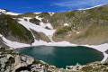
This ascent to the Étang du Diable is off the marked trails. You’ll need a good sense of direction, or follow this route using the app or a GPS. As a result, the hike is classified as difficult. The return journey will largely follow the GRP®.
The landscape is very rocky, the temperature is cool, and it’s often windy.
This lake is situated below the Pic des Mortiers. See my hike
La Peira Escrita and the Étang du Diable
 7.95 mi
+2,369 ft
-2,382 ft
5h 45
Moderate
Departure from Fontrabiouse (Pyrénées-Orientales)
7.95 mi
+2,369 ft
-2,382 ft
5h 45
Moderate
Departure from Fontrabiouse (Pyrénées-Orientales)
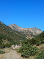
This walk takes you to the Peira Escrita valley, a historic landmark in Capcir, and on to the unexpected Étang du Diable, with its devilishly perfect circle! To do this, we’ll follow a section of the GR® de Pays Tour du Capcir (marked in red and yellow), then take an off-trail route marked with cairns.
Walks near Refuge de la Jaceta
Camporells Refuge - En Beys Refuge
 6.82 mi
+1,562 ft
-2,490 ft
4h 30
Moderate
Departure from Formiguères (Pyrénées-Orientales)
6.82 mi
+1,562 ft
-2,490 ft
4h 30
Moderate
Departure from Formiguères (Pyrénées-Orientales)
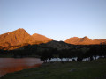
Second stage of the Tour Des Pérics.This stage should only be undertaken in good weather and when there is no fog.Otherwise, you must use the Visorando app or a GPS device to track your route.
⚠️ You are entering the Orlu National Hunting and Wildlife Reserve, where certain regulations must be observed. See practical information.
Camporells Refuge - Lac des Bouillouses via Petit Peric
 7.14 mi
+1,503 ft
-2,267 ft
6 hrs
7.14 mi
+1,503 ft
-2,267 ft
6 hrs
 Very difficult
Departure from Formiguères (Pyrénées-Orientales)
Very difficult
Departure from Formiguères (Pyrénées-Orientales)
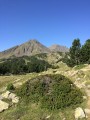
Part of the long itinerary (9 days) around Carlit, hiking from refuge to refuge, based on the Peyrics tour and using various marked trails.
Chemin Vauban From Formiguères to Rouze
13.74 mi
+1,286 ft
-3,018 ft
7h 25
Moderate
Departure from Formiguères (Pyrénées-Orientales)
This section of the Chemin Vauban links Formiguères to Rouze, crossing the Capcir and then the Donezan. The route, which is generally easy and pleasant, alternates between forest tracks, sections through the undergrowth, paths along ridges and more open stretches offering beautiful panoramic views. The route runs alongside the Galbe river, crosses the Col des Ares – which marks the border between the Pyrénées-Orientales and Ariège – and then continues through the Donezan region via Carcanières and Le Puch. It also takes you past the magnificent Château d’Usson before reaching the village of Rouze.
Crossing from Balcère to Les Angles
4.84 mi
+489 ft
-755 ft
2h 40
 Easy
Departure from Les Angles (Pyrénées-Orientales) (Pyrénées-Orientales)
Easy
Departure from Les Angles (Pyrénées-Orientales) (Pyrénées-Orientales)
An easy, two-thirds shaded route suggested by a Year 3 class. Superb views to help children from the countryside discover the mountains: lake, forests.
Refuge d'en Beys - Refuge des Bésines
 5.61 mi
+2,178 ft
-1,759 ft
4h 30
Difficult
Departure from Orlu (Ariège)
5.61 mi
+2,178 ft
-1,759 ft
4h 30
Difficult
Departure from Orlu (Ariège)
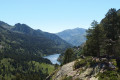
Amendment on 12 September 2022: new route marked on the ground, approved on Saturday 10 September 2022.Third stage of the Tour des Pérics. Day classified as difficult. Short distance but difficult terrain.The climb from the refuge d'en Beys to the passage through the Orlu Reserve (2,400 m) is difficult.The balcony path from (6) to (8) is very beautiful.
⚠️ From (S/E) to (5)you are in the Orlu National Hunting and Wildlife Reserve, where regulations must be observed. See practical information.
Refuge d'en Beys - Orlu via the Étang de Naguille
 9.08 mi
+1,526 ft
-5,217 ft
5h 30
Difficult
Departure from Orlu (Ariège)
9.08 mi
+1,526 ft
-5,217 ft
5h 30
Difficult
Departure from Orlu (Ariège)
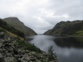
Fourth and final stage of the tour of the Orlu and Montagne d'Ax reserves.I have classified this stage as difficult because of the 1,650 m descent on a steep and sometimes damaged path.The view from the Couillade d'en Beys (3) to the dam (8) is magnificent.The stage begins by heading in the opposite direction to the previous day's route, taking theGR®®107and theGRP®® Tour des Pérics andGRP®® Tour des Montagnes d'Ax. At (2), be careful to turn right, west, onto theGRP®® Tour des Montagnes d'Ax, and continue until you reach the end of the four-day hike.The estimated time is underestimated: the descent is difficult on steep and degraded paths after the Couillade d'en Beys (3).
⚠️ From (S/E) to (10), you are on the edge of or within the Orlu National Hunting and Wildlife Reserve, where regulations must be observed. See practical information.
Refuge d'en-Beys - Barrage des Bouillouses
 10.08 mi
+2,257 ft
-2,136 ft
6h 35
Difficult
Departure from Orlu (Ariège)
10.08 mi
+2,257 ft
-2,136 ft
6h 35
Difficult
Departure from Orlu (Ariège)
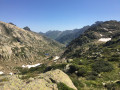
The second stage of this circuit is rocky at first, then more rolling. The whole thing is enchanting.The trail is well marked.
⚠️ From (S/E) to (3), you are in the Orlu National Hunting and Wildlife Reserve, where regulations must be observed. See practical information.
En Beys Refuge - Camporells Refuge
 7.15 mi
+2,605 ft
-1,680 ft
5h 35
Difficult
Departure from Orlu (Ariège)
7.15 mi
+2,605 ft
-1,680 ft
5h 35
Difficult
Departure from Orlu (Ariège)
Part of the long itinerary (9 days) around Carlit, travelling from refuge to refuge, based on the Peyrics tour and using various marked trails.
⚠️ You are entering the Orlu National Hunting and Wildlife Reserve, where regulations must be observed. See practical information.
Lac des Bouillouses - Mas de Franc
 11.51 mi
+1,509 ft
-2,989 ft
6h 35
Moderate
Departure from Les Angles (Pyrénées-Orientales) (Pyrénées-Orientales)
11.51 mi
+1,509 ft
-2,989 ft
6h 35
Moderate
Departure from Les Angles (Pyrénées-Orientales) (Pyrénées-Orientales)
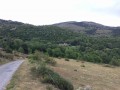
Part of the long (9-day) itinerary around Carlit, hiking from refuge to refuge, based on the Tour des Pérics and using various marked trails.
Refuge des Bouillouses – Refuge d’en Beys
 11.19 mi
+3,077 ft
-3,219 ft
7h 50
Difficult
Departure from Les Angles (Pyrénées-Orientales) (Pyrénées-Orientales)
11.19 mi
+3,077 ft
-3,219 ft
7h 50
Difficult
Departure from Les Angles (Pyrénées-Orientales) (Pyrénées-Orientales)
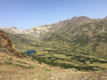
The first day of this route amongst the lakes.
It will take you from Les Bouillouses to the En Beys refuge, passing from one valley to another.