Country:
 City:


The tour starts at the Tourist Information Centre in the heart of the spa town of Bad Bertrich. There is a bus stop nearby, and there are various parking options in the town.
(S/E) We set off from the Tourist Information Centre onto the ‘Ritter-Räuber-Römer’ heritage trail and, right at the start, walk along Kurfürstenstraße past the imposing façade of the Parkhotel. This former guesthouse was part of the remarkable electoral palace that the art-loving Elector Clemens Wenzelslaus had built in the Ueßbach Valley in 1787–1788. Behind the Parkhotel, the ‘HeimatSpur’ trail veers right into Clara-Viebig-Straße. After a gentle climb, we leave the built-up area of the spa town – home to Germany’s only Glauber’s salt spa – and follow the signposts into the Ueßbach Valley.
(1) We walk along a narrow, shady forest path beside the water, which flows down a level lower to the right towards the Alf. We cross the L103 and turn right just beyond it.
(2) We walk a short distance past the L103 and on towards the Elfenmühle. The name ‘Elfenmühle’ does not derive from elves or fairies. Rather, the mill, built in 1860, was the eleventh mill in the Ueßbach Valley. Today, we find a hotel and restaurant there. Just behind the Elfenmühle, we cross the Ueßbach.
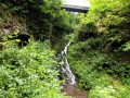
(3) The path leads past the roaring waterfall and up to the Elfengrotte. It is of volcanic origin. We walk through the Elfengrotte and, emerging from the darkness of the small cave, descend via a stone staircase past the Elbesbach waterfall deeper into the narrow gorge. Here we come across a slightly smaller cataract, whose multi-branched whirlpools plunge down some three metres. Behind the Elbesbach Waterfall, the HeimatSpur runs for a short stretch through the woods; we keep to the right and walk alongside the L104.
(4) We follow the road to the right, join the L103 and walk alongside the Ueß. We leave it at the next opportunity, turning left onto a wide forest path. To the right of the route, massive basalt formations rise vertically, whilst the Ueß can be seen repeatedly to the left of the path. A short while later, the route narrows to a narrow riverside path which, constantly rising and falling, follows the torrent against the direction of the flow. We soon reach the Florianshütte, which is a good spot for a rest.
(5) At the next fork, we keep to the left and cross the Ueß again via a narrow footbridge. On the opposite bank, the route climbs briefly up the wooded slope; we follow the torrent as it winds its way through a narrow, rocky canyon. In a wide left-hand bend, the route then leaves the immediate banks of the Ueßbach and climbs quite steeply up the slope. Rocky paths and unspoilt forest tracks characterise the route here.
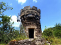
(6) On the hilltop, the route crosses a fairly broad ridge. Here, you can take a detour of about 150 metres to the castle rock of the former Entersburg, the highest point of the walk. This High Medieval spur castle, originally named Nantersburg, was built at the end of the 11th century by the Lords of Nantersburg. Albero von Montreuil, Archbishop of Trier, had the walls demolished again in 1138. Today, the Steffenswarte, erected in 1895, adorns the hilltop with its panoramic views. We turn round and, back on the main path, keep to the right and then immediately right again. The path leads downhill into the Ueßbach valley. This time, we follow the Ueßbach downstream along wild riverside paths.
(7) We reach the L104 again, follow the footpath running parallel to the road and cross the bridge to the left. On the other side, we turn left, cross the Ueßbach and turn right onto the L103. We are back on the route we took on the way there. We pass the Elfenmühle again, follow the path across the car park and then turn right. We cross Kurfürstenstraße, turn immediately right just beyond it and, via Clara-Viebig-Straße, reach the bridge over the Ueßbach; turning left onto Kurfürstenstraße takes us back to the starting point.

 Visorando Member
 Difficult