Country:
 City:
City:


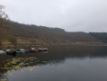
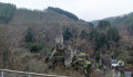
Paid car park at the entrance to Manderscheid when approaching from the motorway, Grafenstraße. View of the ruins of Oberburg Castle and Niederburg Castle.
(S/E) The viewpoint overlooking the castles is on your left; cross the road carefully and take Rue Zur Mariengotte opposite.
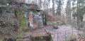
(1) Do not take the path on your left straight away, even though it is signposted (closed in February 2023), so that you can walk past the Marian grotto.
(2) After the grotto, take the path on your left. Head downhill, keeping to your right, and you’ll come to another path; continue straight on along this.
Vulkamaarpfad signposting (blue ellipse on a green ellipse on a yellow background)
At a bend, you’ll come to a viewpoint overlooking the castle ruins. Continue along the path to the multi-way junction before reaching another viewpoint and its shelter.
(3) Turn onto the path furthest to the right. Follow the path, passing handrails and small footbridges. At the Fork in the road, keep to the left. Continue along the path, passing the Philosopher’s Bench, until you reach a track.
(4) Carry on and cross a stream running across the path. At the right-hand bend, head towards the shelter on your left. Discover a viewpoint. With your back to the shelter, head back towards the signpost. Turn right. Follow the path until you emerge from the woods. Walk to the road, ignoring the path leading off towards the farm on your left.
(5) Turn left and walk carefully along the road for 150 m. At the start of the bend, turn right and walk along the meadow. At the corner of the meadow, carry on straight ahead and enter the woodland. The path bends sharply to the right, then sharply to the left, and leads to a wide forest track.
(6) Carry on to the right. Head downhill and take the next hairpin bend to the left. You’ll come to a footbridge over the Kleine Kyll. Cross it.
(7) Turn right. Cross a wooden bridge over the Horngraben. Turn left onto the path immediately afterwards. Climb up into the Gorge du Loup. Cross the footbridge. Climb up to the right. Cross another footbridge and climb up the scree slope to the right. Continue to the left and rejoin a path.
(8) Carry on to your left. Emerge from under the trees and take the farm track to the left until you reach the first path on your right.
(9) Turn right. Cross a small footbridge and, a little further on, cross the stream. At the path, keep left. At the junction, carry straight on.
(10) On your right, you’ll find the Mosenberg Volcanoes Park. Walk past the various rock formations and head up towards the signposts. Turn right. Enjoy the view of the section you’ve just walked along, then walk to a hairpin bend on the left.
(11) Take the path leading uphill. At the track, keep to your left. Emerge from under the trees and turn right as soon as you re-enter the woodland. Climb up to the shelter and enjoy the view from the Mosenberg.
(12) Continue opposite the steps and go down the path. At the junction, turn left – not onto the path opposite. At the next shelter, turn right and walk to the multi-way junction.
(13) Take the path opposite, slightly to your left. Head uphill and, at the junction, keep to your left. At the top, enjoy the view over the Windsborn crater lake. Head downhill and, at the crossroads, turn left. Go round the barrier and, at the Fork in the road, take the left-hand path. Head downhill to the road.
(14) Turn left onto the footpath running alongside the road and enter Bettenfeld. Turn left and then right towards the car park. Turn right before the car park and the lake. At the junction, keep left and at the next junction turn left until you reach the first road on your right.
(15) Turn right and, at the main road, turn right. At the square with the walking signs, turn left and walk past the church. Turn left, then immediately right onto the road before house no. 2. The road bends to the right; walk as far as the birch trees.
(16) Turn left onto the grassy path. Walk down to the Marian shrine. Turn right and continue downhill. Cut across a road and carry on along the path opposite. At the next road, turn right and walk through the village. Explore the Meerfeld Maar; walk to the end of the Maar and the car park entrance. The signposting ends here.
No Signposting
(17) Cross the main road with care. Cross the river and, after crossing it, take the forest track on the left towards Manderscheid (4 km). Walk for just over 500 m until you reach a Fork in the road. Head down the left-hand path. At the sewage treatment works, turn right until you reach the junction with a shelter.
(18) Take the path going uphill to the left. Walk for 900 m until you reach a path leading downhill on your left.
(19) Follow this path downhill. Ignore the path on the right and carry on straight ahead. The path turns sharply to the right. Walk downhill to the road. Follow the road to the right, taking care, for about 250 m. At the T-junction, turn left. Continue to follow the road , taking care.
(20) Head up the path to the left of the railings. At the top, carry on to the right. Follow the Vulkamaarpfad signposts until the next junction.
(21) Turn right, towards Manderscheid (2 km). Follow the path until you reach a junction as you leave the woods.
(22) Keep to your left. Enter Manderscheid. Follow the road to the T-junction. Turn right. At the roundabout, go straight on. Follow the main road as it bends to the right. Head downhill and you’ll find your car park on the left at the next bend (S/E).
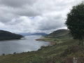
 Allow time to observe the volcanic remains on display at Mosenberg. As we started from Bettenfeld, we ate in Manderscheid (at the Stadt Café, a snack bar, but there are also restaurants), the only option on the route (completed in December 2025).


 Visorando Member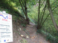
 Difficult