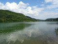
Devil’s Cave, Skywalk and Klumpertal

All around Pottenstein, you can admire the magnificent natural beauty on any of the walking trails. A particularly exciting route leads from the summer toboggan run and the Skywalk – with stunning views over the Weihersbach Valley – into the idyllic Klumpertal. And, of course, the famous Devil’s Cave is a must-see on this circular walk through the rocky landscape of Franconian Switzerland.

Details

n°47978332
Creation:
Last update:
Last review:
  • Walking
    Activity: Walking
  • ↔
    Distance: 4.75 mi
  • ◔
    Average duration: 2h 40 
  • ▲
    Difficulty: Moderate

  • ⚐
    Back to start: Yes
  • ↗
    Ascent: + 558 ft
  • ↘
    Descent: - 561 ft

  • ▲
    Highest point: 1,499 ft
  • ▼
    Lowest point: 1,237 ft

Photos

Description of the walk

Start: The circular walk begins at the visitor car park at the Pottenstein Adventure Rock, Am Langen Berg 50. The Skywalk or the summer toboggan run can be visited at the end or the start of the circular walk. If you take the summer toboggan run down into the valley right at the start, you can then continue the circular walk from the car park at the bottom, near the valley station.

(S) From the car park, we head back towards the road ‘Am Langen Berg’ and, just before reaching the road, turn right onto the narrow path into the woods. The path zigzags down into the valley and meets a T-junction, where we keep to the right. The valley station for the toboggan runs is located in the building here. We continue slightly above the valley station along the Weihersbach stream and cross the junction straight ahead, above another car park.

(1) The narrow forest path takes us along the valley, running above Schöngrundsee. Beyond Schöngrundsee, we keep to the right at both forks and then descend in a left-hand bend to the entrance of the Teufelshöhle.

(2) After a visit (the exit is on the other side), we return to the entrance, cross the bridge over the Weihersbach, walk a few metres towards the car park and cross the Weihersbach again. Immediately after the stream, we turn left and follow the ‘Main-Danube Trail Part 1’ markings along the hillside through the woodland, always staying above the Weihersbach.

(3) On the left-hand side is a chain of ponds with the Heiners Forellenräucherei restaurant. Behind the ponds, we reach the St 2663. We turn left, cross the Weihersbach and cross the road. Opposite, a path leads us past the Schüttersmühle. Behind the buildings, we turn right.

(4) We then walk past the farm’s kiosk and continue straight on along the edge of the wood, taking the right-hand path at the fork. Along the banks of the Weihersbach, we now walk into the idyllic Klumpertal valley, which is famous for its mills. After crossing the Weihersbach, we arrive at Mittelmühle, one of the mill estates in the Klumpertal valley.

(5) Here we turn left and then immediately right again to continue following the course of the Weihersbach.

(6) Soon, on the right-hand side, we come to a small body of water, which is the source of the Weiherbach. There is also a small picnic area here. At the fork behind the source, we keep to the left, continue along the stream and come to the next mill.

(7) However, apart from a few remains of walls and an information board, there isn’t much left to see of the Klumpermühle. We pass the ponds on the left-hand side and, as the path curves to the right, reach the Klumper spring with its information board.

(8) At the next junction, we turn right and follow the Klumpertal Circular Walk along the mountainside, always keeping to the route. After a wide left-hand bend, we continue to the right and, at the two forks in the path immediately one after the other about 400 metres further on, turn right at each one. At the next fork, we keep to the left

(9) We pass the Drachenfelsen on our left and continue straight on at the junction.

(10) Shortly after the Entenstein – a rock with a grotto beneath it – we cross the car park and keep slightly to the left on the main road, before immediately turning right back onto the path. Following the sign for ‘Lillachquelle–Kleiner Kulm’, we continue through the wood and turn right at the junction.

At the fork shortly afterwards, we stay on the main path (slightly to the left) and cross the next junction straight ahead (Wallfahrerweg PW2). At the next fork, we turn left and follow the route. In a small clearing, we keep left at the fork and arrive at the Pottenstein Adventure Centre.

(11) If you didn’t visit the Skywalk at the start of the tour, you can do so now.

(S/E) Straight ahead lies the car park from which we set off.

Waypoints

  1. S/E : mi 0 - alt. 1,401 ft - Car park at the Pottenstein Adventure Rock
  2. 1 : mi 0.32 - alt. 1,299 ft - Schöngrundsee
  3. 2 : mi 0.86 - alt. 1,335 ft - Pottenstein Devil’s Cave
  4. 3 : mi 0.96 - alt. 1,329 ft - Heiner’s Smoked Trout Shop
  5. 4 : mi 1.37 - alt. 1,293 ft - Schüttersmühle kiosk
  6. 5 : mi 1.75 - alt. 1,283 ft - Mittelmühle
  7. 6 : mi 1.89 - alt. 1,358 ft - Weiherbach with its spring
  8. 7 : mi 2.02 - alt. 1,358 ft - Former Klumper Mill
  9. 8 : mi 2.18 - alt. 1,358 ft - Klumper Spring
  10. 9 : mi 2.83 - alt. 1,414 ft - Drachenfels
  11. 10 : mi 3.19 - alt. 1,430 ft - Entenstein
  12. 11 : mi 4.41 - alt. 1,447 ft - Pottenstein Adventure Rock with Skywalk
  13. S/E : mi 4.75 - alt. 1,401 ft - Visitor car park at the Pottenstein Adventure Rock

Notes

Much of the walk takes you through the woods, passing through the Weihersbach Valley and the Klumpertal, and showcases some of the beautiful scenery and sights near Pottenstein that are characteristic of Franconian Switzerland. It can get quite busy on public holidays or during school holidays, but there are plenty of alternative parking options along the route.

  • Car park at the entrance to the Klumpertal
  • Car park at the Teufelshöhle (subject to a charge)
  • Car park at Schöngrundsee
  • Car park at the Schüttersmühle

Equipment

  • Sturdy footwear with good tread
  • Sufficient quantities of drinks in your rucksack
  • The circular route is well suited to the summer months thanks to its long forest sections
  • In snowy or icy conditions, some sections can be very slippery and difficult to walk on
  • Some of the attractions are only open during the summer months
  • Dogs are permitted in the Teufelshöhle and at the Pottenstein Adventure Rock, but they are NOT allowed inside the castle (please check the current regulations in advance)

Worth a visit

Pottenstein Adventure Rock
A particular highlight of the circular walk is undoubtedly the summer toboggan run and the Skywalk, a viewing platform high above the valley. Please note the opening times (information at https://www.erlebnisfelsen-pottenstein.d...). Those who take the summer toboggan run down into the valley can continue the circular walk from the valley station at the bottom.

Devil’s Cave
With its underground chambers, the Devil’s Cave is one of the most beautiful and largest stalactite caves in Bavaria. It can be explored as part of a guided tour (opening hours during the summer months: 9 am to 5 pm; further information at https://www.pottenstein.de/teufelshoehle)

Pottenstein Castle
This remarkable castle complex has stood on the cliff high above Pottenstein for around 1,000 years. Today, the complex is privately owned and can be visited during opening hours. (Information at https://www.burgpottenstein.de/preiseoef...)

Food and drink

  • Restaurant at the Teufelshöhle
  • Kiosk at Klumpertal by the Schüttersmühle, Schüttersmühle 2
  • Kiosk at the Pottenstein Adventure Cliffs, Am Langen Berg 50
  • Heiner’s Smoked Trout Shop, Schüttersmühle 5

There are further restaurants in Pottenstein.

Reviews and comments

5 / 5
Based on 1 review

Reliability of the description
5 / 5
Ease of following the route
5 / 5
Route interest
5 / 5
mit-mama-nach.de
mit-mama-nach.de

Thank you very much for the positive review. I’m really pleased that you enjoyed it.

Best wishes, Michaela

Machine-translated

User 29498441

Overall rating : 5 / 5

Date of your route : Jun 24, 2026
Reliability of the description : ★★★★★ Very good
Ease of following the route : ★★★★★ Very good
Route interest : ★★★★★ Very good
Very busy route : No

That was one of the most beautiful walks we’ve done in Franconian Switzerland. The paths were never boring, the route was well-marked and there was plenty to see.

Machine-translated

For more walks, use our search engine .

The GPS track and description are the property of this route's author. Please do not copy them without permission.