


Greystoke Forest Loop
Details
Creation:
Last update:
–
–
-
 Activity: Walking
 -
 Distance: 11.36 km
 -
 Average duration: 3h 35
 -
 Difficulty: Not specified
 -
-
 Back to start: Yes
 -
 Ascent: + 111 m
 -
 Descent: - 117 m
 -
-
 Highest point: 340 m
 -
 Lowest point: 262 m
-
 Country:
United Kingdom
Country:
United Kingdom
-
 Area: Lake District
 -
 District:
Mungrisdale
District:
Mungrisdale -
 Start/End: N 54.699283° / W 2.96279°
 -


 Hour-by-hour weather


Waypoints
- S/E : km 0 - alt. 283 m
- 1 : km 0.03 - alt. 282 m - Turn right
- 2 : km 0.24 - alt. 285 m - Turn slight left
- 3 : km 0.24 - alt. 285 m - Turn left
- 4 : km 0.62 - alt. 296 m - Turn slight left
- 5 : km 1.4 - alt. 287 m - Turn right
- 6 : km 2.67 - alt. 304 m - Turn left
- 7 : km 2.88 - alt. 290 m - Turn right
- 8 : km 4.51 - alt. 333 m - Turn left
- 9 : km 8.81 - alt. 275 m - Turn sharp right
- 10 : km 10.39 - alt. 264 m - Turn left
- 11 : km 10.39 - alt. 264 m - Turn left
- 12 : km 10.6 - alt. 263 m - Turn left
- 13 : km 11.14 - alt. 285 m - Turn slight right
- 14 : km 11.35 - alt. 282 m - Turn right
- S/E : km 11.36 - alt. 281 m
Other walks in the area
Carrock Fell
 Visorando member 4.95 km
+421 m
-421 m
2h 35
Visorando member 4.95 km
+421 m
-421 m
2h 35
 Difficult
 Departure from Mungrisdale (Westmorland and Furness)
Great walk to Carrock Fell. The path to the summit is very steep but short. A bit of scrambling to reach the summit.
Bowscale & Mosedale
 Association / Club / Walk leader 5.09 km
+32 m
-32 m
1h 35
Association / Club / Walk leader 5.09 km
+32 m
-32 m
1h 35
 Easy
Departure from Mungrisdale (Westmorland and Furness)
Easy
Departure from Mungrisdale (Westmorland and Furness)
A virtually level farmland and mossland stroll through two pretty Lakeland hamlets with views of Carrock Fell and beyond.
Blencathra
Association / Club / Walk leader 13.06 km
+640 m
-636 m
5h 35
Difficult
Departure from Mungrisdale (Westmorland and Furness)
Circular route up to the Saddleback of Blencathra. The route follows some of the easier routes on this iconic fell; the
still-considerable effort is rewarded with dramatic mountain views.
Souther Fell
Association / Club / Walk leader 9.15 km
+320 m
-319 m
3h 30
 Moderate
Departure from Mungrisdale (Westmorland and Furness)
Moderate
Departure from Mungrisdale (Westmorland and Furness)
The broad ridge of Souther Fell gives excellent views of Blencathra and more distantly over the Vale of Eden to the North Pennines.
Blencathra via Sharp Edge from Scales
Visorando member 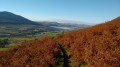 7.21 km
+622 m
-588 m
3h 50
Moderate
Departure from Threlkeld (Westmorland and Furness)
7.21 km
+622 m
-588 m
3h 50
Moderate
Departure from Threlkeld (Westmorland and Furness)
Sharp Edge is the highlight of this Lake District walk to Blencathra's highest point at Hallsfell Top. Sharp Edge is challenging mountain environment and needs treating with respect. The views from the Top are stunning covering most of the Lake District's highest fells.
Orthwaite
Visorando member 7.54 km
+248 m
-244 m
2h 50
Moderate
Departure from Ireby and Uldale (Cumberland)
Nice circular walk from Orthwaite village around Little Cockup and Great Cockup. This path is not really popular. Dog friendly.
⚠️Good navigation skill is needed as the path is not visible the entire walk.
Dunmallard Hill Settlement, Pooley Hill
Association / Club / Walk leader 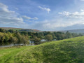 2.13 km
+50 m
-50 m
0h 45
Easy
Departure from Dacre (Westmorland and Furness)
2.13 km
+50 m
-50 m
0h 45
Easy
Departure from Dacre (Westmorland and Furness)
This circular walk brings you along River Eamont before going up into the woodlands around Dunmallard Hill. On the way enjoy views of the countryside and over Ullswater loch.
For more walks, use our search engine .
The GPS track and description are the property of this route's author. Please do not copy them without permission.

