Country:
 City:
City:


The walk starts at the Thier-à-Liège Municipal Youth Centre, 302 Boulevard Ernest Solvay, which is accessible by car (plentiful parking) and by bus on route 24.
(S/E) Walk down Boulevard Ernest Solvay and take the path on your left which leads to Rue Alphonse Tilkin.
(1) At the end of the street, turn right onto Rue Charles Gothier. Walk to No. 5 and look at the drawing above the front door.
The path is lined with allotment gardens. These gardens are typical of the Thier-à-Liège area and have enabled many immigrant workers to reconnect with the farming practices of their countries of origin. Many families in the neighbourhood have benefited from them for generations. Leased by the City of Liège for many years, these allotments made headlines when the city decided not to renew the leases due to soil contamination issues. Thanks to the campaign by residents and local organisations in Thier-à-Liège, the city abandoned plans to expropriate the small-scale growers and instead proposed farming techniques suitable for contaminated sites.
Cross the road and head to Poldine Park.
Poldine was a market trader who sold produce all year round (see the sign on the square). Every morning, summer and winter alike, Poldine would head into town with her cart full of fruit and vegetables to sell them. Since the start of the 21st century, the city’s place-names committee has been renaming various locations after famous women from Liège in an attempt to restore a certain gender balance. It was in 2004 that this patch of lawn was therefore given the name ‘Parc Poldine’!
Continue along Rue Léopold Harzé, then turn left to reach Place Herbert Hoover. Turn right onto Rue de Volgograd.
This street, along with Rue d’Esch-sur-Alzette and Rue de la Solidarité, forms part of the garden city that lies at the heart of the Cité du Tribouillet. This street is nicknamed the “bird street”. Take a look at the tympanum above the doors!
(2) At the end of Rue de Volgograd, you’ll come out onto Boulevard Ernest Solvay; turn left onto Rue d’Esch-sur-Alzette and then onto Rue de la Solidarité.
Given that Rue de Volgograd and Rue de la Solidarité were formerly known as Rue de la Prévoyance and Rue de la Mutualité, it is fair to say that the estate’s place names clearly illustrate the progressive (or paternalistic?) ethos that led to the creation of the garden city.
Turn back.
(2) Walk up Boulevard Ernest Solvay and stop at No. 152.
At No. 152 (a building nicknamed the ‘Casablanca’) there is a plaque commemorating the competition for affordable workers’ housing, which resulted in many of the homes surrounding the Tribouillet garden city. Whilst in the 1920s the garden city model had been chosen to provide decent housing for workers, by 1930, in the wake of the 1929 crisis, building houses had become financially unviable. It was the apartment block model that emerged as the solution to the problem of workers’ housing. Here, as well as at the start of Rue Joseph Rémy a few steps further on, a particular type of building is showcased. The architectural feature of these two blocks is the use of walkways, ensuring that all entrances open out onto the outside, giving them the appearance of a ship!
Continue up the boulevard until you reach Jacques Pelzer’s Jazz Club. Jacques Pelzer was a famous saxophonist who once ran a chemist’s shop on this very spot! Continue along the boulevard until you return to the Community Youth Centre.
(S/E) Head towards the roundabout via the Place des Musiques. Walk down Rue Renardi to the right and take the first flight of steps directly on your left. You’ll reach the Cité Chapeauville, a small, entirely pedestrianised village designed in 1982 in a traditional style. At the pipes – which actually form the heating system for all the flats in the estate – turn left into Rue Chapeauville to reach Rue du Haut Pavé. Turn right, then take Rue de l’Ermitage on your left.
Head to the front of houses nos. 3 and 5 to discover grimacing sun faces, intertwined dragons, Greek letters and other esoteric symbols. These houses were built in a neo-Gothic style during the first half of the 20th century.
(3) At the Church of Saints Victor and Leonard (built in 1905 in an early 13th-century Gothic style), first turn left then right onto Avenue Dieudonné Lambrechts, then take Rue du Préay on your right and carry straight on until you enter the woods. After passing house number 81, turn right and head up the path
At the large stone on the left, take the sharp left-hand bend and continue uphill along the Sentier Matraifosse. Keep to the right as you walk alongside the field on your left.
As you cross the Sentier Matraifosse, you will have passed a reed bed, which has flourished thanks to seepage water from the slag heap. This vegetation, covering an area of barely 35 ares – unexpected in such a location – attracts a rather remarkable diversity of wildlife.
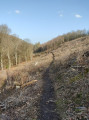
At the five-a-side football pitch, take a sharp right-hand bend and continue uphill along the Batterie-Nouveau slag heap, built between 1930 and 1965, when the coal mine to which it is linked closed.
(4) Once at the top of the slag heap, explore the remains of the old coal mine and admire the panoramic view over Liège.
Head back down the way you came and return to the mini-football pitch. Then take Boulevard Hector Denis and walk down it on the left-hand side.
(5) Turn right onto Rue Haut des Tawes, heading towards the Walthère Dewé Memorial. Then turn left onto Rue Coupée, still heading towards the memorial.
On the left, on Rue Coupée, you can see some community gardens made available by the Dewé family (Walthère’s descendants), who own the land. Please note that this is private property!
Walk down the street to reach the Walthère Dewé Memorial, which is also the Saint-Maurice Chapel.
(6) This memorial was erected after the Second World War in honour of this Liège-based Resistance fighter who was shot dead in 1944.
Walthère Dewé was the leader and founder of the ‘Dame Blanche’ intelligence network during the First World War and of the ‘Service Clarence’ during the Second. The large statue of a woman at the rear of the chapel is a fine representation of the Dame Blanche – look at the gesture she is making with her finger!
Carry on to the end of Rue Coupée, where you’ll come out onto Rue Fond des Tawes. Carry on straight ahead along this street, then turn left onto Rue de la Sèche.
(7) Take Rue du Géron on your right, which turns into a footpath further on.
You’ll spot some wooden houses (nos. 63, 65, etc.). There’s no doubt about it: you’re standing in front of the former home of the woodcutter, Richard Lannoy, who naturally used wood to renovate this cluster of old workers’ houses in 2010!
Head towards them, carry on to the right and then turn straight left. Turn right after house no. 88, staying on the same street, and you’ll come out onto Rue du Thier-à-Liège.
Turn right to reach numbers 143 and 144, where you can see the houses with irregular layouts caused by the successive collapses and subsidence of the mine galleries on which they stand.
Then walk back up the street until you reach the Youth Centre (S/E).

 Visorando Member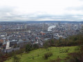
 Moderate

 Difficult