


Refine your search for walks in Gare de Mercus-Garrabet-Centre
Gare de Mercus-Garrabet-Centre walks


 Visorando Member
 Easy
Easy Walks near Gare de Mercus-Garrabet-Centre
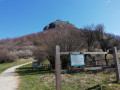
 From Montségur to Prades via the Gorges de la Frau
 11.50 mi
 +3,376 ft
 -2,697 ft
 8h 15
8h 15
 Difficult
 Departure from Montségur (Ariège)
Montségur, the main stronghold where the Cathars took refuge whilst being hunted down by the Crusaders and the Inquisition, was besieged in 1244, and 225 Cathars who refused to renounce their faith were burnt right here, at the foot of the rocky peak. From there, networks were organised not only for escape but also for the spread of Cathar ideology, in order to evade the Inquisition.
Étang du Rouch via Étang de Gnioure
 8.63 mi
+6,322 ft
-1,004 ft
10 hrs
8.63 mi
+6,322 ft
-1,004 ft
10 hrs
 Very difficult
Departure from Siguer (Ariège)
Very difficult
Departure from Siguer (Ariège)
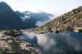
Climb the ridge marking the border with Andorra to the beautiful Étang du Rouch, which seems to sit at the foot of the Pic de Font Blanca, passing by the majestic Étang de Gnioure and its lovely, long valley:
- numerous waterfalls during the fairly steep and very stony climb up to the Peyre bridge;
- a short, slightly vertiginous ledge section to reach the immense Étang de Gnioure;
- a long path running alongside the lake, then the stream, and winding its way into the valley;
- a hillside climb that starts off fairly gentle but ends up quite steep, leading up to the Étang du Rouch.
Port de Lers–Bassiès Refuge via Pas du Roc, Étang de Labant, Col Fouzès
 7.46 mi
+2,927 ft
-2,493 ft
6h 00
Difficult
Departure from Suc-et-Sentenac (Ariège)
7.46 mi
+2,927 ft
-2,493 ft
6h 00
Difficult
Departure from Suc-et-Sentenac (Ariège)
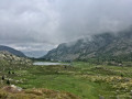
The first day takes you to the Refuge de Bassiès, passing huts, a valley, mountain passes, an old mine, a pond, and various cols and mountain passes. The stretch from the Col de las Fouzès to the Port de Bassiès is particularly beautiful.The route follows paths and tracks that are difficult due to their terrain (rock, scree, unmarked).See practical information * From (3) to (6) an unmarked path with gradients of 15% and 25%, with the presence of Patou dogs from (4). From (12) to (18) a marked path with gradients of 16% to 30%.The GPX track is necessary in places to avoid any confusion, as the route does not necessarily follow GR®, GRP® or PR® trails.Allow around 6 hours for the walk.