Country:

 City:
City:


Park near the Chânes stadium.
(S/E) Set off towards the village. Just before the electricity pylon, turn left onto the dirt track. At the junction with the road, turn right and continue to the first crossroads.
(1) At the bend, head up to the left towards the farm buildings; ignore the turn-off to the right for Château de Lavernette and continue to Bouteau. At the junction with Impasse de la Vernette, keep right until you reach a three-way junction.
(2) Carry on to the right, following the yellow markings. At the next junction, continue straight ahead on the tarmac section, ignoring the markings that head off to the left.
(3) After the descent, turn left and cross the Ruisseau du Goitrand. At the next junction, continue to the left, then turn right 100 metres further on onto a path marked in yellow. Walk uphill to the ruined house.
(4) Head up to the right towards Les Molards, following the yellow markings.
(5) At the junction of the Chemin de la Grouillère and the Chemin vers Chânes, carry straight on.
(6) Cross the Chemin des Rontés (castle on the left, mast on the right) and head straight ahead. Walk past the houses in Les Molards on the left and continue to the Route de Fuissé.
(7) Head straight on towards Vinzelle and Loché, then turn left at the sign to follow the path towards the Bois de Saint-Léger. At the next junction, continue straight on, pass under the power lines and reach a crossroads.
(8) Turn left to cross the Bois de Saint-Léger and emerge onto the access road to the château of the same name.
(9) Head down to the left, cross the RD172 with care and follow signs for Beauregard. After about a hundred metres, head down to the right into the vineyards, taking a right-hand bend followed by a left-hand bend. Cross the small road, then turn left about twenty metres further on and join the D209.
(10) Cross the departmental road carefully towards the hut. After 300 m, head downhill to the left towards Pouilly, then go uphill opposite along the vineyards of Château du Clos and reach the junction with the Route du Lavoir.
(11) Turn right towards the crossroads, then head up Rue de la Chapelle on the right to cross the village.
(12) Turn left past the château, towards Morlays. Turn left again after 200 m and head downhill past the buildings on Rue du Bois Sansonnet. Once past these, continue along the path on the right until you reach Rue de la Croix, then follow it by turning left.
(13) At the Morlays crossroads, head up the road opposite towards Chasselas, then turn right onto the path between the electric fences of the donkey and horse pastures.
(14) Head up to the left and make your way to Mont de Pouilly.
(15) Head downhill to the left and follow the path along the fence of the Teppes pastures (above the high-voltage power line). At the junction with the ‘MJC Héritran’ sign, head downhill to the right for about 200 metres (passing under the high-voltage power line) then turn left.
(16) Head down to the right towards La Côte.
(17) At the four-way junction, take the left-hand branch, then turn right about a hundred metres further on. When you reach the next fork, first turn left then right to head south again and continue to the Route de Fuissé at a place called Les Combettes.
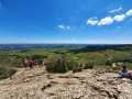
(18) Cross the road, then head up to the right towards the car park, heading for the orientation table. You’ll reach it at the Bois de Fée. Beautiful views over the Beaujolais hills: Mont de Besset towards Juliénas, the Grange du Bois and its two masts, Pic de Rémont towards Chenas, Fut d’Avenas, etc.
(19) Set off again to the right onto the path running alongside the Bois de Fée and head down towards the water reservoir, then on to the houses at Les Brûlés.
(20) Head down to the Route des Grands Champs on the right. After about 150 m, take the path on the left and follow a series of bends to the right and left, keeping the Balmont Haut radio mast in sight. You’ll reach a road.
(21) Head downhill to the right, leaving the mast on your left. At the next junction, turn left and you’ll reach a T-junction near a wide cross-path.
(22) Turn left along this track, cross it at a Fork in the road and head down to the left onto the footpath towards the Chânes stadium. At the next junction at a place called Vernette, head down to the right towards the Grand Chemin, near the Croix des Batailles, which stands on the right.
(23) Turn immediately left onto the vineyard path. Join the Route de la Creuze-Noire and follow it to the right towards the stadium and the Château de Creuse Noire. Reach the junction with the Route du Stade and turn left to reach the car park (S/E).


 Visorando Member

 Easy
Easy 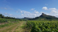
 Difficult