Étang de la Neuville via the ‘école buissonnière’ route

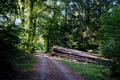
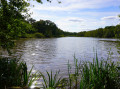
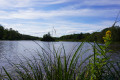
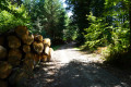
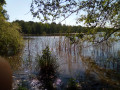
After a long (but scenic) detour through the woods and along a wild path, you’ll come across a lovely pond right in the heart of the Montagne de Reims.

Details

3219029
Creation:
Last update:
Last review:
  • Walking
    Activity: Walking
  • ↔
    Distance: 6.14 mi
  • ◔
    Average duration: 3h 05 
  • ▲
    Difficulty: Moderate

  • ⚐
    Back to start: Yes
  • ↗
    Ascent: + 249 ft
  • ↘
    Descent: - 256 ft

  • ▲
    Highest point: 879 ft
  • ▼
    Lowest point: 696 ft

Photos

Description of the walk

Park on the D71 at the Promenade des Hauts de Germaine, between this village and the D951.

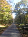
(S/E) Head south along the path forming part of theGRP® de la Montagne de Reims, marked with a few yellow-and-red signs. Follow the sign for Mutigny; you’ll soon come to a Y-junction at a place called La Cabotière.

(1) Ignore the path on the right which leads directly to the pond; continue along theGRP®, which is also the Ancient Roman Road. You’ll reach the junction with theGR®14.

(2) Continue south along the path, which now forms part of both theGR® and theGRP®, to reach a junction of paths at the entrance to the village of Mutigny.

(3) Take the path on the right.
Please note: from here onwards, some of the paths used may not necessarily be shown on the map. Follow the signposts carefully and the route marked on the map (the photos may also be helpful).

About a hundred metres after leaving theGR®14and taking the path, you’ll come to a pond on the left; take the path on the right. Very soon after, at the edge of the woods where you can see the fields below, turn right.

Shortly afterwards, at a new junction, you’ll come to two paths; ignore the path on the right which goes uphill and take the path on the left. Very soon after that, you’ll reach a path that crosses the road; take the path on the right.

Please note: from here on, the path is barely visible in places; follow the route carefully as it heads generally north.
You’ll emerge onto a lovely path at the junction with theGR®14.

(4) From here, there are several possible routes. Take the path through the woodland where there is a gate at the entrance (which may be open or closed), signposted with red, green and blue arrows. You will reach the house at La Neuville-en-Beauvoir.

(5) Opposite the house, take the path through the tunnel (heading north-east), which leads into the woodland to reach the Grand Étang de la Neuville.

(6) Continue along this path to reach the junction you passed on the way out.

(1) Turn left and follow the path back along the same route you took on the way out to return to the car park on the D71 (S/E).

Waypoints

  1. S/E : mi 0 - alt. 850 ft - Car park on the D71
  2. 1 : mi 0.6 - alt. 843 ft - Crossroads on the circular loop
  3. 2 : mi 2.2 - alt. 814 ft - GR-GRP junction
  4. 3 : mi 2.69 - alt. 817 ft - Upper part of the village of Mutigny
  5. 4 : mi 3.9 - alt. 801 ft - Take the path where there is a gate
  6. 5 : mi 4.77 - alt. 876 ft - La Neuville en Beauvoir
  7. 6 : mi 4.98 - alt. 869 ft - The Grand Étang de la Neuville
  8. S/E : mi 6.14 - alt. 850 ft - Car park on the D71

Notes

Note: in wet weather, avoid the long detour as the ground can be very muddy; head straight for the pond at the first right-hand fork after the start.

The narrow, poorly marked path mentioned in the description can be tricky in wet weather, so it is advisable to wear suitable footwear. Do not hesitate to step off the path to avoid muddy ground and certain steep sections (which, fortunately, are quite rare).

Worth a visit

Fishing (for fish or photos) at the pond.

Always be cautious and plan ahead when you're outdoors. Visorando and the author of this route cannot be held responsible for any accidents occurring on this route.

The GR® and PR® markings are the intellectual property of the Fédération Française de Randonnée Pédestre.

Reviews and comments

4.6 / 5
Based on 3 reviews

Reliability of the description
4.5 / 5
Ease of following the route
5 / 5
Route interest
4.3 / 5
BrunoFlyman
BrunoFlyman

Hello "Annie S3",
I’m glad you enjoyed the walk

Machine-translated

Annie S3.
Annie S3.

Overall rating : 4.7 / 5

Date of your route : Aug 03, 2020
Reliability of the description : ★★★★★ Very good
Ease of following the route : ★★★★★ Very good
Route interest : ★★★★☆ Good
Very busy route : No

Hello,
We did this route yesterday. It was very peaceful. There is indeed a section that’s a bit tricky to find; we had to use Google Maps at that point. We wanted to add a short circular route to see the second pond. However, it was rather difficult to navigate and takes you past an isolated house that seems to be a meeting point for hunters: there were lots of cars parked there. I managed to take a few lovely photos and, on our way back around 7 pm, we were lucky enough to spot a doe… which ran off before I could take a photo of her.
Don’t hesitate to take extra photos to help you make the right choices when you reach a crossroads…
Thank you for this guide.

Machine-translated

BrunoFlyman
BrunoFlyman
• Edited:

Hello Sally,
On the way to Germaine, 450 metres from the starting point indicated on the map, there’s a path on the left and an area with a barrier on the right where you might be able to park

Machine-translated

sally
sally

Hello,

Please note...
From today, there is no longer any parking on the D71 for the start.
They’ve just put up a barrier because of rubbish left in the car park by inconsiderate people
Unfortunately for us

I’d planned to organise this walk on Sunday with some other people... So, unless you can suggest a new place for us to park our cars, I’ll start the walk from Mutigny

Looking forward to it
Kind regards

Sally

Machine-translated

BrunoFlyman
BrunoFlyman

Hello "virgule",
I’m glad you enjoyed the walk

Machine-translated

virgule
virgule

Overall rating : 5 / 5

Date of your route : Jun 27, 2020
Reliability of the description : Not used / Not applicable
Ease of following the route : ★★★★★ Very good
Route interest : ★★★★★ Very good
Very busy route : Yes

Hello,

I followed this route today, Saturday. To my great surprise, I came across quite a few people, whereas usually there’s no one around. There were more than twenty mountain bikers around Mutigny, of all ages, and they were rather noisy. There were also about ten cars at Poteau Sainton, with people feasting in the hunters’ hut. Apart from that, it was a very quiet area, with no walkers.

I know these woods very well, and I was delighted to discover the little path that runs from Mutigny to Poteau Sainton – I hadn’t known about it before. This is a case where even the best description won’t do it justice. The path isn’t on the map, so I used the app, and I’ve got exactly the same route, give or take the usual GPS inaccuracies. Without the app, I’d clearly have risked getting lost, especially as the path is quite lovely in its first half, but then it’s been badly damaged by the foresters.

All in all, a lovely discovery – thank you.

Machine-translated

BrunoFlyman
BrunoFlyman

Hello Francis,
I’m glad you enjoyed the walk
There’s no car park at the start, just a widened track where you can park.
It is indeed easy to get lost between point 3 and point 4, as the path is sometimes barely visible, as I mention in the description.
And at point 5, you must take the path heading north-east (see photo). But the one heading north also leads to the pond, as you may have noticed.

Machine-translated

Francis BUREAU
Francis BUREAU

Overall rating : 4.3 / 5

Date of your route : Jun 22, 2020
Reliability of the description : ★★★★☆ Good
Ease of following the route : ★★★★★ Very good
Route interest : ★★★★☆ Good
Very busy route : No

It’s a pleasant walk, most of which is very well shaded.
I couldn’t find the car park at the start, but I parked right at the beginning of the path (which is very wide)
I followed the directions carefully, but before reaching point 4 I took the wrong path; I ended up on the GR14 (not where I was supposed to be), so I turned left and managed to find point 4.
At point 5, I took a path through a tunnel, but it wasn’t the right one. When I reached the pond, I had to cut across the woods (a few dozen metres) to get back onto the right path.

Machine-translated

Other walks in the area

For more walks, use our search engine .

The GPS track and description are the property of this route's author. Please do not copy them without permission.