Enval – l’Ambène – Saint-Pierre Abbey in Mozac

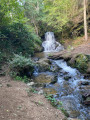
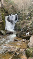
A short, half-day walk to visit the Abbey Church of Mozac along a picturesque path. Return via the same route.

Details

69244793
Creation:
Last update:
Last review:
  • Walking
    Activity: Walking
  • ↔
    Distance: 4.87 mi
  • ◔
    Average duration: 2h 25 
  • ▲
    Difficulty: Easy

  • ⚐
    Back to start: Yes
  • ↗
    Ascent: + 184 ft
  • ↘
    Descent: - 184 ft

  • ▲
    Highest point: 1,345 ft
  • ▼
    Lowest point: 1,161 ft

Description of the walk

Park on Allée des Graviers. 

(S/E) Walk down the street on the right towards the bridge over the Ambène and take the path branching off to the right just before the bridge: signpost. Follow the right bank of the Ambène, then cross it via the footbridge and continue along the left bank until you reach a T-junction with a track.

(1) Turn right onto this track to reach a four-way junction. Turn left and continue to the D446. Cross carefully at the designated crossing and cross the railway line. 

(2) Turn left onto the downhill path that runs alongside the railway line: the start is a bit tricky due to patches of tarmac. Follow this path to l’Ambène.

(3) Turn right to follow the path running along the right bank of the stream. Turn left to cross the footbridge: there are signposts. Return to the path on the right and you’ll come out onto Rue Louis Aragon, which runs past some detached houses.

(4) Cross the road to rejoin a path and return to a street called Chemin de la Rivière, which leads onto the D986, Avenue Jean Jaurès.

(5) Cross it carefully to rejoin the path opposite, still following the Ambène. Walk along the right bank, past the sports complex, and reach Avenue Léo Lagrange. Cross the road to rejoin the path. Continue straight on until you reach Rue de l’Abbaye. 

(6) Turn right to follow this street, which leads to the Abbey Church of Saint-Pierre, the park and the Lapidary Museum.

(7) Follow the outbound route in the opposite direction to return to the car park (S/E).

Waypoints

  1. S/E : mi 0 - alt. 1,345 ft - Allée des Graviers - Ambène (rivière) - Affluent du Bédat
  2. 1 : mi 0.39 - alt. 1,296 ft - T-junction
  3. 2 : mi 1.04 - alt. 1,257 ft - Level crossing
  4. 3 : mi 1.23 - alt. 1,237 ft - Continuation along the Ambene
  5. 4 : mi 1.79 - alt. 1,194 ft - Rue Louis Aragon
  6. 5 : mi 2 - alt. 1,181 ft - Avenue Jean Jaurès
  7. 6 : mi 2.32 - alt. 1,161 ft - Rue de l’Abbaye
  8. 7 : mi 2.43 - alt. 1,165 ft - Saint-Pierre Abbey Church
  9. S/E : mi 4.87 - alt. 1,345 ft - Allée des Graviers - Ambène (rivière) - Affluent du Bédat

Notes

An easy walk requiring no special equipment.

Worth a visit

The highlight of this short walk is a tour of the architectural complex comprising the abbey church and Mozac Abbey. It can be done as a half-day trip or starting from Enval (near Volvic and Chatel Guyon), and you can visit the old town and have lunch there.

The Abbey Church of Saint-Pierre de Mozac, in its present form, dates from the 12th century. It is open every day except 1 May. 

The Lapidary Museum can be visited by appointment. It houses sculptures from the original 7th-century abbey that were discovered on the site.

Reviews and comments

5 / 5
Based on 2 reviews

Reliability of the description
5 / 5
Ease of following the route
5 / 5
Route interest
5 / 5
Christi19
Christi19

Overall rating : 5 / 5

Date of your route : Oct 07, 2025
Reliability of the description : ★★★★★ Very good
Ease of following the route : ★★★★★ Very good
Route interest : ★★★★★ Very good
Very busy route : No

A pleasant walk with no elevation gain. The cathedral is well worth visiting.

Machine-translated

JP Dulac
JP Dulac

Overall rating : 5 / 5

Date of your route : May 07, 2025
Reliability of the description : ★★★★★ Very good
Ease of following the route : ★★★★★ Very good
Route interest : ★★★★★ Very good
Very busy route : No

A lovely, well-shaded route along the Ambene River
No significant elevation gain and the path is fairly wide
It’s a return walk along the same path and remains very pleasant

Machine-translated

Other walks in the area

For more walks, use our search engine .

The GPS track and description are the property of this route's author. Please do not copy them without permission.