Country:
 City:


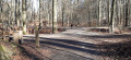

Park on Chaussée de Saint-Job, in a car park opposite the Séquoia shop, about 300 metres from Place Saint-Job. You can reach this starting point from Uccle Saint-Job station, which is 200 metres away in the direction of Place Saint-Job.
STIB bus route 60 also runs along Chaussée Saint-Job. The ‘De Wansijn’ stop is next to the car park at the starting point.
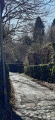
(S/E) Leave the car park and walk along Chaussée Saint-Job heading west, i.e. towards the roundabout. Further on, turn left onto Avenue Dolez and look out for the small footbridges on the right, built over the marshes bordering the Kauwberg. Follow these footbridges to the end, near the railway bridge.
(1) A path climbs to the left, leading into and across the Kauwberg whilst maintaining the same direction. Follow it for about 600 metres, then at the T-junction, take the path that climbs to the right and runs alongside a meadow, then passes through a wooded area before joining Avenue de la Chênaie opposite the cemetery. Turn left, then take Avenue des Pâturins, the first road on the right.
(2) This avenue (actually a small cul-de-sac) continues as a path. Carry on straight ahead in the same southerly direction. At the first enclosed field, continue along the path leading to the second enclosed field. Then turn left to exit the enclosed field onto Avenue Dolhez.
(3) Cross the road carefully and walk a few metres to the right to find, on your left, the start of a path next to No. 480. This path leads to the Bois de Verrewinkel. Walk through the woods, continuing straight ahead along the path as it descends. At the bottom, turn right and you’ll reach the edge of the woods on Rue de Percke.
(4) Head to the right; you are now in Linkebeek. Continue along Rue de Percke, which climbs further on through the meadows and passes under the railway line. This is also the route ofthe GR®512. Follow thisGR® route until it reaches Rue de la Longue Haie.
(5) Cross over, take the lane opposite and cross the next street (Rue Hollebeek). Continue along the path that runs alongside the fields, still heading in the same direction.
(6) Once in the middle of the fields, take the first path that leaves theGR® and heads down to the left. Follow this path until it reaches the first houses in Rhode-Saint-Genèse.
(7) At the first junction, take the road on the left, then turn right at the next crossroads (Avenue des Martins-Pêcheurs). At the first bend, continue along the path leading uphill opposite, cross a small street and carry on straight ahead through the park until you reach Rue de la Ferme.
(8) Turn left along Avenue de la Culture. Follow it to the end, then, at the T-junction, turn left onto Avenue de la Pépinière, which passes under the railway line and leads to a Y-junction.
(9) Pass Avenue de la Libération on your left and continue along Avenue des Touristes until you reach the junction with Avenue de la Forêt de Soignes. Cross it – be careful, as this road is very busy. Continue in the same direction along Rue Driesbos. Follow this street until you reach a junction with five streets.
(10) Turn right onto Chemin des Moines: this is the small cobbled street that runs down between two properties. At the end, a path running perpendicular to it runs alongside the ponds. Turn left and follow it to Rue du Dragon, which you should take to the left. At the next junction, carry on straight ahead along Chemin de Heuken, which runs between two ponds. After about a hundred metres, a path leads uphill to the right.
(11) Take this path. It leads through fields, then back between houses. At Avenue Bel Horizon, turn left and continue to the junction with the Chaussée de Waterloo. Please note: you must cross at the pedestrian crossing, as this road is very dangerous.
(12) Carry on straight ahead and take Chemin Hazedelles through the forest. Follow this path for about 1.5 km, crossing Drève Francus. You’ll reach Drève de Lorraine at a junction with six paths.
(13) Turn left onto this lane. Continue for about 1 km, crossing two major forest tracks.
(14) Atthe third junction, turn onto the winding path which climbs to the left and continues to the Chaussée de Waterloo, not far from the junction with the Drève Saint-Hubert on the right. Cross this lane and turn right onto it again for about a hundred metres.
(15) Take a path on the left that leads into the forest, then, shortly afterwards, take the first path on the left reserved for pedestrians (Chemin de Waterloo). Follow it through the woods heading due north until you reach a small road; turn right and rejoin the path 20 metres further on to the left. At the next junction, keep left onto a forest track and continue in the same direction until you reach a wide left-hand bend, which takes you back onto the Chaussée de Waterloo, near the “Prince d’Orange”.
(16) Cross the Chaussée and turn right onto Avenue du Prince d’Orange, then take thesecond street on the right, Avenue Wellington. Follow it to the end and, at the T-junction, turn left onto Avenue Jacques Pastur for a few dozen metres.
(17) Then turn right onto a path signposted ‘Parc Fond’Roy’. The path crosses the park, heading down towards the Vieille Rue du Moulin. Turn left onto this road and follow it for about a hundred metres.
(18) Before the bend in the road, turn onto a small path that climbs to the right and crosses the Plateau Avijl. This area of meadows and gardens is now a protected area. Continue along the main path to cross it. You’ll reach Rue Jean Benaets opposite a large block of flats. Follow the street to the right and, a little further on, turn left onto Chemin Avijl, a tiny alleyway that winds its way between the houses and leads to Chaussée Saint-Job. All that remains is to turn left to reach the car park about a hundred metres further on (S/E).
.

 Visorando Member
 Easy

 Association / Club / Walk leader