Country:
 City:
City:


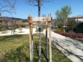
The starting point is in the village of Saint-Georges-d’Orques at the end of Chemin du Reclus. Parking is limited but is available at the side of the road. This spot is well known to dog walkers and is a crossing point for horses from the village’s riding centre.
(S/E) Head west along the old railway line, which has been converted into a leisure trail. The path is typical of the Montpellier hills, being rather stony.
(1) Ignore the return path on the left and carry on straight ahead. Ignore another path on the left. Continue straight ahead.
(2) Ignore another return path on the left. Carry on for a further 300 m along the old railway line.
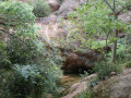
(3) After 1,500 m along the old railway line from the start, turn left, pass under an old railway bridge and immediately take the path on the left. Follow the Ruisseau de Lasséderon.
(4) At the entrance to the wooded area, at the fork, turn left, still following the stream, and, 200 m further on, continue along the path which turns right and moves away from the stream. You’ll reach the top of the hill, at the end of a track.
(5) Take the path on the right, heading due west, which turns north, then left at the junction to join a small track.
(6) Turn right onto this track, then onto a path that continues it, keeping the same northerly direction and ignoring the offshoots to the left and right.The Visorando app may be useful. After a long maze of forest tracks, you’ll rejoin the old railway line and the old railway bridge.
(3) Carry on straight ahead along the path you took on the way there, but in the opposite direction, and you’ll come back to a fork you passed on the way there.
(2) Take the path leading down to the right. Cross the stream and follow it as it takes a circular course to the right.
(7) After crossing the dry stream, follow it for about 150 m. The path is clearly marked, so there’s no need to worry here.
(8) Climb steeply to the left, heading north-east. The final stretch of the walk involves a fairly steep climb before reaching the old railway line.
(1) You’ll reach the ‘Chemin du Reclus’ and follow it to the right for a few metres until you reach the car park (S/E).

 Visorando Member

 Association / Club / Walk leader
 Moderate