Between La Sep and La Morge

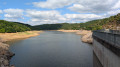
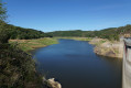
This route from Saint-Hilaire-la-Croix, with its Romanesque church and 12th-century priory, offers sweeping views over the Allier valley and the Madeleine mountains. Numerous crosses dot this route, which winds its way along the Sep dam.

Details

n°23768910
Creation:
Last update:
Last review:
  • Walking
    Activity: Walking
  • ↔
    Distance: 8.84 mi
  • ◔
    Average duration: 5h 05 
  • ▲
    Difficulty: Moderate

  • ⚐
    Back to start: Yes
  • ↗
    Ascent: + 1,194 ft
  • ↘
    Descent: - 1,198 ft

  • ▲
    Highest point: 1,975 ft
  • ▼
    Lowest point: 1,280 ft

Photos

Description of the walk

On the D2144, 23 km north-west of Riom towards Montluçon, at a place called l’Arbre de la Ronce, take the D406 to Saint-Hilaire-la-Croix. There is a car park near the tree-lined square in front of the town hall and the church.

(S/E) From the starting sign at the entrance to the car park (church and 12th-century priory), take the D406, passing on the left-hand side of the “nursery school”. Follow this road for 1 km. At the top of a hill, turn right onto a path which, after 500 m, crosses a road at the entrance to the Combe de la Lèbre.

(1) Carry on straight ahead and descend to the junction of severalPR® trails, with a view of the reservoir. Continue along the path on the left overlooking the reservoir, until you reach the Sep dam.

(2) Cross the dam and head down the path on the left (gate) to the river. Turn right (gate) onto the flat path to reach the Moulin Josse.

(3) Take the road (D122) to the right for 150 m. Take thefirst path on the left, which crosses the Morge via a footbridge, climbs back up into the forest and emerges onto the plateau. Continue straight ahead until you reach the hamlet of La Tour Serviat. The path becomes a tarmac lane and leads onto the D408.

(4) Turn left onto it, then, at the Fork in the road with the cross, carry on straight ahead and pass the bus shelter. After 150 m, take a path on the right.

(5) At the T-junction, turn right, then immediately left. After the cross (Croix de Saint-Priest, patron saint of Montcel, 1898), the path becomes grassy and descends through meadows (offering sweeping views of the Allier valley and the Madeleine hills) and then into the woods. Turn right onto the D408 for 400 m and head down a path on the right, which cuts across two bends in the road and rejoins it in the village of Montcel. Continue straight down, passing the town hall and then the church, until you reach the junction below the church.

(6) Take the Jozerand road (D408). In the hamlet of Les Chanteaux, leave the road at the hairpin bend and take the path opposite. You’ll reach the D122 at a place called Pont de Montcel.

(7) Turn left onto it and, at the junction after the bridge over the Morge, head straight up. At thefirst junction 100 metres on, turn left onto a track and follow it for 2 km. At the crossroads on the plateau, take the grassy path straight ahead which leads down to the Rioux stream.

(8) Walk alongside it for a few metres, cross it (footbridge) and reach a small road. Follow it straight ahead, passing through the hamlet of La Rochette, then that of Les Bajaris straight on. Continue, passing La Croix la Pierre (dating from 1874) and reaching the junction withthe GR®300.

(9) Turn right onto it towards Saint-Hilaire-la-Croix. At the iron cross, turn left and walk past the cross known as ‘Jacques’ (dating from 1573) to return to the town hall car park (S/E).

Waypoints

  1. S/E : mi 0 - alt. 1,814 ft - Car park at the town hall and the - Église Saint-Hilaire (Saint-Hilaire-la-Croix)
  2. 1 : mi 0.99 - alt. 1,903 ft - Combe de la Lèbre
  3. 2 : mi 2.02 - alt. 1,519 ft - The dam at - Sep (cours d'eau) - Affluent de la Morge
  4. 3 : mi 2.42 - alt. 1,476 ft - Moulin Josse - Morge (rivière) - Affluent de l'Allier
  5. 4 : mi 3.94 - alt. 1,972 ft - The Serviat Tower
  6. 5 : mi 4.43 - alt. 1,877 ft - T-junction
  7. 6 : mi 5.28 - alt. 1,526 ft - Montcel
  8. 7 : mi 5.8 - alt. 1,299 ft - The Montcel Bridge
  9. 8 : mi 7.38 - alt. 1,581 ft - Le Rioux
  10. 9 : mi 8.37 - alt. 1,857 ft - GR300
  11. S/E : mi 8.84 - alt. 1,814 ft - Car park at the town hall and the - Église Saint-Hilaire (Saint-Hilaire-la-Croix)

Notes

For your safety, always take a bottle of water, a hat, warm and rainproof clothing with you, and wear suitable walking shoes.
Depending on weather conditions, some routes are not recommended in bad weather (fog) or are impassable, or even off-limits, during the winter season.
Some sites are fragile; please stay on the designated paths. Avoid picking wild flowers and disturbing wildlife. Please pick up your rubbish.
On some routes, pets are not allowed.

Always be cautious and plan ahead when you're outdoors. Visorando and the author of this route cannot be held responsible for any accidents occurring on this route.

The GR® and PR® markings are the intellectual property of the Fédération Française de Randonnée Pédestre.

Reviews and comments

4.7 / 5
Based on 1 review

Reliability of the description
5 / 5
Ease of following the route
5 / 5
Route interest
4 / 5
ElisabethMichel
ElisabethMichel

Overall rating : 4.7 / 5

Date of your route : May 26, 2024
Reliability of the description : ★★★★★ Very good
Ease of following the route : ★★★★★ Very good
Route interest : ★★★★☆ Good
Very busy route : No

A really lovely walk with some lovely paths...
No spectacular views, but a peaceful, idyllic setting...
The Sep reservoir is a very interesting spot and the waterfall cascading down the steps is well worth seeing...
Best done in really dry weather to avoid the muddy patches here and there.
We started the walk at the church in Montcel and found ourselves at the Étang des Grands Prés by lunchtime – a lovely spot with picnic tables and benches.

Machine-translated

Other walks in the area

For more walks, use our search engine .

The GPS track and description are the property of this route's author. Please do not copy them without permission.