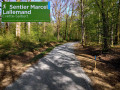
Between Cravanche and the Haut du Mont

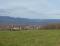
This walk, on a limestone plateau to the south of the Salbert massif, overlooks the town of Belfort. It offers views of the Vosges massif (the northern border of the Territoire de Belfort), as well as various parts of the town, the old town, and the vast Alstom factory.

Details

n°73315679
Creation:
Last update:
Last review:
  • Walking
    Activity: Walking
  • ↔
    Distance: 2.72 mi
  • ◔
    Average duration: 1h 30 
  • ▲
    Difficulty: Easy

  • ⚐
    Back to start: Yes
  • ↗
    Ascent: + 335 ft
  • ↘
    Descent: - 325 ft

  • ▲
    Highest point: 1,562 ft
  • ▼
    Lowest point: 1,381 ft
  • ⚐ Country: France
  • ⚐ City: Essert (90850)
  • ⚑
    Start/End: N 47.648314° / E 6.814027°
  • ❏
    IGN map(s): Ref. 3520ET, 3621OT
  • Hour-by-hour weather

Description of the walk

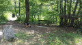
The route starts from a free car park at the edge of the woods, near Combe la Dame (elevation 435).

(S/E) Turn your back on the road (D16) and follow the path marked with a Red Triangle for about 350 m.

(1) After a very gentle climb, turn left at the three-way junction onto a ridge path on the north side, marked with a Red Ring. Pass over a valley, an old quarry and the Cravanche cave.

(2) The path continues on the eastern side after turning right, offering a fine view of Belfort and the Vosges. You will reach a junction.
   
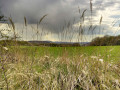
(3) Turn right, following the Red Ring markings. The return journey is on the western side, along a path that runs alongside a lovely pasture and is marked by old boundary stones. Return to the three-way junction at the start.

(1) Carry on straight ahead and return to the car park where you started (S/E). 

Waypoints

  1. S/E : mi 0 - alt. 1,391 ft - Car park
  2. 1 : mi 0.24 - alt. 1,447 ft - Junction of the circular loop
  3. 2 : mi 0.78 - alt. 1,467 ft - Right-hand bend, views
  4. 3 : mi 1.53 - alt. 1,381 ft - Junction, turn right
  5. S/E : mi 2.72 - alt. 1,394 ft - Car park

Reviews and comments

4.8 / 5
Based on 2 reviews

Reliability of the description
5 / 5
Ease of following the route
5 / 5
Route interest
4.5 / 5
User 28749416

Overall rating : 4.7 / 5

Date of your route : Sep 07, 2026
Reliability of the description : ★★★★★ Very good
Ease of following the route : ★★★★★ Very good
Route interest : ★★★★☆ Good
Very busy route : No

A pleasant walk through the woods.
Unfortunately, the view of Belfort is spoiled by the high-voltage power lines.

Machine-translated

User 7104004

Overall rating : 5 / 5

Date of your route : Feb 09, 2026
Reliability of the description : ★★★★★ Very good
Ease of following the route : ★★★★★ Very good
Route interest : ★★★★★ Very good
Very busy route : No

Very nice route

Machine-translated

Other walks in the area

For more walks, use our search engine .

The GPS track and description are the property of this route's author. Please do not copy them without permission.