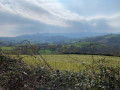
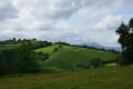
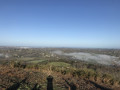
Between Amotz and Suhalmendi

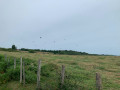
A lovely circular route through the hills, starting from Amotz and heading towards Suhalmendi.

Details

4222616
Creation:
Last update:
Last review:
  • Walking
    Activity: Walking
  • ↔
    Distance: 5.73 mi
  • ◔
    Average duration: 3h 15 
  • ▲
    Difficulty: Easy

  • ⚐
    Back to start: Yes
  • ↗
    Ascent: + 712 ft
  • ↘
    Descent: - 702 ft

  • ▲
    Highest point: 702 ft
  • ▼
    Lowest point: 62 ft

Photos

Description of the walk

From Saint-Pée-sur-Nivelle, head towards Sare via the D3. Park at Amotz in the fronton car park.

(S/E) Leave the car park and turn left along the D3 until the first bend. As you come out of the bend, ignore a road branching off to the left.

(1) Turn left onto the second road heading north. This road runs alongside the D3 and joins it further on.

(2) Carefully turn left along the D3 until you reach the next road branching off to the left.
On this stretch, the verge is not very well maintained and is often overgrown with tall grass, and the departmental road is quite busy.

(3) Turn left, heading south-west, onto Chemin Larrondoa, then continue along Chemin Mirandako Borda (Miranda Farm). After the farm, the road becomes a track. Turn left towards the south, then turn right onto the track until you reach a road at a T-junction.

(4) Turn left. Keep to the right at the Eltxcauspeko Borda junction and carry on to the next junction.

(5) Carry on to the right along the wide Elsosp Borda track, which winds its way to a triangular junction.

(6) Turn left and stay on this track until you reach Mendiondo Farm (Mendiondokoborda).

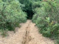
(7) Follow Chemin Mendiondokoborda to the left for 100 m, then turn left again, heading north, at the first junction. The track ends and becomes a footpath.

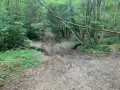
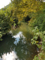
(8) Take the footpath on the right heading east. Follow a ridge and then, after a fairly steep descent, follow the Tontolo Stream (Tontoloko Erreka) until you rejoin the Martienea Track.

(9) Turn left towards the north, then take the first road on the right to join the D3. Turn right along the D3 to return to the fronton car park (S/E).

Waypoints

  1. S/E : mi 0 - alt. 118 ft - Amotz fronton car park
  2. 1 : mi 0.32 - alt. 138 ft - Murionea Track
  3. 2 : mi 0.66 - alt. 72 ft - D3 road - Nivelle (fleuve)
  4. 3 : mi 0.84 - alt. 62 ft - Larrondoa Track
  5. 4 : mi 1.52 - alt. 354 ft - T-junction, turn left
  6. 5 : mi 1.82 - alt. 387 ft - Junction; turn right
  7. 6 : mi 2.91 - alt. 614 ft - Triangular junction
  8. 7 : mi 3.64 - alt. 594 ft - Mendiondokoborda
  9. 8 : mi 4.05 - alt. 571 ft - Ridge path on the right
  10. 9 : mi 5.14 - alt. 128 ft - Martienea Path
  11. S/E : mi 5.73 - alt. 118 ft - Amotz fronton car park

Notes

There are no water sources along the route.

This route should be avoided after rainfall as it becomes very difficult to descend between (8) and (9), and the path along the stream becomes very muddy as it is regularly damaged by forestry machinery.

Reviews and comments

4.7 / 5
Based on 2 reviews

Reliability of the description
5 / 5
Ease of following the route
4.5 / 5
Route interest
4.5 / 5
togola
togola

Overall rating : 4.7 / 5

Date of your route : Jul 31, 2023
Reliability of the description : ★★★★★ Very good
Ease of following the route : ★★★★☆ Good
Route interest : ★★★★★ Very good
Very busy route : No

A major point to bear in mind towards the end of the walk
. The descent is really steep and rutted! There is a slightly easier alternative route halfway down, but it’s still not easy by any means, especially with children or beginners!!

Machine-translated

celafet
celafet

Overall rating : 4.7 / 5

Date of your route : Apr 05, 2021
Reliability of the description : ★★★★★ Very good
Ease of following the route : ★★★★★ Very good
Route interest : ★★★★☆ Good
Very busy route : No

There are some lovely views along this route, but the section between points 2 and 3, which runs alongside the road without a pavement, isn’t great. There’s also a stretch between points 8 and 9 that I found very dangerous: an extremely steep descent where one of the children in our group took quite a nasty tumble.

Machine-translated

Other walks in the area

For more walks, use our search engine .

The GPS track and description are the property of this route's author. Please do not copy them without permission.