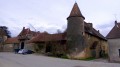
From the abbey to the châteaux, starting from Cirey-les-Bellevaux

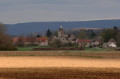
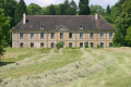
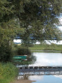
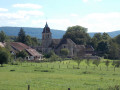
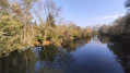
This circular route starts at the town hall in Cirey-les-Bellevaux. Enjoy your walk along the Ognon as you pass numerous landmarks: the château, the Saint-Justin Chapel and the Malgéard Mill.

Details

29060760
Creation:
Last update:
Last review:
  • Walking
    Activity: Walking
  • ↔
    Distance: 13.92 mi
  • ◔
    Average duration: 7h 10 
  • ▲
    Difficulty: Difficult

  • ⚐
    Back to start: Yes
  • ↗
    Ascent: + 837 ft
  • ↘
    Descent: - 860 ft

  • ▲
    Highest point: 945 ft
  • ▼
    Lowest point: 719 ft
  • ⚐ Country: France
  • ⚐ City: Cirey (70190)
  • ⚑
    Start/End: N 47.395779° / E 6.132584°
  • ❏
    IGN map(s): Ref. 3322E, 3422O
  • Hour-by-hour weather

Photos

Description of the walk

Park in the town hall car park.

(S/E) With your back to the town hall, turn right onto Rue de l’Église. As you leave the village, head up the hill on the right.

(1) Cross the D09 by first turning right then left and continue along the Cirey hillside until you reach the Bois de la Lançoire.

(2) Walk along the edge of the Bois de la Lançoire. Once at the bottom, cross the D209 then turn left onto the road towards Chambornay-lès-Bellevaux. Follow it to the right, then leave it shortly after the bridge on the right. Carry on and pass above the abbey.

(3) Continue to follow the signposts and keep going straight ahead until the end of the track at the Combe de Louis.

(4) Take the track on the left and continue along the road to reach the D31 at Chambornay.

(5) Cross it carefully and turn left onto Rue de la Graye, then straight on into Rue du Treuil. At the square, carry on straight ahead and then take the first right. At the church, turn left towards the Chapelle Saint-Justin.

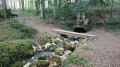
(6) Leave the road, stay on the path on the right and carry on straight ahead until you reach the junction near the river and the Moulin de Malgérard.

(7) Take the forest track on the left which runs alongside the stream. Keep left onto the D5 and then right onto the track that runs alongside the woodland and fields. At the track, keep left and join the D31.

(8) Follow it for about a hundred metres, then leave it to take a path which, further on, turns left to rejoin the same departmental road.

(9) Cross the D31 with care and continue along the path which leads to the first houses in the village of Aulx-lès-Cromary.

(10) Turn right onto the Chemin des Craies. Keep right at the end of the track, then turn left at Aux Plantées. Continue straight ahead along the track.

(11) At the end of the track, turn right onto the Route de Moncey (D5), cross the Ognon and arrive at a crossroads.

(12) Turn left towards Thurey-le-Mont, following the D14. Leave Moncey, continuing straight ahead on the D14e, then turn left at the water treatment plant.

(13) Turn onto a path climbing to the right. Follow the road past the town hall. Continue straight on at the bend, follow the signposts and leave the village via the Chemin de la Combe until you reach a path on the right.

(14) Take the path on the right, then continue towards Bois Bas.

(15) Cross over, staying on the same track until it ends at another forest track.

(16) Turn left. After a climb, go down the first right before turning left onto a track until it ends: turn sharply left onto a path. Follow it until you reach a sort of roundabout.

(17) Turn left onto a footpath, then first turn right then left to exit the forest. Continue straight on to reach Cirey. Cross the Ognon, continue to one of its branches and emerge onto Rue de l’Église.

(18) Turn left onto this street to reach the town hall (S/E).
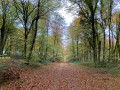
Waypoints

  1. S/E : mi 0 - alt. 755 ft - Cirey Town Hall
  2. 1 : mi 0.4 - alt. 768 ft - D209
  3. 2 : mi 0.8 - alt. 883 ft - Bois de la Lançoire
  4. 3 : mi 1.76 - alt. 833 ft - Castle (former abbey)
  5. 4 : mi 2.56 - alt. 925 ft - Combe de Louis
  6. 5 : mi 3.6 - alt. 778 ft - D31
  7. 6 : mi 3.96 - alt. 843 ft - Saint-Justin Chapel
  8. 7 : mi 4.95 - alt. 768 ft - Malgérard Mill
  9. 8 : mi 5.54 - alt. 840 ft - D31
  10. 9 : mi 6.2 - alt. 804 ft - D31
  11. 10 : mi 6.88 - alt. 807 ft - First houses in Aulx-lès-Cromary
  12. 11 : mi 8.05 - alt. 735 ft - Route de Moncey (D5)
  13. 12 : mi 8.4 - alt. 735 ft - Bridge - Ognon (rivière)
  14. 13 : mi 9.12 - alt. 745 ft - Water treatment plant
  15. 14 : mi 9.54 - alt. 804 ft - Junction on the path
  16. 15 : mi 9.79 - alt. 781 ft - Bois Bas entrance
  17. 16 : mi 10.79 - alt. 919 ft - Junction onto a forest track
  18. 17 : mi 12.34 - alt. 906 ft - Roundabout
  19. 18 : mi 13.76 - alt. 748 ft - Rue de l’Église
  20. S/E : mi 13.92 - alt. 755 ft - Cirey Town Hall

Notes

Parking is available at the Town Hall square.
Follow the dark green signposts.

Worth a visit

Places of interest:
- The River Ognon, which rises at Château-Lambert and flows into the Saône. This river forms a natural border between Haute-Saône and Doubs.
- The former Abbey of Notre-Dame de Bellevaux
- Moncey Castle

Reviews and comments

4.5 / 5
Based on 2 reviews

Reliability of the description
5 / 5
Ease of following the route
4.5 / 5
Route interest
4 / 5
La Godasse Folle
La Godasse Folle

Overall rating : 4.3 / 5

Date of your route : Mar 16, 2025
Reliability of the description : ★★★★★ Very good
Ease of following the route : ★★★★☆ Good
Route interest : ★★★★☆ Good
Very busy route : No

A very accessible walk. For once, we had a bit of an elevation gain in Haute-Saône! It adds a bit of excitement to the walk. Not much tarmac, which is just as well.
On the other hand, there’s not much of interest apart from the countryside and woodland scenery. But it’s a nice walk.

Machine-translated

Patrick_C25
Patrick_C25

Overall rating : 4.7 / 5

Date of your route : Feb 05, 2025
Reliability of the description : ★★★★★ Very good
Ease of following the route : ★★★★★ Very good
Route interest : ★★★★☆ Good
Very busy route : No

A lovely walk through woods and fields.
A very easy route to follow and perfectly signposted; I didn’t use the app at all during the walk. Very few people about and no sections on the road.
No difficulty whatsoever, apart from the length for some – around 23 km.
A few muddy patches in the forest (logging in progress), mainly after Moncey.
I’d recommend it.

Machine-translated

Other walks in the area

For more walks, use our search engine .

The GPS track and description are the property of this route's author. Please do not copy them without permission.