


Refine your search for walks in Église Saint-Roch (Vallenay)
Église Saint-Roch (Vallenay) walks


 Le Clos Saint-Martin in Vallenay
 Tourist office
 5.66 mi
 +75 ft
 -72 ft
 2h 40
2h 40
 Easy
Easy
 Departure from Vallenay (Cher)
This walk offers a mix of wooded landscapes and architectural gems. You’ll also have the chance to meet poultry and snail farmers.
You can also combine this route with those of Saint-Symphorien, Chambon and Crézançay-sur-Cher.
Walks near Église Saint-Roch (Vallenay)
La Celle - Noirlac Abbey
 4.13 mi
+82 ft
-167 ft
2h 00
Easy
Departure from La Celle (Cher) (Cher)
4.13 mi
+82 ft
-167 ft
2h 00
Easy
Departure from La Celle (Cher) (Cher)
In Bruère-Allichamps, a stone topped with the French flag marks the geographical centre of France.Until the4th century, this stone showed Roman legions the right direction and bears the following inscription:Happy Augustus, Tribune for thethird time, Father of the Fatherland - Proconsul. Leagues: 14 from Bourges (Avaricum) 12 from Châteaumeillant (Mediolanum) 25 from Neris
Virlay - La Tranchasse
 7.09 mi
+43 ft
-33 ft
3h 20
Easy
Departure from Saint-Amand-Montrond (Cher)
7.09 mi
+43 ft
-33 ft
3h 20
Easy
Departure from Saint-Amand-Montrond (Cher)
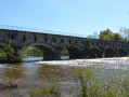
In Saint-Amand-Montrond, Lake Virlay is a popular spot for walkers and sailing enthusiasts. The streets of Saint-Amand are perfect for a leisurely stroll and lead you to the Chemin de ronde de la Forteresse de Montrond. Follow the Canal de Berry and discover the Gallo-Roman theatre in Drevant and the Pont Canal de la Tranchasse.
From Meillant to La Celle
 5.08 mi
+171 ft
-151 ft
2h 30
Easy
Departure from Meillant (Cher)
5.08 mi
+171 ft
-151 ft
2h 30
Easy
Departure from Meillant (Cher)
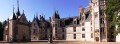
First stage of the hike from Meillant to the Tronçais Forest.
Meillant to Tronçais path
 38.05 mi
+1,070 ft
-896 ft
7 days
38.05 mi
+1,070 ft
-896 ft
7 days
 Moderate
Departure from Meillant (Cher)
Moderate
Departure from Meillant (Cher)
Leaving Meillant, you will pass through La Celle, Bruère, Saint-Amand-Montrond, Drevant, Colombiers, Coust and Charenton-du-Cher before finally reaching the Saint-Bonnet pond in the Tronçais forest (Allier).
Discover the heart of France and its landscapes, as well as Meillant Castle, Noirlac Abbey, Virlay Lake, the Berry Canal and the Marmande Valley.
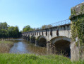
La Tranchasse - Coust Pond
 4.85 mi
+125 ft
-98 ft
2h 20
Moderate
Departure from Colombiers (Cher) (Cher)
4.85 mi
+125 ft
-98 ft
2h 20
Moderate
Departure from Colombiers (Cher) (Cher)
Construction of the Canal de Berry began around 1808 on the initiative of Napoleon I and was completed in 1841. It took its current name, "Canal de Berry", in 1830. Its creation required, among other things, the installation of 115 locks, one every three kilometres. It consists of three branches that meet at Fontblisse, which is point 0. Many barges used to travel along it, transporting grain, wood and iron ore. The canal was decommissioned in 1955.
Coust Pond - Charenton
 5.04 mi
+305 ft
-233 ft
2h 35
Moderate
Departure from Colombiers (Cher) (Cher)
5.04 mi
+305 ft
-233 ft
2h 35
Moderate
Departure from Colombiers (Cher) (Cher)
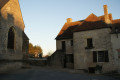
The commune of Coust is located south of the Cher, on the border between Berry and Bourbonnais in the Chignon valley. In the past, the stream fed a large pond between Pied de Coust and the church. It turned the wheels of the mills at Touzelles and Petit Paris before reaching the Rouchat mill. In the past, this stream was essential for Saint-Amand as it fed the moats of Montrond Castle and then those of the Saint-Amand-sous-Montrond enclosure.