Country:
 City:
City:


At Le Rove on the D568, park in the Allée des Écoles near the chemist’s.
(S/E) Head west, past the pharmacy, then turn right onto Boulevard de la Carrairade. Pass to the right of the church, cross Avenue Juliot Curie (D5), then follow Traverse du Baou to the last houses.
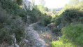
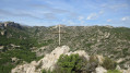
(1) Turn right onto a stony path that climbs steeply, heading north-east. You’ll catch sight of the Vierge du Rove. You might want to make a round trip there.
(2) At an H-shaped junction, keep to the right, following the ridge. You’ll reach a multi-path junction, including the gas pipeline track at elevation 238.
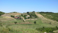
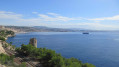
(3) Cross the track, then head east along the wide, straight track. There are stunning views of the Bay of Marseille on one side, and on the other side ofthe Étang de Berre with the Sainte-Victoire massif in the background. Pass elevation 272 (the summit, marked by a large cemented cairn), then elevation 260 at a track junction. Continue eastwards until you reach a Fork in the road and a wire fence. Below: La Vérune, a barn used for milking wild goats to produce Brousse du Rove.
(4) Turn right and follow the track that passes by the Puits de l'Escorche. Further on, turnsharply left at a Y-junction at the 218-metre mark, then immediately look for a path on the right.
(5) Follow this path as it climbs between two hills. After a bend to the left, turn right at a Y-junction, heading south-east. Please note that the path is barely visible at first.
(6) You’ll reach a junction with a wide path (cairn). Turn right onto this straight path heading west. You’ll reach a Y-junction.
(7) Turn left, heading south, for a gentle climb. The path then descends, winding gently. Admire the Grands Vallons with their numerous terraces used for rainwater retention. You’ll reach a star-shaped junction.
(8) Take thefirst path on the left, which climbs southwards towards a menhir-shaped rock. Further on, pass an old wooden electricity pole. You’ll reach the ridge and a DFCI track. Follow this track to the left. Take in the scenery. You’ll reach a Y-junction.
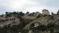
(9) Follow the track on the right (barrier) which climbs and passes an old electricity substation. You’ll reach a large circular clearing, the summit at altitude 279. Cross it and follow a small path that runs along a ridge and descends towards a DFCI track with a hairpin bend. Stunning views of Marseille, the hamlet of La Nerthe and the quarries.
(10) Turn left onto the track, pass a brick ventilation shaft, then keep left at a Y-junction. Follow an access track to the quarries below, then after a left-hand bend and a short climb, join a DFCI track at a Y-junction and a barrier.
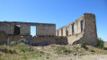
(11) Turn right onto the track, then leave it on the right 50 m further on to take a path that climbs to the top of a hill. At the top (elevation 273), turn left to descend towards the ruins of an old sheepfold, then arrive at a crossroads with a large, solitary cypress tree in the middle.
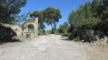
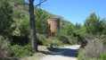
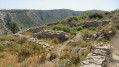
(12) Continue straight on towards an old cemented pillar, the former entrance to the Domaine de Cossimont. Arrive at the site and explore the grounds: a well, the remains of a garden, an orchard, an orange grove, terraces, dwellings and a large farm building.
(13) At the north-eastern end of the large building, turn right towards some stone walls. You’ll catch a glimpse of the Vérune, a goat’s path. After a short climb, you’ll reach a junction with the gas pipeline track (yellow posts) at elevation 238.
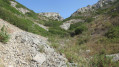
(14) Turn left onto this track, which descends steeply. At the bottom of the valley, turn right heading north onto a small stony path, then 100 m further on, turn left at a Y-junction.
(15) Turn right at two successive junctions and come out onto a wide, very stony path.
(16) Turn left onto a path that climbs and then descends into a large plain, with the Puits du Siou Blanc on the right . Continue towards two enormous pine trees.
(17) Continue straight on at an X-junction at the 218m mark and follow the Vallon Gorge de Madame track, lined with deciduous trees planted by primary schools in Le Rove. The scenery is magnificent. At the end of the long straight path, you’ll reach another school plantation and a Y-junction. Leave the path to the Vallon de la Gipière on your right, then arrive at a triangular junction at elevation 167.
(18) Keep to the left, then 40 m further on, leave the track to the left. Do not follow the track leading uphill alongside the gas pipes, but turn immediately right into a pretty valley hollow. At the end of the valley, you will reach the junction you passed on the way out.
(2) Turn right and follow the route back in the opposite direction to return to the car park (S/E).
 Visorando Member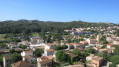

 Difficult