Country:

 City:


Red and white markings on the GRT66 trail – access
(S) From the refuge, head north-east up the steep slope towards the Col de Terre Negre and Beille (the IGN 1:25,000 map is inaccurate here). You’ll reach a fork in the path. There’s a wooden signpost.
(1) Leave the climb to the Col de Terre Negre on your right. Continue straight ahead along the GRT66 access route. You will reach the Col du Reutort at an elevation of 2,245 metres fairly quickly. Directional signpost.
YellowPR®markings
(2) Turn left, north-west, climbing up the ridge. You’ll come to a barely visible fork.
(3) Two options:
- turn right to climb to the Pic de Pradet and rejoin the original path further on.
- continue along the mountainside, following the route map provided and the route description.
You’ll come to a confusing fork in a grazing area. Yellow markings in two directions.
(4) Ignore the right-hand turn which suggests heading due east (to climb Pic de Pradel). Carry on straight ahead following the yellow markings along the mountainside. Take care on this sloping path. You must pay close attention. The path turns westwards until it reaches a pass at the end of a ridge.
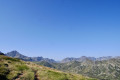
A very beautiful spot with stunning, wild scenery. View of the Étang de Laparan below.
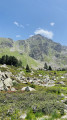
(5) Turn sharply right, heading due north-east on the other side of the ridge. Magnificent scenery. The path descends slightly to the 2307-metre mark and climbs again as it heads due north. Reach the highest point at 2341 metres (360° panorama).
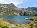
(6) Continue north and, via a steep descent, reach the Étang de Ruille. The path to follow is clearly visible, marked and signposted (often in the opposite direction to the ascent).
(7) Go round this beautiful pond on the left and reach a junction and the GRT66 access point. There is a signpost.
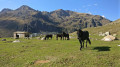
(8) Turn left, heading due north, onto the GRT, heading downhill, and arrive at the banks of the Ruisseau de la Coume du Rieutort. Go round the enclosure on the left, cross the stream and reach the beautiful Cabane du Rieutort (bench).
(9) Continue along the right bank of the stream without crossing the footbridge. After a gentle descent, enter the forest and finish the day with a steep descent to reach the Étang de Laparan car park (E).
 Visorando Member

 Difficult