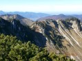
From Lake Tegernsee to the summit of the Fockenstein

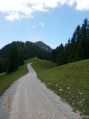
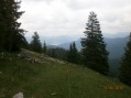
The Fockenstein (1,564 m) is a peak in the Bavarian Pre-Alps, to the west of Lake Tegernsee. Starting on a forest track alongside a stream, the second half of the walk offers superb views of the Bavarian Alps. Once you reach the summit, you’ll be treated to a magnificent panorama.

Details

282169
Creation:
Last update:
Last review:
  • Walking
    Activity: Walking
  • ↔
    Distance: 8.82 mi
  • ◔
    Average duration: 6h 05 
  • ▲
    Difficulty: Moderate

  • ⚐
    Back to start: Yes
  • ↗
    Ascent: + 2,365 ft
  • ↘
    Descent: - 2,333 ft

  • ▲
    Highest point: 5,072 ft
  • ▼
    Lowest point: 2,772 ft

Photos

Description of the walk

The starting point is at the Sonnenbichl ski resort.

(S/E) From the car park, take the path leading uphill through the forest (follow the E4/611a signposted route). Do not take the path on the left (which is also signposted E4). After a few metres, you will cross the
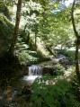
Zeiselbach after a few metres.
After the stream, you’ll reach a crossroads; turn left to stay on the E4/611a
Continue along the forest path for about 4 kilometres, following the stream until you reach the next junction.

(1) Ignore the path coming from the right (it is higher up); your path then takes a hairpin bend to the left, crosses the stream and, 200 metres further on, you’ll reach another junction: turn right to leave the forest.
Walk along the edge of the forest for about 300 metres; the path turns left and you’ll come to a chalet-restaurant, the “Aueralm”.

(2) Continue for 800 metres until you reach a path on the right (the return route for the walk).

(3) Stay on the path until you reach a hamlet (Neuhüttenalm) consisting of four houses, 1 km further on.

(4) Take the path straight ahead (do not turn left) and follow it for 600 metres to the next junction.

(5) Turn right; after 650 metres, the path ends.

(6) Then follow a simple path which climbs up to the Fockenstein. Pass a path on your left and reach the summit via a fairly steep climb.

(7) From the summit of the Fockenstein, head back down via the path opposite for about 1,200 metres until you rejoin the track you took on the way up.

(3) Walk back down to the car park along the same path you took on the way up (S/E).

Waypoints

  1. S/E : mi 0 - alt. 2,772 ft - Start at the car park at the end of Sonnenbischlweg
  2. 1 : mi 2.5 - alt. 4,045 ft - Turn left to head towards Zeiselbach
  3. 2 : mi 2.8 - alt. 4,150 ft - Mountain hut and restaurant, the “Aueralm”
  4. 3 : mi 3.16 - alt. 4,154 ft - Continue along the path
  5. 4 : mi 3.75 - alt. 4,383 ft - “Neuenhüttenalm” hamlet
  6. 5 : mi 4.07 - alt. 4,547 ft - Turn right
  7. 6 : mi 4.45 - alt. 4,829 ft - At the end of the road, take the footpath
  8. 7 : mi 4.83 - alt. 5,069 ft - Fockenstein summit
  9. S/E : mi 8.82 - alt. 2,776 ft - Car park

Notes

To get there from Munich

  • Train/Bus: Take the train towards Tegernsee and get off at Gmund. Then take bus 9559 (the bus stop is on the road opposite the station, which you’ll need to cross) towards Tegernsee (make sure you take a bus that goes via Bad Wiessee, as this isn’t the direct route to Tegernsee), and get off at Söllbach, Bad Wiessee. Walk back up the main road to cross the “Söllbach” stream. Turn left onto “Sollbachstraße”, then right onto “Sonnenbichweg”, which leads directly to the start of the route.
  • By car: from Munich, take the A8 motorway towards Salzburg, and exit at Holzkirchen. Then take the B318. In Gmund, when you reach the traffic lights just before the bridge over the “Mangfall” river, turn right to stay on the B318. In Bad Wiessee, turn right onto Söllbachtalstraße, which becomes “Sonnenbichlweg”. The road ends at a car park where you can park. There is a charge for parking; the price is reasonable and is charged per day.

Hiking map: KOMPASS-Wanderkarten, Volume 8 “Tegernseer Tal” ISBN-13: 978-3990440728

Worth a visit

Along the way, you can stop for a bite to eat at the “Aueralm” chalet restaurant.
Head to the shore of LakeTegernsee, which is bordered by the starting/finishing town of Bad Wiessee.
In Rottach/Egern (at the far end of the lake), a cable car (the Wallbergbahn) takes you close to the summit of the “Wallberg” (1,722 m), which you can then climb to on foot after getting off the cable car. You can also enjoy a meal at the “Panorama Restaurant”. The ascent to the Wallberg from Rottach/Egern is another hiking option.

Reviews and comments

4.7 / 5
Based on 1 review

Reliability of the description
4 / 5
Ease of following the route
5 / 5
Route interest
5 / 5
Piefer1607#
Piefer1607#

Overall rating : 4.7 / 5

Date of your route : Sep 12, 2024
Reliability of the description : ★★★★☆ Good
Ease of following the route : ★★★★★ Very good
Route interest : ★★★★★ Very good
Very busy route : No

Quite easy to follow as the route is well signposted

Machine-translated

For more walks, use our search engine .

The GPS track and description are the property of this route's author. Please do not copy them without permission.