
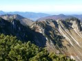
Brecherspitz summit

The Brecherspitz is a superb peak situated to the south-west of Schliersee. It is shaped like a horseshoe, which hikers traverse from one end to the other after climbing the steep forest track leading to the Ankel-Alm mountain inn.
Note: it is possible to cycle up the forest track on a mountain bike, leaving it at the Ankel-Alm and then continuing on foot. Watch out for the sloping metal gutters on the descent!

Details

n°303206
Creation:
Last update:
Last review:
  • Walking
    Activity: Walking
  • ↔
    Distance: 7.40 mi
  • ◔
    Average duration: 6h 00 
  • ▲
    Difficulty: Moderate

  • ⚐
    Back to start: Yes
  • ↗
    Ascent: + 3,022 ft
  • ↘
    Descent: - 3,015 ft

  • ▲
    Highest point: 5,423 ft
  • ▼
    Lowest point: 2,644 ft

Photos

Description of the walk

(S) From Fischenhausen-Neuhaus railway station, take Wendensteinstraße to the end and turn right onto Waldschmidtstraße. Stay on Waldschmidtstraße until the end. It then ends in a footpath.

(1) Follow this path until you reach Buchenweg, then turn right. Immediately take the forest track towards the Ankel-Alm inn.

You will then come to a first path on the right, leading to a junction (a forest road joins at an angle of about 20 degrees to your right): do not take the path on the left, but the one opposite. Stay on this path until you reach the Ankel-Alm: walk for about 2.7 km up this slope, which has a gradient of approximately 17 per cent.

(2) At the inn, continue uphill.

(3) After the inn, the path splits into two tracks; take the one on the right, leaving the Ehard-Alm mountain hut on your left.

(4) The path runs the entire length of the Brecherspitz, before rejoining the left-hand path you left behind on the way up.

(5) A third of the way along the path, you’ll come to the Saint-Lehonard chapel. You’ll then see a path leading down to the right – do not take it.

(6) You will then come to the Birkenstein, followed by the Brecherspitz Vorgipfel.

(7) Do not take the path on the right; you will eventually reach the summit of the Brecherspitz.

(8) Begin the descent and reach the junction.

(3) Turn right, passing the Ankel-Alm inn.

(2) Head back down to the village along the same forest track as on the way up and reach the station (S/E).

Waypoints

  1. S/E : mi 0 - alt. 2,644 ft - Fischenhausen-Neuhaus station
  2. 1 : mi 0.75 - alt. 2,664 ft - Path after Waldschmidtstraße
  3. 2 : mi 2.58 - alt. 4,206 ft - “Ankel-Alm” inn
  4. 3 : mi 2.65 - alt. 4,259 ft - Junction
  5. 4 : mi 2.7 - alt. 4,295 ft - “Ehard-Alm” alpine hut
  6. 5 : mi 3.27 - alt. 5,098 ft - “St Lehonard” Chapel
  7. 6 : mi 3.48 - alt. 5,177 ft - Birkenstein
  8. 7 : mi 3.6 - alt. 5,318 ft - Brecherspitz pre-summit
  9. 8 : mi 3.95 - alt. 5,404 ft - Highest point: the Brecherspitz
  10. S/E : mi 7.4 - alt. 2,644 ft - Fischenhausen-Neuhaus station

Notes

How to get there (from Munich)
By car: Take the A8 motorway towards Salzburg, then leave at Weyarn (exit 98). Head towards Schliersee and then Bayrischzell. When you reach the end of the lake, cross the railway line; the station is immediately on your right.

By train: Direct service from München Hauptbahnhof towards Bayrischzell. Get off at Fischenhausen-Neuhaus.
Make sure you board the correct carriage at Hauptbahnhof, as the train splits into three sections en route.

Hiking map: KOMPASS-Wanderkarten, Volume 8 “Tegernseer Tal” ISBN-13: 978-3990440728

Worth a visit

If travelling by train: you can walk along the shore of Lake Schliersee to the town of the same name to catch the train at the station. The road is closed to motor traffic on this side of the lake.

Reviews and comments

5 / 5
Based on 1 review

Reliability of the description
5 / 5
Ease of following the route
5 / 5
Route interest
5 / 5
Yedan Derig
Yedan Derig

Overall rating : 5 / 5

Date of your route : Aug 19, 2019
Reliability of the description : ★★★★★ Very good
Ease of following the route : ★★★★★ Very good
Route interest : ★★★★★ Very good

Great hike, easily accessible from Munich. The ridge sections offer superb views.

Machine-translated

For more walks, use our search engine .

The GPS track and description are the property of this route's author. Please do not copy them without permission.