Double circular loop from Wasserbourg to Buchwald

This route starting from Wasserbourg takes you to the Buchwald Farm Inn via Le Ried; the return route is via Schlossmatt.
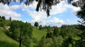
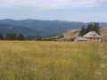
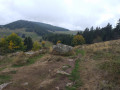
The route winds its way partly through woodland and partly across stubble fields, offering lovely views of the small Wasserbourg valley at the foot of the Petit Ballon and the entrance to the Munster valley.
You can expect a few steep sections, but most of the climbs are gentle.

Details

4092275
Creation:
Last update:
Last review:
  • Walking
    Activity: Walking
  • ↔
    Distance: 9.74 mi
  • ◔
    Average duration: 5h 55 
  • ▲
    Difficulty: Moderate

  • ⚐
    Back to start: Yes
  • ↗
    Ascent: + 1,621 ft
  • ↘
    Descent: - 1,650 ft

  • ▲
    Highest point: 3,340 ft
  • ▼
    Lowest point: 1,719 ft

Description of the walk

Park in the car park behind Wasserbourg Church.

(S/E) Walk up Rue du Petit Ballon, then turn left straight away to follow the Red Ring marked trail, which, after the last houses, heads into the forest.

(1) When you reach a house on your left, turn onto the path on the right. As you emerge from the forest, take a sharp left-hand bend and head towards a large crossroads.

(2) Take the track on the right at an acute angle. Ignore two turn-offs to the left. Cross the Hanspenbach stream at a hairpin bend in the path. Continue by taking the path on the left at the next junction. Keep following the ‘Red Ring’ markings at the subsequent junctions until you reach the Krebsbach stream.

(3) Continue along this path, which passes the Chalet Saint-Hubert and the Brunnenmaettle mountain refuge. Join a forest track.

(4) Follow it for a few metres, then turn left off it. Carry on to reach the Schreiplan junction, which is still signposted with the Red Ring.

(5) Turn left onto the path marked with the Blue Triangle. Pass close to two bockhaus on either side of the path. You will soon reach a five-way junction.

(6) Carry on straight ahead, still following the Blue Triangle markings, to reach the Ferme-Auberge du Ried. Then take the path opposite, marked with a Red Disc. Climb up to the Buchwald car park.

(7) Carry on straight ahead to reach the Ferme-Auberge de Buhwald.

(8) Return to the previous junction.

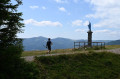
(7) Follow the middle path, known as the Herzog path and marked with a Yellow Triangle, to reach the highest point of the walk at a viewpoint

(9) Continue along the path and begin the descent to return to the five-way junction you passed earlier.

(6) Turn right onto the path you took on the way up to reach the Schreiplan crossroads.

(5) Turn right onto the Chemin du Schreiplan, marked with a Red Ring. At the hairpin bend, leave the track and continue straight ahead. You’ll reach Schlossmatt.

(10) Continue down the slope to the right, skirting the Wassenberg – the ruins of an old castle – and descend to Wasserbourg via the path marked with a Red Ring. This will take you to the car park at Wasserbourg church (S/E).

Waypoints

  1. S/E : mi 0 - alt. 1,755 ft - Car park at Wasserbourg church
  2. 1 : mi 0.42 - alt. 1,936 ft - Junction, turn right
  3. 2 : mi 0.75 - alt. 2,195 ft - Junction, turn right
  4. 3 : mi 2.12 - alt. 2,457 ft - Chalet Saint-Hubert
  5. 4 : mi 2.68 - alt. 2,585 ft - Road from Wasserbourg to the Petit Ballon
  6. 5 : mi 3.39 - alt. 2,694 ft - Schreiplan
  7. 6 : mi 4.21 - alt. 2,969 ft - Crossroads
  8. 7 : mi 5.42 - alt. 3,310 ft - Buchwald car park
  9. 8 : mi 6.15 - alt. 3,327 ft - Buchwald Farm Inn
  10. 9 : mi 6.92 - alt. 3,340 ft - Belvédère de Buchwald
  11. 10 : mi 9.09 - alt. 2,205 ft - Schlossmatt
  12. S/E : mi 9.74 - alt. 1,755 ft - Car park at Wasserbourg church

Notes

Chalet Saint-Hubert, the Brunnenmaettle mountain refuge.
Ferme-Auberge du Buchwald and Auberge du Ried.

Worth a visit

View of the Wasserbourg valley and the entrance to the Munster valley.

Reviews and comments

4.1 / 5
Based on 3 reviews

Reliability of the description
4 / 5
Ease of following the route
4 / 5
Route interest
4.3 / 5
User 18573942

Overall rating : 2.7 / 5

Date of your route : Aug 18, 2025
Reliability of the description : ★★☆☆☆ Disappointing
Ease of following the route : ★★☆☆☆ Disappointing
Route interest : ★★★★☆ Good
Very busy route : No

Once you reach Schlossmatt, where the directions say to continue downhill and go around the ruins of Wassenberg Castle, there are no further directions: no more red rings! After searching for a long time, we had to take the road to Wasserbourg. Another person (who also had the Visorando app) was in the same situation as us.

Machine-translated

njmartin
njmartin

Overall rating : 5 / 5

Date of your route : Jul 30, 2023
Reliability of the description : ★★★★★ Very good
Ease of following the route : ★★★★★ Very good
Route interest : ★★★★★ Very good
Very busy route : Yes

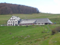
The aim, as well as going for a walk, was to have lunch at the Buchwald farmhouse inn, halfway along the route. We weren’t disappointed! A very good home-cooked meal, with perfect desserts (half-portions of tarts to mix and match according to your taste), and a friendly, efficient welcome. Please note, you’ll need to book in advance, as the inn is often fully booked at weekends. We weren’t able to enjoy the terrace with its superb view, due to intermittent rain and wind.

Machine-translated

D.Brion
D.Brion

Overall rating : 4.7 / 5

Date of your route : Sep 02, 2021
Reliability of the description : ★★★★★ Very good
Ease of following the route : ★★★★★ Very good
Route interest : ★★★★☆ Good
Very busy route : No

A lovely walk alternating between stubble fields and woodland. The Emile Hertzog path is very pretty. Lovely views of Wasserbourg. No particular difficulties.

Machine-translated

Other walks in the area

For more walks, use our search engine .

The GPS track and description are the property of this route's author. Please do not copy them without permission.