From Les Bayards to the Col du Cernil

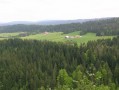
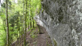
In tribute to a local boy, this lovely walk sets off from the “Echanges Scolaires” holiday home in the village of Les Bayards, heading towards the Col du Cernil and the Bois des Envers, before returning via Les Places.

Details

n°106735418
Creation:
Last update:
Last review:
–
  • Walking
    Activity: Walking
  • ↔
    Distance: 5.54 mi
  • ◔
    Average duration: 3h 10 
  • ▲
    Difficulty: Moderate

  • ⚐
    Back to start: Yes
  • ↗
    Ascent: + 745 ft
  • ↘
    Descent: - 748 ft

  • ▲
    Highest point: 3,937 ft
  • ▼
    Lowest point: 3,212 ft

Photos

Description of the walk

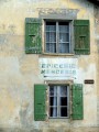
(S/E) “Les Echanges Scolaires” holiday home – Les Bayards

A commemorative walk in the footsteps of Horace, a local who grew up in the village of Les Bayards from the early 1930s until the end of the Second World War. Having moved to France, he would regularly return to his home village to recharge his batteries until his death on 24 July 2026.

Waypoints

  1. S/E : mi 0 - alt. 3,258 ft - The Holiday Home
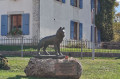
  2. 1 : mi 0.08 - alt. 3,232 ft - The Wolf of Les Bayards
  3. 2 : mi 1.37 - alt. 3,570 ft - Barbed-wire marker post
  4. 3 : mi 1.66 - alt. 3,694 ft - Old Cernil Road
  5. 4 : mi 2.05 - alt. 3,845 ft - Col du Cernil
  6. 5 : mi 2.36 - alt. 3,842 ft - Meadow of Gentians and Edelweiss
  7. 6 : mi 2.5 - alt. 3,839 ft - Bois des Envers
  8. 7 : mi 3.49 - alt. 3,937 ft - Highest point
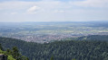
  9. 8 : mi 4.46 - alt. 3,422 ft - Panoramic view of Les Bayards
  10. 9 : mi 4.61 - alt. 3,360 ft - Les Places
  11. S/E : mi 5.54 - alt. 3,258 ft - The Holiday Home

Notes

The walk starts at the car park of the “Les Echanges Scolaires” holiday home, in the Bise district.

Other walks in the area

For more walks, use our search engine .

The GPS track and description are the property of this route's author. Please do not copy them without permission.