Country:
 City:
City:


Introduction:
This entire route will take walkers across numerous streets, avenues and other roads. To avoid repetition, it is stated here once and for all that you must exercise great caution whenever crossing the road, ensuring you only do so at pedestrian crossings and/or traffic lights.
Start at Place Denfert-Rochereau. Access via the metro (lines 4 or 6) or the RER (line B).
(S) Head south-south-east along Avenue René Coty, situated on the side of the RER station. Walk along the avenue on the left-hand pavement or on the shaded central reservation.
(1) Turn left onto Rue d’Alésia and pass under the railway bridge. Then turn right onto Avenue de Sibérie and walk alongside the Jardin Marie-Thérèse Auffray. Next, turn right to walk alongside Place Mohamed Bouazizi. Cross Avenue Reille and enter Parc Montsouris.
(2) First turn left then right to reach the edge of the lake. Follow Allée Jacques Higelin and walk alongside the lake. At the far end, turn left, cross a stream and walk past a bandstand.
(3) Turn right onto Allée du Lac. Just before the park exit, turn sharply right onto Allée de la Mire. Before a bridge, turn left to leave the park near the RER station.
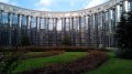
(4) Cross Boulevard Jourdan and the tram line at the pedestrian crossing, then enter the Cité Internationale Universitaire de Paris, passing the United States Foundation on your left and then the Maison du Mexique on your left-hand side.
(5) Turn right and head west.
(6) Cross a street and continue through Parc Ouest. Then follow theGR®75(red and white markings). Leave the campus and walk along Avenue Paul Appell. Turn right, cross Place Ambroise Croizat and continue along Rue Georges de Perto Riche. Join Boulevard Jourdan and follow it to the left as far as the Porte d’Orléans.
(7) Cross the boulevard and the tram tracks to join Avenue du Général Leclerc opposite. Take the second street on the left, Rue de Coulmiers. You’ll come to a passageway on the right with a flight of steps. Take these steps down to reach the old Petite Ceinture railway line.
(8) Turn left and follow this wide track until you reach a large gate blocking the way. Climb the metal staircase on the right leading to Rue Raymond Losserand.
(9) Turn left onto this road and you’ll reach Porte de Vanves. Follow Boulevard Lefebvre to the right to pass under the railway lines. Then take the first right onto Rue Jacques Baudry. At the corner of Square Castagnary, turn left and then right onto Rue Fizeau.
(10) At the end, enter Parc Georges Brassens and carry on straight ahead until you quickly reach a junction near a puppet theatre.
(11) Carry on straight ahead until you reach a pond. Go round it on the right. Then turn right to leave the park between two bull statues. Turn right onto Rue des Morillons. At the junction, turn right into Rue Brancion to return to the park entrance.
(10) Carry on straight ahead until you reach the junction by the puppet theatre.
(11) Then turn left. Pass the Théâtre Sylvia Montfort on your left. Next, veer left and walk alongside a vineyard on your right. At the end of the path, turn left to leave the park.
(12) Then turn right and cross Rue de Dantzig. Enter the garden of the former Petite Ceinture railway line and continue straight on until you reach Rue Olivier de Serres.
(13) Take a footpath and go down a flight of steps leading to the old Petite Ceinture railway line. Follow this well-maintained path again, crossing several streets until you reach Place Balard. At the end, leave the Petite Ceinture via a flight of steps on the right leading to Place Balard.
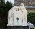
(14) Take the second left onto Rue Balard. At the next junction, turn left into a public garden. At the War Memorial for French Soldiers Killed in Overseas Operations (statues of six soldiers symbolically carrying a coffin), turn right and enter Parc André Citroën.
(15) Walk round the central lawn on the right and carry on straight ahead. At the second junction, turn left and walk alongside the small gardens themed around colours. At the end, first turn left then right to pass under the railway bridge and reach the banks of the Seine.
(16) Turn left and walk along the river. Soon after, turn away from the river and head back up to the Pont du Garigliano. Cross the Seine via the bridge. On the other side, turn left onto Quai Louis Blériot, then onto Quai Saint-Exupéry. Pass a Basque pelota court on your right.
(17) Shortly afterwards, turn right into Rue du Général Niox, then left into Rue du Général Malleterre. Turn right onto Avenue du Général Clavery and ignore Rue Albert Ferry on your right. At the corner of Place de l’Abbé Franz Stock, turn left onto Avenue Dode de la Brunerie; you’ll come to a junction (with the fountains at the Porte de Saint-Cloud on your right).
(18) Turn left and walk past the entrance to the Stade Pierre de Coubertin. Turn right into Square Roger Coquoin. Cross the square and go through a small tunnel. Diagonally cross the square towards the left. At the exit, turn right into the Jardin de la Porte de Saint-Cloud, then left along the Route de la Reine.
(19) Cross the Route de la Reine and turn into Rue du Commandant Guilbaud opposite. Walk past the Stade Français sports complex, the Parc des Princes (football) and then the Stade Jean Bouin (rugby) on your right.
(20) At the traffic lights, turn right onto Avenue de la Porte Molitor and walk past the Molitor swimming pool. At the junction, go straight on and walk past the Lycée La Fontaine. Cross Boulevard Murat at the next set of traffic lights and head towards Porte Molitor.
(21) Turn left onto Boulevard Exelmans and you’ll soon reach Porte d’Auteuil. Turn left to reach the metro entrance, the end point of this first stage (E).
Return via metro line 10. N.B. At Porte d’Auteuil station, all metro trains are bound for Boulogne. To return to central Paris, towards Austerlitz station, get off at the first stop, Boulogne-Jean Jaurès, and take the connecting train on the same platform, opposite.


 Visorando Member
 Easy
Easy