From Saint-Gens to Saumane via the semi-troglodyte farmhouse at Marculy

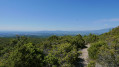
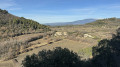
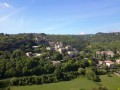
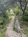
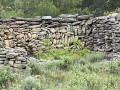
Beautiful paths, sometimes narrow, sometimes wide. Dry stone walls all along the way. Views of the Comtat on one side and the Luberon and the Alpilles on the other. The start of the walk may seem challenging, but it’s fairly gentle after that, although the climb after Saumane may still feel tough.

Details

n°74741747
Creation:
Last update:
Last review:
  • Walking
    Activity: Walking
  • ↔
    Distance: 7.32 mi
  • ◔
    Average duration: 5h 05 
  • ▲
    Difficulty: Moderate

  • ⚐
    Back to start: Yes
  • ↗
    Ascent: + 1,962 ft
  • ↘
    Descent: - 1,952 ft

  • ▲
    Highest point: 2,175 ft
  • ▼
    Lowest point: 600 ft

Photos

Description of the walk

Park at the Ermitage car park in Saint-Gens. 

(S/E) Follow the path heading south to reach the Source de Saint-Gens. 

(1) Turn right, heading towards the Rocher des Trois Luisants. The path climbs steeply from the car park, but the sections are well signposted and straightforward. Leave the Rocher des Trois Luisants to one side and continue to the left until you reach the junction with the track of the same name.

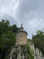
(2) Take another track to the right and leave it further on, at the hairpin bend, to reach the watchtower. 

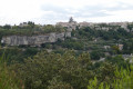
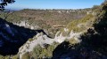
(3) Head straight down towards Saumane until you reach the junction with a track: a steep 600-metre descent winds its way down, offering beautiful views of Vallescure and the surrounding cliffs. 

(4) Follow this track, turning left. 

(5) Keep to the right at this three-way junction, continue straight on at the next junction and begin to negotiate the left-hand bend (elevation 337). 

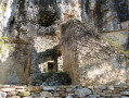
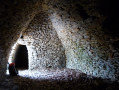
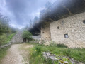
(6) Leave the track and follow the path starting on the right. Walk round the buildings at La Mondote and head for the superbly restored semi-troglodyte farmhouse at Marculy. 

(7) Resume the route by taking a downhill stony path on the left, and admire the drystone shelters in the surrounding area. You’ll come out onto Chemin de la Tapy. 

(8) Follow it straight on towards Saumane-de-Vaucluse. 

(9) At the entrance to the village, turn right onto Rue des Fontaines and arrive at Place de la Mairie. 

(10) Continue for a few dozen metres, turning right, then immediately turn right onto Montée du Château. Pass the castle and continue along the tarmac road. 

(11) Go straight on along a wide path marked by the two GR® de Pays trails, the Massif du Ventoux and the Tour des Monts de Vaucluse: yellow and red markings. 

(12) Carry on straight ahead, following the markings, until you reach the Piste du Grand Puymians. 

(13) Turn right, then left at the three-way junction about a hundred metres further on. Continue to the junction opposite the quarry and rejoin the tarmac road. 

(14) Turn left, walk alongside the quarry and follow the tarmac road which leads directly to the car park at the hermitage (S/E). 

Waypoints

  1. S/E : mi 0 - alt. 1,280 ft - Car park at the - Ermitage de Saint-Gens
  2. 1 : mi 0.21 - alt. 1,467 ft - Source de Saint Gens
  3. 2 : mi 1.13 - alt. 2,172 ft - Track junction, on the right
  4. 3 : mi 1.46 - alt. 2,100 ft - Watchtower
  5. 4 : mi 2.33 - alt. 1,289 ft - Junction with track
  6. 5 : mi 2.61 - alt. 1,329 ft - Three-way junction
  7. 6 : mi 3.06 - alt. 1,106 ft - Elevation 337, leave the track
  8. 7 : mi 3.34 - alt. 928 ft - Semi-troglodyte farmhouse
  9. 8 : mi 3.7 - alt. 627 ft - Chemin de la Tapy - Intrajat (cours d'eau) - Affluent de la Sorgue
  10. 9 : mi 3.94 - alt. 617 ft - Saumane, Rue des Fontaines
  11. 10 : mi 4.09 - alt. 673 ft - Saumane village, Place de la Mairie - Château de Saumane
  12. 11 : mi 4.42 - alt. 837 ft - Junction, go straight on
  13. 12 : mi 5.09 - alt. 1,089 ft - Junction, go straight on
  14. 13 : mi 5.89 - alt. 1,496 ft - Track junction, on the right
  15. 14 : mi 6.71 - alt. 1,575 ft - Junction, quarry
  16. S/E : mi 7.32 - alt. 1,280 ft - Car park at the - Ermitage de Saint-Gens

Worth a visit

Visit to Le Beaucet.

Always be cautious and plan ahead when you're outdoors. Visorando and the author of this route cannot be held responsible for any accidents occurring on this route.

The GR® and PR® markings are the intellectual property of the Fédération Française de Randonnée Pédestre.

Reviews and comments

4.7 / 5
Based on 1 review

Reliability of the description
5 / 5
Ease of following the route
5 / 5
Route interest
4 / 5
godillot1
godillot1

Overall rating : 4.7 / 5

Date of your route : Apr 06, 2026
Reliability of the description : ★★★★★ Very good
Ease of following the route : ★★★★★ Very good
Route interest : ★★★★☆ Good
Very busy route : No

A lovely route, but the start is tough without a warm-up. Starting from the castle car park in Saumane, this route would allow you to warm up before tackling the Saint Gens climb.

Machine-translated

Other walks in the area

For more walks, use our search engine .

The GPS track and description are the property of this route's author. Please do not copy them without permission.