Country:
 City:
City:


Park in the car park by the town hall and school, behind the bus stop.
(S/E) On leaving the car park, turn right towards the village centre onto the Grand Rue Tolosane and, about a hundred metres further on, turn left onto the D22 or Avenue de la Gare towards Buzet. Follow the road for 1.2 km.
(1) At the junction, turn left onto the tarmac track known as Chemin de la Salle Haute, which is reserved for residents’ vehicles, and follow it for 500 m.
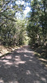
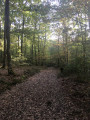
(2) Ignore the path that continues straight ahead and follow the road as it bends to the left. The road climbs towards La Salle, which you go round to the right, following the grassy path that runs alongside the property’s fence. Continue along this path which, after running alongside the fields, enters the woods. Shortly after entering the woods, take the path on the left which descends steeply towards the railway line.
(3) At the bottom of the descent, continue to the left and, on emerging from the woods, follow the edge of the woodland to rejoin a path through the woods, close to the boundary. Turn right as you go downhill to cross the Ruisseau d’en Seaux. Continue uphill along the grassy path, which curves first to the right and then to the left at the top, before joining the Route de Gémil after a descent. Follow this road for a few metres on the right.
(4) Turn left just after the bridge over the Ruisseau de Marignol. Continue along this road towards La Borde Basse. Pass through the hamlet and carry on to the T-junction.
(5) Take the road on the right, which bends left a few metres further on and descends to pass under the railway line. Then head back up towards Montastruc-la-Conseillère, passing through the hamlet of Cante.
(6) At the Stop sign, carefully cross the D30 and follow it to the left for about 400 metres.
White and red markings for theGR® 46
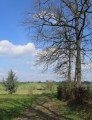
(7) Before the raised section of the road, cross the D30 again and turn left onto theGR® 46 (signposted but running through private property). Please note: it branches off to the right about a hundred metres further on, at the bottom of the short descent, and climbs back up to pass under a magnificent oak tree. A few hundred metres further on, the path joins a tarmac road (Chemin Bonnassié et des Liesses), which you follow down to the left. It passes over the railway tunnel.
(8) At the bottom of the descent, take the right-hand branch of the Y-junction (marked ‘dead end’). At the hamlet of Tabois, leave the tarmac road, which turns left, and continue straight ahead along the grassy path. Cross the stream, turn right for a few metres then left, and head uphill to the left of the hedge separating the fields. At the top, carry on straight ahead along theGR® 46 towards the bell tower of the village of Roquesérière.
(9) When you reach the road, follow it to the left and, at the Stop sign, leave theGR® and head straight ahead to return to the starting point (S/E).

 Visorando Member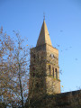
 Easy
Easy