Country:
 City:


Starting point and access: Ponthierry-Pringy railway station.
- RER – Line D, on the section between Melun and Corbeil-Essonnes.
Take the Rue Maurice Leroy exit on the side of platform 2, the one for the Melun to Corbeil direction (if arriving from the opposite direction, use the underpass).
No signposting
(S) With your back to the station, follow the street to the right. Note a row of small houses on the left-hand pavement, all of exactly the same type. At the end, turn right and cross the railway tracks at the level crossing. Then cross the road to take the left-hand pavement (there is virtually no pavement on the right-hand side).
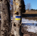
Yellow signposting (rare, as the route is very straightforward)
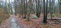
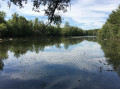
(1) When the road bends to the right, turn left onto a wide path closed to motor vehicles (marked by a chicane formed by three rocks). Walk alongside the Seine on your right and continue straight ahead along the more or less shaded path.
(2) At a memorial stone, you’ll come out onto a small road; follow it to the right. Further on, cross Rue de la Citanguette on the left-hand side and continue straight ahead along the Saint-Fargeau towpath, still running alongside the Seine with the railway line elevated to the left.
(3) Cross Rue de Seine on your left and carry on straight ahead along the gravel towpath, which is lined with poplars at the start. Walk alongside the lawns on your left. When you reach the Lacs de la Guiche, walk alongside the roadside railing leading to a housing estate.
(4) When you reach a sailing club, turn left. Follow a wide track, ignoring all the turnings on the left, and pass a tennis court on your right. Return to the banks of the Seine, join a wide road (with little traffic) and follow it straight on.
(5) At the start of a left-hand bend, pass a chicane on the right and take a gravel track (not shown on the map). You’ll soon reach another track; continue straight on, following the wall of a property on your left.
(6) Pass through a metal gate, rejoin the tarmac and carry on straight ahead, ignoring the turn-offs to the left.
(7) At a fork in the road, continue right along the banks of the Seine (the purple line on the 1:25,000 map, which is supposed to represent thePR®, is not up to date here). Keep going straight on until you reach the footbridge at the Coudray lock.
Red and yellow markings (visible only from the right bank)
(8) Climb the metal staircase leading to the footbridge and cross the Seine over the weir and the locks. At the bottom of the stairs on the opposite bank, carry on straight ahead, in a sort of U-turn. After about 300 m, turn left. Pass a metal barrier and follow a small road.
No signposting
(9) At the Stop sign, turn left. Follow a small road, ignoring all turn-offs on the left, and walk alongside a campsite. Pass through a wooden gate and continue along a path running alongside horse pastures on your right. Further on, don’t be put off by a ‘Dead end’ sign. At the end of the track, turn right and climb gently, following the horse pastures on your right.
(10) At the top, at the entrance to Saintry-sur-Seine, follow the D934 to the left. At the roundabout, go straight on onto the Route de Morsang. Stay on this road and ignore all turn-offs on either side. At the ‘give way’ sign, turn left down Rue du Port aux Sablons. Carry on straight ahead, pass through a metal barrier and reach the banks of the Seine.
(11) Then follow the path on the right and cross a footbridge over a channel. Walk alongside a fence on your right, ignore a few openings that have been cut through it, and stay on the path closest to the river.
(12) When you reach an information sign, carry on straight ahead along a grassy path (ignore a gravel path on the right) and pass a picnic table. Further on, turn right with the path, cross a stream and, at the Fork in the road that appears immediately, turn left. Follow a path below a landscaped lawn (benches, picnic tables). Keep going as close to the river as possible.
(13) When you come to a sort of perpendicular fence, there are two options depending on the water level of the Seine:
- In the event of high water, see an alternative route in the practical information section.
- Otherwise, as shown on the map, go round the fence to the left and follow a path that winds its way between the River Seine and garden fences (access permitted). You’ll pass several small gates or boat garage doors. Some sections are paved. You’ll come to the foot of a few steps and a metal barrier on the right-hand side.
(14) Here again, there are two options depending on the water level of the Seine:
- In the event of flooding, see an alternative route in the practical information section.
- Otherwise, as shown on the map, continue straight on along the path that runs at the foot of a relatively high wall. Follow the path as it winds its way along the banks of the Seine.
(15) You’ll come out onto a tarmac quay and continue straight ahead. After No. 5, turn left and cross a lawn. Carry on along a gravel path, passing a rowing club on your right, then a playground. Continue along a path running parallel to a road, separated from it by a low wall. After a ‘no entry’ sign, go through an opening in the low wall and go round an EDF substation. Then turn left onto Rue de la Pêcherie.
Red and white markings
(16) At the roundabout, turn left and cross the bridge over the Seine. Then cross Quai Jacques Bourgoin and continue straight ahead. After a few metres, turn left onto Rue Saint-Spire. At No. 27, turn right under a portico (a gate in the old ramparts) and arrive at the apse of the cathedral. Walk round the cathedral on the right-hand side.
No signposting
(17) With your back to the cathedral façade, turn right and walk past an old market hall on your right-hand side. Cross a street and continue along Rue des Remparts. At the corner by a bank branch, turn left and take a footbridge over the Essonne.
(18) Carry on straight ahead, walking alongside a car park on your right. Cross Rue Champlouis and continue along a pedestrian path. At the foot of the war memorial, turn right, cross Allée Aristide Briand and follow Rue Félicien Rops towards the station. At the ‘Stop’ sign, go straight on. At the traffic lights, continue straight on towards the station. You’ll come out onto another street; follow it to the right, then turn left to reach Corbeil-Essonnes station (E).
To get back home:
- RER – Line D, towards Juvisy and Paris, Melun or Malesherbes.


 Visorando Member
 Easy
 Very difficult