Country:
 City:


Park in the large car park at the Domaine Départemental de Pichauris.
(S/E) Go through the large gate at the park entrance and follow the path. Walk past the Fontaine Muriel.
(1) Turn right. The path curves to the left and then reaches a small earthen bridge. Turn right after the small bridge and follow the track, which leads to a three-way junction and fire tank no. 524.
(2) Turn left onto the DFCI track. Follow this track, keeping to the right at all times, until you reach fire tank no. 480. Pass to the left of the tank and head down the track opposite, which curves to the right.
(3) At the bottom, turn left towards the south, heading for Puits de l’Aroumi
(signpost). The trail is marked in yellow.
The path winds through the trees, climbing up a series of large rocky steps known as the Escalier du Goï
. Pass through the Barre Coupée gap. You will then reach some man-made steps made of large logs. The path widens, with a stone hut on the left. Continue for about 40 m.
(4) Turn right, heading south, onto the path that climbs through the trees and, after a left-hand bend, joins a straight track leading to the Col du Tubé.
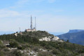
(5) Head straight ahead, south-eastwards, along the partially tarmac-surfaced track. You’ll reach the area near the facilities and masts at Butte des Pinsots. Join the track leading to the Col du Garlaban. Take in the view.
(6) Leave the track to the left and keep to the left. Follow the signs for Lascours
(signpost). The route is marked in yellow.
Caution: there is a difficult section where you’ll need to use a cable anchored in the rock, and a steep descent over scree. You’ll reach the Source de Barquieu.
(7) At the spring, turn left and walk across large limestone slabs, following the yellow markings. Admire the Ravin de Garlaban on your right.
(8) A few metres past the valley floor, turn right towards Lascours (Corniche du Grand Vallon)
. The path is pleasant and easy. Keep to the left until you reach a crossroads and a signpost.
(9) Turn left towards the Grand Vallon cliff path
. Leave the track to get closer to the cliffs and take in the scenery. Take care. Ignore the path on the left and continue to the next junction.
(10) Turn right towards Le Balcon des Tourdres
(signpost). The path is steep. You’ll reach a junction and a signpost.
(11) Continue to the right, towards Mont du Marseillais
. Cross a large limestone slab and pass a large cairn, then begin a winding descent leading to the end of the Grand Vallon. On the left is Baume Plate
(marked on a rock). Follow the path which climbs along the left-hand side of the Grand Vallon.
(12) After a steep, stony descent, you’ll reach a star-shaped junction. Stay in the middle, heading north. The climb is difficult and passes below Mont du Marseillais. When you reach the DFCI track, turn left onto it and continue for about 20 m.
(13) Turn right and, further down, join the wideGRP® ‘Sentier Provence Mines d’Énergies Variante’ path, marked in yellow and red. Turn left, pass an old fire tank, then turn right. Join the tarmac D46A road.
(14) Walk a few metres, then turn left onto the path marked in yellow and red, which runs alongside the road before veering away from it and heading uphill into the forest. At the top, you’ll reach a crossroads of paths.
(15) Head straight ahead onto the descending path. Keep to the right at a junction, then rejoin the tarmac road. Pass fire hydrant no. 474.
(16) Turn left and walk past a riding centre on your right. Ignore the paths to the left and right. Walk past Téo’s Well on your right and you’ll see a house on your left.
(17) Turn left at the gate and head down through the grass to reach a path with the Puits de Jean-Noël on your left. Continue right along this path, then 100 metres further on, cut across to the left to join the wide Sentier des Bergers.
Walk past the old Plâtrière and continue to the right towards the hamlet of Pichauris. Turn right at the wash house, walk past Batiste Long’s Well and reach the junction you passed on the way there
(1). Carry on straight ahead and head for the park’s large gate (S/E).

 Visorando Member
 Moderate