


 Country:

 City:
City:



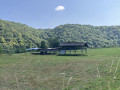
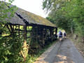

Car park at the entrance to Rue la Routaine, near the chapel, or even further up at the Domaine des Hochets.
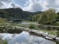
(S/E) Walk back down Rue la Routaine, cross Rue de Charleville and continue along Rue d’en Haut to rejoin the road further down, which you should follow to the right. This road runs alongside the campsite. Take the first alleyway on the left, then keep to the right to reach the footbridge and then the tunnel. After the tunnel, continue to the Semois (opposite the ruined arch of the bridge).
(1) Follow the river to the left towards the centre of Bohan. Turn left before the church, enter Rue de l’Église and head towards Membre on the left. 75 metres after the bend, turn right onto Chemin des Grossarts (also known as Rue de Membre). Keep left halfway along and continue until you rejoin the road. Follow this road for about a hundred metres.
(2) On leaving the village, turn left onto the footpath (do not confuse this with the entrance to a house!). This path runs along the wooded hillside, following a contour line. Follow it to the end. Just as it seems to start curving to the right as it climbs, head down the steep slope to the left to rejoin the road below.
(3) Turn right onto this road and continue to the end of the track to reach the Kelhan Footbridge over the Semois.
(4) Cross the footbridge and take the path on the left, running alongside the river above. Take the second path on the right and begin the climb up the slope (caution: some difficult sections). The path soon joins a narrow forest track.
(5) Follow it to the left. It is relatively level and joins Rue d’Hérissart after 1,300 metres. Walk down this road for about a hundred metres and take the path leading uphill to the left. Keep left at the Fork in the road, continuing slightly uphill. The path then begins to descend. When you reach the tarmac, first turn left then right and continue down to the banks of the Semois. Turn right and walk up the path alongside the bridge, then cross it.
(6) Once you reach the town centre, cross the road and take Rue du Vieux Moulin opposite. Follow it for 400 metres and turn left onto the forest track heading back up the hillside.
(7) After 200 metres, a fairly steep path leads directly to the top of the slope (towards the hamlet known as ‘Les 8 Semois’): ignore this and instead take the ascent via the GR®, a little further on.
(8) At the junction, take the GR® to the right towards the summit of the ridge.
(9) Once at the summit (the hamlet of Les 8 Semois), continue along the GR® to begin a steep descent towards Membre. At the bottom, take the tarmac road to continue the descent. At the crossroads, turn left. Cross the bridge to return to the car park (S/E).

 Visorando Member
 Difficult


 Easy
Easy 
