Country:
 City:
City:


(S) De l'esplanade de la cathédrale de Meaux, longeons la cathédrale à main gauche puis empruntons à droite la Rue de la Cordonnerie. Tournons ensuite dans la 2e à gauche, la Rue Darnetal. Au bout, tournons à droite et empruntons le Pont du Marché pour traverser la Marne.
(1) Tournons aussitôt à gauche, longeons la Marne avec le GR®14A doublé du GR®1 (balisage Rouge et Blanc) et passons sous le Pont Neuf, puis ensuite sous le Pont Foch. Virons à droite sur le quai Charles Deboeuf et montons sur la Route D360 à la hauteur de l'écluse de Cornillon.
(2) Virons à gauche pour franchir le canal et redescendons tout de suite sur la gauche. En bord de Marne, virons à droite, Quai du Maréchal Mortier. Virons de nouveau à droite et longeons l'écluse n°12. Retrouvons la D360 et suivons-la à gauche pour traverser l'écluse.
(3) Redescendons à gauche, sur le Chemin Bas. Obliquons aussitôt à gauche pour rejoindre la Marne. Virons à droite et retrouvons le Chemin Bas. Tournons alors à gauche et longeons la Marne.
(4) Au croisement, retrouvons le goudron et prenons sur notre droite la Rue de Marne. Au croisement suivant, suivons à gauche le Chemin du Vieux Noix. À la fourche, allons à droite, Rue de la Lampe.
(5) Au bout, laissons l'église sur notre gauche et remontons sur notre droite jusqu'aux commerces. Arrivé face à la mairie, empruntons à gauche la Rue Gambetta. Empruntons la 1re ruelle à gauche qui se prolonge par un chemin (Sentier de la Petite Arche). Ignorons un départ sur la droite et franchissons un ru.
(6) Débouchons Rue Gallieni et suivons-la à gauche. Prenons la 1re à gauche, la Rue Raymond Marchand. Au croisement qui suit, allons tout droit, puis virons à droite avec la rue.
(7) Empruntons la Rue du Petit Val à gauche. Au carrefour, prenons la 2e à gauche, le Chemin du Petit Val.
(8) À l'entrée d'un virage à gauche, descendons le chemin à droite en suivant le GR®14A (balisage Rouge et Blanc). Traversons le Ru des Cygnes et remontons de l'autre côté. Au croisement, tourner a droite et suivre le ru des Cygnes.
(9) Franchir le petit pont, poursuivre jusqu'a Boutigny par la Rue henri Adolphe Joly.
(10) Prendre à gauche juste après le premier carrefour, pour suivre la Dhyus jusqu'à Saint- Fiacre, patron des Jardiniers qui a fondé un monastère épiscopal sur un territoire donné par Faron, évêque de Meaux.
(11) Au carrefour, à Saint-Fiacre, il est possible de monter par la Rue de Meaux vers l'église et le prieuré. Continuer sur la Dhuys vers Montceaux les Meaux.
(12) Poursuivons sur l'aqueduc de la Dhuys. Traverser une petite route puis virer à droite (Est-Nord-Est) pour demeurer sur le terre-plain de l'aqueduc. Traverser une autre route et continuer sur l'aqueduc jusqu'à Montceaux-les-Meaux.
(13) À l'entrée de Montceaux-les-Meaux, laissons l'aqueduc continuer tout droit et montons à droite la Rue du vieux Pavé. Au rond-point, obliquons à gauche dans la Rue du Château.
(14) Au croisement, empruntons à gauche la Rue de Lizy (D19). À l'entrée d'un virage à gauche, quittons la route pour un chemin sur la droite et longeons le cimetière de Montceaux. Poursuivons en lisière du Bois Verdelot, toujours avec le GR®.
(15) À l'angle du bois, tournons à droite et allons au Sud-Ouest entre les champs. Au croisement en T suivant, tournons à gauche et, à la fourche qui suit, obliquons à droite.
(16) Au carrefour, virons à droite et suivons l'aqueduc de la Dhuys avec les les GR® 11 et 14A. Traversons une petite route, entrons dans un bois puis traversons une autre route. Après avoir traversé une troisième route, débouchons sur une quatrième route à l'entrée d'Arpentigny.
(17) Abandonnons provisoirement les GR®, traversons la route et suivons l'aqueduc en demeurant d'abord parallèle à une route.
(18) Arrivé au siphon (construction arrondie en pierre Meulière), obliquons à gauche en direction de l'autoroute que nous longeons sur notre gauche le long du grillage pour atteindre un petit tunnel qui nous permet de passer dessous. À la sortie, avançons sur une cinquantaine de mètres puis obliquons à gauche avec l'aqueduc. Ignorons un départ de chemin sur la droite et continuons sur le terre-plain de l'aqueduc.
(19) Traversons une route, continuons en face avec l'aqueduc et retrouvons les GR®. Suivons-les jusqu'au village de Signy-Signets.
(20) Traversons une route et continuons tout droit. Traversons un ru au siphon.
N.B. S'il y a trop d'eau dans le ru, rebroussons chemin, suivons la route à droite pour entrer dans le village, puis obliquons à droite dans la Rue Hoche minot pour rejoindre la Dhuys.
(21) Traversons la Rue Robert Soulat et continuons sur le terre-plain de l'aqueduc. Au croisement suivant, allons tout droit.
(22) Traversons avec beaucoup d'attention la D21, puis tout droit continuons sur la Dhuys. À un croisement de chemins, allons tout droit. Virons à gauche avec l'aqueduc et traversons de nouveau le chemin précédent.
(23) Traversons la route qui mène au hameau de Signy et poursuivons au Nord-Est avec l'aqueduc. Ignorer un départ sur la gauche et restons sur la Dhuys.
(24) Les deux GR® se séparent : suivons tout droit le GR®11, en direction de Jouarre, encore et toujours sur le terre-plain. Traversons un large chemin et poursuivons en face.
(25) Traversons le Ru de Péreuse à gué (ou sur une passerelle de fortune). Remontons jusqu'à la route D114p.
N.B. Après des pluies, le Ru de Péreuse peut être difficile à traverser à gué (voir variante en "Informations pratiques).''
(26) Traversons la route et continuons Nord-Nord-Est dans un bois.
(27) Au croisement, continuons avec l'aqueduc, Sud-Est puis Est. Traversons le Bois de Foy avec l'aqueduc et la route D21a au passage.
(28) Au croisement, prenons à droite une petite route (le Chemin du Pas du Roi) et suivons un PR® balisé en Jaune (laissons le GR® continuer tout droit). Montons jusqu'au Château de Venteuil (point de vue).
(29) Poursuivons sur la petite route. Au croisement en T, effectuons un droite-gauche pour suivre l'Allée de Ventueil (balisage Jaune). Au croisement suivant, prolongeons sur la D402. Croisons la Rue de Comporte côté gauche et continuons tout droit, Rue du Petit Huet.
(30) Quand la rue vire à gauche, continuer tout droit. Virer ensuite à droite pour atteindre le Donjon de Jouarre (E).
 Visorando Member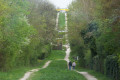
 Moderate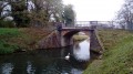
 Difficult
 Easy
Easy 

 Association / Club / Walk leader