A circular route from Lugon to Les Moulins de Thouil

A pleasant walk exploring the Tertre de Thouil, starting from Lugon. This route through the vineyards offers beautiful panoramic views. Furthermore, on the Tertre de Thouil, you can admire two old windmills. 

Details

70611761
Creation:
Last update:
Last review:
  • Walking
    Activity: Walking
  • ↔
    Distance: 3.96 mi
  • ◔
    Average duration: 2h 05 
  • ▲
    Difficulty: Easy

  • ⚐
    Back to start: Yes
  • ↗
    Ascent: + 262 ft
  • ↘
    Descent: - 246 ft

  • ▲
    Highest point: 249 ft
  • ▼
    Lowest point: 39 ft

Photos

Description of the walk

The car park is located next to Lugon Primary School, behind the town hall.

(S/E) Leave the car park heading towards the school. Cross Rue Jules Ferry carefully and take the path heading north to join Rue du 8 Mai 1945. When you reach it, turn left and follow the street towards the Comte neighbourhood to the north-west. Turn right onto Rue du Comte and follow this street as it curves to the left, rejoining Rue du 8 Mai 1945 (D138E4) a little further on.

(1) Turn right and walk carefully along the road. At the first junction, turn right: there’s a lovely view of Pardaillan Castle.

(2) After about five hundred metres, turnright onto a path that runs between plots of vineyards. After fifty metres, the path branches off to the left and begins to climb, passing through a small copse. About one hundred and fifty metres after leaving the copse, turn right and take the path that heads straight towards Branda in an easterly direction, merging with a small road as it reaches the hamlet. 

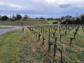
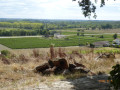
(3) Turn left onto the farm track that runs straight ahead towards the north. At the next crossroads, turn left onto the track heading west, running alongside a vineyard on your right and overlooking another on your left. At the next crossroads, where there is a beautiful solitary tree, turn right to follow the track that climbs straight up towards the Tertre de Thouil. When you reach the foot of the hill, take the track on the left which runs along its slope above the vineyards on your left: there is a lovely view of the Domaine de Bellegarde a little further on to the north-west. The path reaches the plateau of the Tertre de Thouil, where vineyards are planted. Turn right to walk alongside the first row of vines and head towards the mill situated to the south of the Tertre. It has neither wings nor a roof.

(4) Head back to the path you took to reach the Tertre de Thouil and continue northwards, passing under the high-voltage power line. Pass close to Thouil on your left and carry on to the junction with the Chemin du Tertre to enjoy a lovely view of the second mill, which has a roof and is on private property. 

Head back and, as soon as you have passed the hamlet of Le Thouil, carry on straight on to the edge of the hill. At this point, turn left onto a grassy path that runs along the edge of the hill. When you reach a wooded area, take the small path opposite that leads into it and make your way through the woods with care. The path climbs and descends constantly along the edge of the hill, offering magnificent views at times over the plain towards Lugon, Saint-Jean-la-Rivière, etc. Ignore the paths on the left and continue until you come out onto the Route de Thouil. Turn right and follow the road carefully for about fifty metres. 

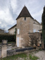
(5) At the junction of the Route de Thouil and the Chemin des Granges, there is a lovely view of Thouil Castle. Turn right to follow the Chemin des Granges. After passing the Chalet de Thouil on your right, the road gives way to a farm track: there are lovely views of the Tertre de Thouil on your right. Continue along the track until you reach the Route du Boutinet. Turn right onto this road and, after a steep climb, you’ll reach the Boutinet on your left. Walk well past the property there.

(6) Take the grassy path on the left that runs alongside the property’s fence. Go round the garden, which has a shed, until you reach a path that descends towards the Courant du Bas de Comte, heading south-east. When you reach the stream, turn right and follow it until you reach a wood.

(7) At the edge of the woodland, turn left, cross the Courant du Bas de Comte via a small bridge and continue along the path which climbs towards the D138 road. Turn right and follow the road carefully towards Lugon. As soon as possible, walk along the edges of the grassy vineyard plots for greater safety. Just before reaching Campardon, rejoin the road with care and continue straight on towards the Caveau de Lugon on Rue Louis Pasteur. Walk past it and carry on, keeping to the right, until you reach the junction with Rue du 8 mai 1945.

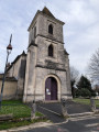
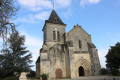
(8) Turn right; as you pass, you’ll see the Church of Saint-Genès and Saint-Barthélémy, then the Town Hall on your left. Carry on straight ahead towards the school to return to the starting point of the route (S/E). 

Waypoints

  1. S/E : mi 0 - alt. 98 ft - School car park
  2. 1 : mi 0.33 - alt. 85 ft - Rue Le Comte x D138E4 road
  3. 2 : mi 0.62 - alt. 46 ft - D138E4 road x path on the right
  4. 3 : mi 1.08 - alt. 164 ft - Branda
  5. 4 : mi 1.51 - alt. 246 ft - Moulin Sud on the Tertre de Thouil
  6. 5 : mi 2.28 - alt. 184 ft - (D246E3) x Chemin des Granges
  7. 6 : mi 2.79 - alt. 144 ft - Road and footpath
  8. 7 : mi 3.25 - alt. 69 ft - Crossroads
  9. 8 : mi 3.83 - alt. 118 ft - Rue du 14 Juillet x Rue du 8 mai 1945
  10. S/E : mi 3.96 - alt. 98 ft - School car park

Notes

This walk across varied terrain requires suitable footwear. The section at the top of the Tertre de Thouil is partly along a fairly narrow and stony path.

This walk does not present any real difficulties in terms of navigation. It is advisable to follow the directions in the description and on the map, whilst also paying close attention to the landscape. Street names also help you find your way. Waypoints (with their GPS coordinates) and the distance from the starting point are useful aids for hikers exploring the route for the first time. Using the Visorando app on a smartphone is a bonus, as it provides a precise GPS route.

Route completed by the author on 8 March 2025.

Worth a visit

Lugon and Carney Island

Lugon is thought to take its name from Lug, a Celtic god, or from Lucus, meaning woods and forests, the ‘c’ of which is believed to have changed to a ‘g’ over time. The origin of the name Île du Carney is unclear; whilst its topographical significance is undeniable – the island was once separated from the mainland by a backwater of the Dordogne – the name ‘Carney’, derived from the Occitan word ‘carne’, raises serious historical doubts… The two parishes were merged in 1806.
According to some, the earliest evidence of settlement on the site dates no earlier than the Gallo-Roman period. Indeed, the commune consists of marshes – low-lying, swampy land that is not particularly hospitable. Others, however, believe the area has been continuously inhabited since prehistoric times, as the terrain—with its steep slopes, the marshes bordering the river and the river itself—made the region a safe place to live.

In the past, the inhabitants often travelled by water, which offered greater safety. Barges, gabarres and other flat-bottomed boats were used in the marshes, where every house had its own landing stage; during floods, the Dordogne reaches a width of 800 metres opposite the Grande Chapelle.

Until just before the Revolution of 1789, boats would undergo quarantine at the port of Lugon before arriving in Libourne. Foreign vessels would call at the port during the early harvest season to load white wines from the Fronsac region.

The village took shape around the 11th century thanks to a priory founded by Guîtres Abbey. The higher ground long served as hunting grounds and farmland for neighbouring villages.

Today, the main industry is wine-growing.

Source: Fronsadais Tourist Office website

Placesto visit

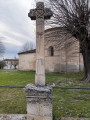
The Church of Saint-Genès.

The Church of Notre-Dame de l’Île du Carnay, known as the Old Chapel.

Pardaillan Castle.

Reviews and comments

3.7 / 5
Based on 5 reviews

Reliability of the description
3.4 / 5
Ease of following the route
4 / 5
Route interest
3.8 / 5
Marie-Renée VALLET
Marie-Renée VALLET

Overall rating : 3.3 / 5

Date of your route : May 12, 2026
Reliability of the description : ★★★☆☆ Average
Ease of following the route : ★★★☆☆ Average
Route interest : ★★★★☆ Good
Very busy route : No

A lovely, pleasant walk with some beautiful views, but between points 4 and 5 the path is closed, so you have to take a detour via the Route du Thouil to reach point 5 and rejoin the route, which adds just over a kilometre to the walk. Between points 7 and 8, the path isn’t always very well signposted and is sometimes overgrown with tall grass and brambles.

Machine-translated

RP33
RP33

Overall rating : 3 / 5

Date of your route : Dec 27, 2025
Reliability of the description : ★★★☆☆ Average
Ease of following the route : ★★★☆☆ Average
Route interest : ★★★☆☆ Average
Very busy route : No

The walk is pleasant, however between 4 and 5 (private path prohibited: hunting reserve) and between 7 and 8, section of path obstructed by brambles.

Machine-translated

johndifool10
johndifool10

Overall rating : 4.7 / 5

Date of your route : Sep 25, 2025
Reliability of the description : ★★★★★ Very good
Ease of following the route : ★★★★★ Very good
Route interest : ★★★★☆ Good
Very busy route : No

Very pleasant hike, easy to follow

Machine-translated

isèrevercors
isèrevercors

Hello, you must have got it wrong, because this walk is very well maintained and there are no sections with brambles… I’ve done this walk three times now without any problems, and what’s more, it’s very popular – we’ve come across groups of walkers several times.

Machine-translated

User 25006763

Overall rating : 4 / 5

Date of your route : Jun 01, 2025
Reliability of the description : ★★☆☆☆ Disappointing
Ease of following the route : ★★★★★ Very good
Route interest : ★★★★★ Very good
Very busy route : No

A lovely walk, but one section is clearly impassable. As I was trying to follow the route and was on my own, I ventured into this unmaintained section with brambles and tall grass (1.50m) to avoid a long detour, but with a child it would simply be impossible. Then again, I’m new to walking, so perhaps I don’t know how to use the app properly. But the views are magnificent.

Machine-translated

isèrevercors
isèrevercors

Overall rating : 3.7 / 5

Date of your route : Apr 12, 2025
Reliability of the description : ★★★★☆ Good
Ease of following the route : ★★★★☆ Good
Route interest : ★★★☆☆ Average
Very busy route : Yes

Hello, this is the first version of this walk, and it’s more enjoyable to do. But still, it’s good all the same

Machine-translated

Other walks in the area

For more walks, use our search engine .

The GPS track and description are the property of this route's author. Please do not copy them without permission.