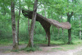
From the River Save at Saint-Majan towards Lombez

Here we suggest a fairly easy 10 km cycle route.
The route is suitable for mountain bikers.
Feel free to explore more of Lombez: there are two other signposted walks on offer.

Details

47291554
Creation:
Last update:
Last review:
  • Walking
    Activity: Walking
  • ↔
    Distance: 6.13 mi
  • ◔
    Average duration: 3h 00 
  • ▲
    Difficulty: Easy

  • ⚐
    Back to start: Yes
  • ↗
    Ascent: + 236 ft
  • ↘
    Descent: - 236 ft

  • ▲
    Highest point: 784 ft
  • ▼
    Lowest point: 525 ft

Description of the walk

(S/E) From the car park at the Esplanade de la Grangette, take the gravel path leading to the far end of the car park. Cross the footbridge over the River Save.

(1) Continue and head up the path to cross the second footbridge. Keep to the right along a stony path.

(2) Enter the historic centre. Pass under the archway (where you’ll find a piece of street art), then walk through the market hall. Walk past Sainte-Marie Cathedral and continue straight ahead along Rue de l’Église to reach Rue Notre-Dame. Turn left and head towards the junction.

(3) Carry on straight ahead along Rue des Pénitents. At Boulevard des Pyrénées, turn left and continue until you reach the first street.

(4) Turn right. At the three-way junction, go straight on into Impasse des Canaouères until you reach a dirt track.

(5) Carry on until you reach a bend at the start of a hill.

(6) Head up the slope on the right to reach the Route de Montarus. Join it on the right and follow it downhill. Ignore three tracks on the left to reach the junction at the Chapel of Saint-Majan.

(7) Turn left, towards the chapel. Continue to the end of the hedge on the left.

(8) Head downhill to the right along the tree-lined path and join the Chemin de Saint-Majan.

(9) Follow it to the left. When you reach the cycle path, turn right to join the RD39.

(10) Cross it (dangerous crossing!). Take the safe path that runs alongside the departmental road. You’ll reach the sign marking the entrance to Samatan.

(11) Turn right onto a small path leading to the lake. Turn left and walk past the buildings of the Village Club les Miliades. At the far end of the lake, turn left and head towards a small wooden bridge.

(12) Cross the bridge and continue along the cycle path until you reach a shed. Carry on along the grassy strip running alongside the River Save and pass the veterinary surgery.
Turn right onto the promenade along the embankment and head towards Rue du Marcadieu.

(13) Turn right. Cross the bridge over the River Save and head towards a car park. At the end of the car park, you’ll find a grassy path.

(14) Turn right and you’ll reach a crossroads.

(15) Turn right and reach the banks of the Save. Head up the path on the left which runs alongside the river to Lombez. Turn left towards the gendarmerie and reach the car park on the left (S/E).

Waypoints

  1. S/E : mi 0 - alt. 548 ft - Esplanade de la Grangette car park
  2. 1 : mi 0.15 - alt. 545 ft - Footbridge - Save (rivière)
  3. 2 : mi 0.41 - alt. 548 ft - Gravel path – entrance to the historic centre
  4. 3 : mi 0.58 - alt. 554 ft - Crossroads, Rue des Pénitents
  5. 4 : mi 0.68 - alt. 564 ft - Rue Saint-Adoure
  6. 5 : mi 0.97 - alt. 600 ft - Dirt track towards the hills above Lombez
  7. 6 : mi 1.37 - alt. 650 ft - Bend, start of the climb
  8. 7 : mi 2.2 - alt. 633 ft - Path to St-Majan Chapel
  9. 8 : mi 2.33 - alt. 620 ft - End of the hedge on the left, tree-lined path
  10. 9 : mi 2.56 - alt. 548 ft - Saint-Majan Trail
  11. 10 : mi 2.71 - alt. 551 ft - Crossing the RD39 - Save (rivière)
  12. 11 : mi 3.15 - alt. 554 ft - Entrance to Samatan
  13. 12 : mi 3.58 - alt. 538 ft - Lake Samatan - Save (rivière)
  14. 13 : mi 3.89 - alt. 541 ft - Rue du Marcadieu
  15. 14 : mi 4 - alt. 535 ft - Grassy path
  16. 15 : mi 4.18 - alt. 535 ft - Crossroads
  17. S/E : mi 6.13 - alt. 548 ft - Esplanade de la Grangette car park

Notes

Signposted path – suitable for mountain bikes

Worth a visit

Reviews and comments

4.7 / 5
Based on 2 reviews

Reliability of the description
5 / 5
Ease of following the route
5 / 5
Route interest
4 / 5
SeveMorg
SeveMorg

Overall rating : 4.5 / 5

Date of your route : Aug 11, 2024
Reliability of the description : Not used / Not applicable
Ease of following the route : ★★★★★ Very good
Route interest : ★★★★☆ Good
Very busy route : No

A really lovely start to the walk, with the shaded banks of the Save and the pretty town of Lombez (its cathedral, its half-timbered houses…).

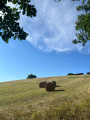
The stretch through the fields is perfect for taking in the scenery, particularly the superb sunflowers. At the top of a short climb, a mirabelle plum tree provided just the right sweet treat – brilliant!

I didn’t enjoy the section around the leisure centre quite as much, as the vegetation mostly hid the branches of the River Save from view. Fortunately, there was the sound of the water gurgling at the waterfall :-)

There are plenty of stretches in the blazing sun, so if you’re sensitive to the sun, give this a miss!

Machine-translated

PATRICE31800
PATRICE31800

Overall rating : 4.7 / 5

Date of your route : Apr 12, 2024
Reliability of the description : ★★★★★ Very good
Ease of following the route : ★★★★★ Very good
Route interest : ★★★★☆ Good
Very busy route : No

Hello everyone.
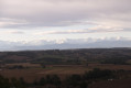
We went on this walk in lovely weather. It’s a lovely, fairly varied walk between Lombez and Samatan, with some beautiful panoramic views along this route towards the Pyrenees and the surrounding valleys. However, the dirt track between points 5 and 6 is currently impassable (tall grass, water, mud); it’s best to head up the field on the right and follow the edge. There are picnic spots at the Saint Majan chapel and Samatan Lake. Thanks for sharing.

Machine-translated

Other walks in the area

For more walks, use our search engine .

The GPS track and description are the property of this route's author. Please do not copy them without permission.