Kazé Drawing Trail

The Kazé Drawing Trail invites you to sketch in the heart of nature. Along this 4 km circular route, there are stops offering an introduction to various techniques. Suitable for all levels, these information boards help you to observe the natural heritage around you.

Details

2744352
Creation:
Last update:
Last review:
  • Walking
    Activity: Walking
  • ↔
    Distance: 2.38 mi
  • ◔
    Average duration: 1h 10 
  • ▲
    Difficulty: Easy

  • ⚐
    Back to start: Yes
  • ↗
    Ascent: + 121 ft
  • ↘
    Descent: - 131 ft

  • ▲
    Highest point: 732 ft
  • ▼
    Lowest point: 581 ft

Photos

Description of the walk

Park in the car park at Saint-Elix-d’Astarac Town Hall.

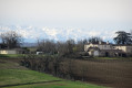
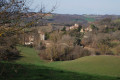
(S/E) Head to the saltire and the starting point opposite the town hall. Follow the signposts bearing the Sentier Dessin du Kazé logo and walk up the street towards the village. Pass the war memorial then turn right towards the church. Take a detour around the church to admire the scenery and find sketching spot no. 1.

(1) Turn back for a few dozen metres, then turn left towards Le Cartié. Follow the route and the path which descends and further on becomes a small tarmac road. Cross the bridge over the Gimone.

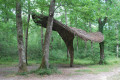
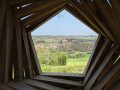
(2) Turn right at the entrance to the woods. Carry on straight ahead through the woods and discover ‘Le Kazé’. Take the opportunity at sketching spot no. 2 to admire the land art installation and sketch it. At the foot of the installation, turn right to leave the woods.

(3) Stop for a while under the large, magnificent oak tree to have a go at sketching session no. 3. Head back towards the small car park and take the road on the right to walk back up towards the village.

(4) Turn left onto the stony path and follow it to reach sketching spot no. 4 without crossing the bridge over the Bergonne. Follow the path which leads onto Rue du Point d’Arcole. Continue straight on until you reach the town hall car park (S/E).

Waypoints

  1. S/E : mi 0 - alt. 636 ft - Town hall car park
  2. 1 : mi 0.31 - alt. 728 ft - Église Saint-Pierre-ès-Liens (Saint-Élix)
  3. 2 : mi 1.06 - alt. 591 ft - Entrance to the Arrouy Wood
  4. 3 : mi 1.52 - alt. 584 ft - Notable trees
  5. 4 : mi 1.72 - alt. 584 ft - Junction
  6. S/E : mi 2.38 - alt. 636 ft - Town hall car park

Notes

(S/E) Car park, toilets and water point on site.
Drawing kits are available on site at the town hall or the Tourist Office (in Gimont and Simorre).
Further information on the Kazé Drawing Trail is available from the Coteaux Arrats Gimone Tourist Office.
The time given for this walk does not, of course, include breaks for sketching.

Worth a visit

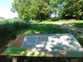
Along the route: four sketching breaks to learn various techniques and see our surroundings in a different light.
Break no. 1 – behind the church: “Little Tuscany”
Break no. 2 – in the Larrouy woods: “Le Kazé”
Break no. 3 – beneath the great oak: “remarkable trees”
Break no. 4 – along the path: “One step, one stone, a path that winds on...”

Discover the land art installation “Le Kazé” (“wind” in Japanese): information panels on site and further details available from the Coteaux Arrats Gimone Tourist Office.

Nearby: explore the village of Saramon, with its fishing lake and lakeside walk, and its summer leisure centre; discover the village of Simorre and its abbey church; follow the ‘Sentier à p’Art’ art trail; visit Boulaur Abbey, and more.

Further information is available from the Coteaux Arrats Gimone Tourist Office

Reviews and comments

4.7 / 5
Based on 2 reviews

Reliability of the description
5 / 5
Ease of following the route
5 / 5
Route interest
4 / 5
User 29821664

Overall rating : 4.7 / 5

Date of your route : Jul 02, 2026
Reliability of the description : ★★★★★ Very good
Ease of following the route : ★★★★★ Very good
Route interest : ★★★★☆ Good
Very busy route : No

A lovely route

Machine-translated

COCHARDMOD
COCHARDMOD

Overall rating : 4.7 / 5

Date of your route : Jul 22, 2025
Reliability of the description : ★★★★★ Very good
Ease of following the route : ★★★★★ Very good
Route interest : ★★★★☆ Good
Very busy route : No

Very easy tour done with the family and three children (aged 5, 7 and 11). They loved it! We took photographs and drew pictures at the lodge. Snack at point 3.

Machine-translated

Other walks in the area

For more walks, use our search engine .

The GPS track and description are the property of this route's author. Please do not copy them without permission.