Country:

 City:


The route starts at the Hippoltskirch car-share area, situated in front of the chapel.
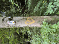
Red Saltire Markings
(S/E) With your back to the chapel, turn left and walk very carefully alongside the D21b road, then cross the River Ill and continue until you reach the left-hand bend in the road.
Blue Disc signposting
Take the second track on the right, which climbs steadily. Pass two disused tracks on the left before taking a wide left-hand bend into the Bois de Mohrenfeld. Continue to the end of the bend.
(1) Take the path that continues level to the right. Cross a disused track, then follow the next one to the left. At each junction, keep going downhill straight ahead until you reach the bottom of the valley. Turn right towards the stream.
(2) Head up the track on the left, which follows a small valley. Continue to a meadow and a pass.
(3) Keep to the left, then turn right along the meadow until you reach the next junction.
(4) Head up the road on the left, leaving it at the first bend. Take a hairpin bend to the right. You’ll come across a number of tracks in varying states of disrepair: keep going straight on until you reach a well-maintained cross-track.
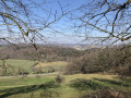
(5) Cross it, head uphill and keep to the right, then turn left until you reach another track: follow it to the left, then continue uphill to the right towards Le Horni and reach the junction at Signal du Glaserberg. To the left is a clearing offering views of Switzerland.
Red Saltire signposting
(6) Turn sharply right and keep heading straight on until you reach the Col du Neuneich.
(7) Turn right, pass to the right of the shelter towards the viewpoint, walk alongside it and follow the track. Keep to the left on the ridge. At the Fork in the road, turn left and head straight on to the summit of the Glaserberg.
(8) Stay on the track. Pass the mast and ignore a track on the right. Ignore the next one on the left to reach a shelter in an open area.
(9) Cross the road and take the track to the right of the shelter. Keep to the left and reach the start of the descent at the Source de l’Ill.
(10) Turn right. After two bends, keep to the right to reach the bottom of the descent. Stay on the track on the right until you reach the start of a path on the left.
Unmarked
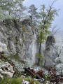
Follow this path down the steps. It leads to the Source de l’Ill.
(11) Keep going straight on until you reach the road.
Red Saltire signpost
Head down this road to the left, pass the fountain and continue to the next street.
Blue Triangle signpost
(12) Turn right towards the chapel. If you climb the steps, you can enjoy a view of Winkel. Otherwise, follow the road to where it ends.
(13) Continue along the track that runs alongside it. Ignore a track opposite and turn left at a hollow. Then keep going straight ahead until you reach the first houses in Ligsdorf.
(14) Head straight ahead along the street and follow it down to the inconspicuous stream. Cross the stream and keep going straight ahead until you reach the Ligsdorf village hall, situated just before the sports ground.
(15) Turn left towards the church, then right along the main road. At the Fork in the road, keep left, then carry on straight for about 300 m, before turning left again until you reach the outskirts of Ligsdorf.
(16) Just before the bus stop and the ‘Exit’ sign, head up to the right, then take the first path on the right before joining the track on the left. Leave the mountain bike path on your right and rejoin the road.
(17) Continue along the path which starts opposite with a steep incline before levelling out onto a path that curves to the left. It then takes a long bend to the right and, at the end of the bend, reaches a junction.
Red Saltire signpost
(18) Keep straight ahead along the ridge. Watch out for the drop-off on the left. Begin the descent, which leads to a pass.
(19) Take the second track on the right. After a right-hand bend, head down a rutted track to the left until you reach the bottom: turn left to reach a junction leading towards a house.
(20) Head down the track on the right, then keep straight ahead. Continue in this direction until you reach a small tarmac road: turn left towards the houses and join the departmental road (with a crucifix on your left).
(21) Follow it down to the right. Take the 90° right-hand bend and continue to the next bend.
(22) Head straight on and do the same at the next bend to join a track. At the end of the plateau, it turns left and becomes a path descending steeply towards the D21b1.
(23) Carefully head back up this track on the left until you reach the chapel and the car park (S/E).

 Visorando Member
 Easy

 Moderate