Country:

 City:


Start from the bridge over the river on the D12, at Granvals.
(S) From the junction next to the café-restaurant, follow the road towards the motorhome site and the village of Bonnechare.
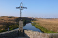
(1) 500 m before the village, leave this small road and take a grassy track on the right-hand side which climbs through the pastures and joins the ridge (look out for the reflective markers at the side of the road). Follow this path to its end, taking in the remarkable scenery. Note: there is a granite cross standing alone in a field on the right-hand side near Las Coumbos.
(2) Go past the fence on your right and follow the barbed-wire fence to reach the end of the pasture. You will then come to a track that joins the road below. Turn right and continue on to Gramont.
(3) At the first house, ignore the path that climbs up to the right after the fountain and carry on along the road until you reach the Pont de Gournier.
(4) Cross the bridge over the Bès, then turn left onto the D12. After a few metres, at the cross, follow the path on the right (GRP® signposted) to Recoulettes.
(5) In the hamlet, keep to the right. A small road winds through a jumble of granite boulders and climbs up to Recoules-d’Aubrac.
(6) Walk past the cemetery and the church on your left, then keep to the right at the corner by the lodge. The small tarmac road markedGRP® is very quiet and, if you take care, will take you back to the D12 towards the village of Saint-Urcize.
(7) Once you’ve crossed the bridge below the village, take the first street on the right. At the junction, continue left onto Rue du Carrierou, then right onto Rue du Poustel. This narrow street soon gives way to a flight of steps leading up to the village centre.
(8) At the last few steps, turn left between the church and the town hall and walk up Rue Jean Vaissier to the corner where there is a café.
(9) Then turn left onto Rue du 19 Mars 1962. The road runs past a car repair garage and then the tourist office. At the next junction, ignore the road on the right leading to the campsite and continue along Rue du Champ de Rambaille.
(10) At the bend, keep to the right and follow the small road downhill, which runs past a few houses on your left before joining a path signposted “Aubrac au cœur”.
(11) Carry on straight ahead at the cross. Cross the small stream and follow the River Hère on your left. The PR® trail then winds its way up the Hère valley, passing close to the Gouteille Waterfall.
(12) At the junction, keep left below a development of wooden chalets.
(13) Ignore a track on the left and continue south-south-west between the peat bogs. Enter the Bois de Saint-Urcize.
(14) At the crossroads, take the path opposite (cross-country ski trail). Continue through the woods, staying on the main signposted path.
(15) At the ski lift pylon, below the Croix des Goutals, climb over the fence via a ladder and walk along a low stone wall on your right-hand side, which borders the forest.
(16) At the end of this, climb a few metres up to the left and step over another step-over. Follow a wall on your left. Cross a track and, before the slope, cross the plot, veering to the right to reach the low wall opposite.
(17) Turn right and follow the low wall on your left until you reach its end (markers). Then head south-west and follow a fence on your right towards the strip of woodland alongside the road. Cross another stile to reach the D15.
(18) Follow the road to the left through a strip of coniferous trees. Note: fallen trees make the path treacherous in places. You will reach the Croix des Trois Évêques.
(19) Continue along the D15 to the Buron de Canuc car park. Note the Aubrac State Forest and the summit of Les Truques on your right.
(20) Carry on to the left along a single path that winds its way through peat bogs and pastures (follow the green markings). This will take you to the GR®65.
(21) Then follow the track to the right (green and red-and-white markings). Head south-east then south-west to join the D987 near the former Royal-Aubrac sanatorium.
(22) Cross the road and continue along the path opposite (still following the same markings).
(23) At the junction as you approach the hamlet, carry on straight ahead. Pass the former Dômerie on your right, then head into the centre of the hamlet and on to the Tour aux Anglais (E).
 Visorando Member
 Moderate
 Very difficult

 Easy