From Fontana to Barano via Monte Epomeo

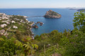
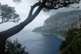
This is a hike that alternates between peaks, hidden valleys and countryside overlooking the sea. A few viewing points offer stunning panoramic views of the Aragonese Castle and the Bay of Naples, with Vesuvius as a backdrop. From Monte Epomeo, the island’s highest peak, there is a 360° view.

Details

n°22166373
Creation:
Last update:
Last review:
  • Walking
    Activity: Walking
  • ↔
    Distance: 5.41 mi
  • ◔
    Average duration: 3h 35 
  • ▲
    Difficulty: Moderate

  • ⚐
    Back to start: No
  • ↗
    Ascent: + 1,273 ft
  • ↘
    Descent: - 2,005 ft

  • ▲
    Highest point: 2,516 ft
  • ▼
    Lowest point: 728 ft

Photos

Description of the walk

The walk starts at the entrance to the village of Fontana.
From the entrance to Fontana when coming from Barano, the starting point is at the junction between the SP270 and Via Militare.

(S) Take the tarmac road that winds its way up towards Monte Epomeo.

Note: if you wish to avoid a 1.5 km stretch of road, ask to be dropped off directly at the next junction.

(1) At the Y-junction, turn left. Pass the first restaurant, “Miscillo Sapori”, then you’ll come to a second restaurant, “La Porta di Agartha”.

(2) From there, leave the road and take a path through the woodland which heads slightly to the left, south-west, up a steep slope.

(3) Pass the path on the left leading to Pietra Dell’Acqua (see ‘During the walk’ or ‘Nearby’). The path then opens out, revealing the summit of Mount Epomeo. Pass the restaurant “La Grotta” on your right and climb up to the viewpoint nestled at the summit.

(4) From the summit viewpoint, walking north of the “La Grotta” restaurant, head to another viewpoint situated to the north-east.

(5) Head back down the same route to the “La Porta di Agartha” restaurant.

(2) Just past this, leave the path you took on the way up from Fontana and take a track to the left which then narrows into a path. Cross the Via Militare, which leads to the radio relay station, and rejoin the path directly opposite.

Ignore a few paths coming from the right or left, and head left past a small concrete hut.
The path then descends through the woodland and at one point takes on the appearance of a small canyon. At the junction marked by an old brick well, turn left onto another path heading east-northeast. You’ll soon reach Piano San Paolo: a small clearing with a wayside shrine topped by a large wooden cross.

(6) Take the inconspicuous path on the right which climbs through the woodland in a south-easterly direction towards Monte Trippodi. Towards the end, the path is rather faint but there is no risk of getting lost.

(7) Take in the view, then retrace your steps back to Piano San Paolo.

(6) Head to the junction by the brick well and take the path that descends due south, briefly following a ridge line. At the Y-junction, follow the path on the right which leads to a small building nestled in lush greenery.

(8) “This building, overlooking the sea, houses the remains of a wine press and barrel rings.”
Then return to the path you left earlier and continue the descent southwards. In a less wooded area, pass a wide, paved, stepped path on your right.

Walk past a few isolated houses and, when you reach an estate hidden behind a high wall, take a detour of about ten metres to the left to admire a stunning view of the Aragonese Castle against the backdrop of the Neapolitan coast. Return to the path and continue almost due south.

(9) Walk past the Madonna di Candiano, making sure not to miss out on yet another stunning view.
About 200 metres further on, the path joins a tarmac dead end near a water tank on the left: Via Vicinale Buttavento. Continue along this road, go down its seemingly endless flight of steps, then leave it a little further on by turning right onto Via S. Liugori.
Walk past the Chiesa di San Rocco and finish the walk in the square of the same name: there is a bus stop and a Tabaccio (S/E).

Waypoints

  1. S : mi 0 - alt. 1,473 ft - Fontana, Via Militare
  2. 1 : mi 0.85 - alt. 1,926 ft - Junction, turn left
  3. 2 : mi 1.04 - alt. 2,172 ft - La Porta di Agartha, restaurant
  4. 3 : mi 1.2 - alt. 2,254 ft - Path junction towards Pietra Dell’Acqua
  5. 4 : mi 1.43 - alt. 2,480 ft - Summit of Mount Epomeo, panoramic view - Sommet de l'île.
  6. 5 : mi 1.51 - alt. 2,480 ft - Second viewpoint
  7. 6 : mi 3.08 - alt. 1,506 ft - Piani San Paolo
  8. 7 : mi 3.4 - alt. 1,581 ft - Monte Trippodi
  9. 8 : mi 4.02 - alt. 1,516 ft - Construction, wine press
  10. 9 : mi 4.8 - alt. 1,194 ft - Madonna Di Candiano. Panoramic view
  11. E : mi 5.41 - alt. 728 ft - Walk past the church - Place di San Rocco, Barano d'Ischia

Notes

Water points
(3): in the toilets at the “La Grotta” restaurant situated at the summit of Mount Epomeo (and also in the toilets at other restaurants).

Shelters
The restaurants along the route are: “Miscillo Sapori”, “La Porta di Agartha” and “La Grotta”.
(8) The small building housing the remains of an old wine press.

Equipment
Standard day-hiker’s kit. Walking poles are recommended as some of the descents are steep.
In summer, bring plenty of water and something to cover your head.
The island’s hiking map is entitled: “Hiking Map of the Islands of Ischia and Procida – Kompass 680”.

Buses
The island has excellent bus services. ‘Tabaccio’ (tobacco shops) sell tickets (for a single day or multiple days) as well as a map of the network.
Timetables are not displayed at bus stops between villages, but are generally posted in the village squares.
Buses run from Barano approximately every half hour.
Make sure you validate your ticket well in advance of getting off the bus, as the fine for not doing so is €43 per person.

What you’ll find in Barano d’Ischia

“Tabaccio” (tobacco shop), a fruit and vegetable shop, a small supermarket, a cash machine and a hotel-restaurant.

Card payments

Occasionally, the internet connection may be unreliable and prevent this payment method from being used: in this case, please ensure you have sufficient cash.

Worth a visit

Things to do

Visit the “Casa Museo” before setting off on your hike. The museum is on the SP270 as you approach Fontana from Barano.

Pack light and treat yourself to a meal on a terrace restaurant at the top of the island to enjoy the view for longer.
Booking recommended. Make sure the restaurants are actually open: generally, the tourist season begins in early May.

From (3), it is possible to walk a circular route to the “Pietra Dell’Acqua”. This is a rock that was once converted into a cistern. It is situated at the summit of Monte della Guardia: the island’s second-highest peak (alt. 720 m).
To get there from (3), the route is clearly signposted and can be followed without a map. Allow 45 minutes for the round trip.

Reviews and comments

3.8 / 5
Based on 2 reviews

Reliability of the description
4 / 5
Ease of following the route
3.5 / 5
Route interest
4 / 5
User 7624167

Overall rating : 3.7 / 5

Date of your route : Sep 20, 2026
Reliability of the description : ★★★★☆ Good
Ease of following the route : ★★★☆☆ Average
Route interest : ★★★★☆ Good
Very busy route : No

We couldn’t find the path to Monte Trippodi.

Machine-translated

LioA
LioA

Overall rating : 4 / 5

Date of your route : Feb 22, 2024
Reliability of the description : ★★★★☆ Good
Ease of following the route : ★★★★☆ Good
Route interest : ★★★★☆ Good
Very busy route : No

A pleasant route, but we couldn’t find Monte Trippodi – best to give this detour a miss

Machine-translated

Other walks in the area

For more walks, use our search engine .

The GPS track and description are the property of this route's author. Please do not copy them without permission.