Circular route from Campagnano to San Pancrazio via Piano Liguori

This walk begins almost immediately with a picture-postcard landscape offering a unique view of the Aragonese castle. In a hamlet that seems to have ‘sprung up out of nowhere’, a country café offers a gourmet break, and its terrace invites you to relax for a while whilst looking out over the island of Capri. The countryside, with its skilfully organised farmland, reveals at every turn a scene like an abstract work of art that you simply cannot tire of looking at.

Details

28911378
Creation:
Last update:
Last review:
  • Walking
    Activity: Walking
  • ↔
    Distance: 4.46 mi
  • ◔
    Average duration: 3h 40 
  • ▲
    Difficulty: Moderate

  • ⚐
    Back to start: Yes
  • ↗
    Ascent: + 1,864 ft
  • ↘
    Descent: - 1,860 ft

  • ▲
    Highest point: 1,198 ft
  • ▼
    Lowest point: 482 ft

Photos

Description of the walk

To get to the village of Campagnano by bus or car, see Practical Information.

In the village, the walk starts from the Piazza di Campagnano, where the Chiesa della Santissima Annunziata stands.

(S/E) Facing the church, turn right onto Via Campagnano and walk for just under 500 metres.

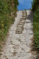
(1) Leave Via Campagnano and turn right onto Via Torre via a small stone staircase at the corner of a house. A sign and some electrical transformers are visible by the staircase.
After a short hairpin bend, the path then makes a 360° turn and climbs, sometimes through the woodland, sometimes above terraced vineyards, revealing the Aragonese castle. Walk past a picnic table, then leave Via Torre, which branches off to the left. Pass the junction with the path leading to the Cantina Torre di Mezzo and enter a mini-canyon.

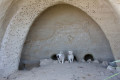
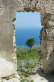
(2) This mini-canyon, which climbs steeply, is fitted with a wooden handrail. The path, which heads south-west, becomes less steep and runs close to a few isolated dwellings. Look out for a path on the left which climbs for about fifty metres to an open plateau where there is a ruined building with a lovely view of the island of Capri; then return to the main path and continue the route. Pass a shelter carved into the rock where some puppies have made their home, then a path on the left which branches off sharply, and continue south-west.

(3) At the T-junction with a bench and a metal post marked with a blue arrow, turn left at the corner of the first house in the hamlet of Piano Liguori. Continue along the narrow lane which descends towards the south-east, then crosses the hamlet and runs past a small restaurant which is a well-known stop for walkers.

(4) At the junction by this restaurant, carry on in the same direction and leave the hamlet. At the first junction, carry on south, keeping to the left.
Go down a flight of steps and, at the next junction, ignore the path on the right and continue roughly due south.
The path widens and, after a bend heading northwards, leave the path briefly to view the cliffs eroded by the elements, then rejoin the path leading to the Chapel of San Pancrazio.

(5) From the chapel, you can reach a cave situated below and then descend as close as possible to the headland, bearing in mind that there is a steep drop. Otherwise, turn back.

(4) Take the path on the right which goes round the Piano Liguori restaurant and then heads south-east before turning north-west through fields of vines and artichokes.

(6) At the three-way junction, turn right. The path overlooks the sea and the cultivated fields. Pass a restaurant nestled in the countryside on your left, ignore a path on your right that veers off sharply, and continue until you reach the junction with a wider track.

(7) Turn right at the fork. The houses become more numerous, some displaying remarkable architecture. Further on, you’ll come to a tarmac road leading to Via Campagnano.

(8) Keep left to follow this road, which leads directly back to the starting point at Piazza di Campagnano and the Chiesa della Santissima Annunziata (S/E).

Waypoints

  1. S/E : mi 0 - alt. 538 ft - Piazza & Chiesa della Santissima Annunziata
  2. 1 : mi 0.29 - alt. 492 ft - Stairs on the right
  3. 2 : mi 0.65 - alt. 971 ft - Steep climb
  4. 3 : mi 1.32 - alt. 1,099 ft - Metal post, first on the left
  5. 4 : mi 1.43 - alt. 1,040 ft - Junction with the Piano Liguori restaurant
  6. 5 : mi 2.16 - alt. 492 ft - San Pancrazio Chapel and cave
  7. 6 : mi 3.16 - alt. 873 ft - Three-way junction, on the right
  8. 7 : mi 3.58 - alt. 728 ft - At the junction, turn right
  9. 8 : mi 3.98 - alt. 568 ft - Via Campagnagno
  10. S/E : mi 4.46 - alt. 541 ft - Piazza & Chiesa della Santissima Annunziata

Notes

I – How to get to Campagnano:
I-1 – By bus:
The island has excellent transport links. ‘Tabaccio’ (tobacco shops) sell tickets (for a single day or multiple days) as well as a map of the network. Between villages, timetables are not displayed at bus stops but are usually shown in the main squares. Buses run approximately every half hour.
Make sure you validate your ticket well before getting off the bus. In 2022, the fine was €43 per person.
I-2 – By car:
From the SP270 (this road circles the island), from Via Michele Mazzella in the municipality of Ischia, turn onto Via Fondo Bosso. The road leading to Campagnano is clearly signposted.
Once on Via Campagnano, when you see the Chiesa della Santissima Annunziata, turn right onto Via Serbatoio and, 100 metres further on, turn right again to reach the car park (Parcheggio).

II – Equipment:

Standard day-hike attire. Walking poles are recommended as some of the ascents and descents are steep.

In summer, bring plenty of water and something to cover your head.

The island’s hiking map is entitled: “Hiking Map of the Islands of Ischia and Procida – Kompass 680”.

III – Water points:
None, apart from the restaurants located on or near the route.

IV – Shelters:
The few restaurants located on or near the route and the cave beneath the chapel of San Pancrazio (5).

V - Credit card payments:
Occasionally, the internet connection is unreliable and does not allow for this method of payment.
Some small shops and restaurants further afield do not have the necessary equipment.
Everyone should ensure they have sufficient cash to cover this eventuality.

VI – Bookings at restaurants along the route:
During peak season, it is best to ring ahead to book a table.
To lighten your rucksack, you can book a table at the restaurant in the hamlet of Piano Liguori, which is situated in the middle of the circular route, or at other establishments near the route.
The vegetables served at the restaurant in Piano Liguori are grown right next to the restaurant (mixed salads, artichoke fritters, etc.).

Worth a visit

During the hike:

The Chiesa della Santissima Annunziata, situated in Piazza di Campagnano, at the start of the walk.

Near the walk:

The Acquedotto dei Pilastri, situated on Via Michele Mazzella (SP 270).

Reviews and comments

4.6 / 5
Based on 3 reviews

Reliability of the description
4.3 / 5
Ease of following the route
4.3 / 5
Route interest
5 / 5
bolero
bolero
• Edited:

Overall rating : 3.7 / 5

Date of your route : Apr 14, 2026
Reliability of the description : ★★★☆☆ Average
Ease of following the route : ★★★☆☆ Average
Route interest : ★★★★★ Very good
Very busy route : No

Hike taken in April 2026 ... as for buses, there’s good service. Take the 182 or 183.
Otherwise, it’s best to follow the trail. There’s mobile coverage.
The spot where the puppies were must have grown up 🙂
I didn’t make it all the way to 5 and back...
A slightly tricky section with reeds between 4 and 6... but you can get through!
Magnificent view... Over to you!

Machine-translated

j-m-j
j-m-j

Overall rating : 5 / 5

Date of your route : May 10, 2024
Reliability of the description : ★★★★★ Very good
Ease of following the route : ★★★★★ Very good
Route interest : ★★★★★ Very good
Very busy route : No

The walk can be completed in its entirety; we didn’t come across any areas with rockfalls.
The round trip, excluding stops, takes 2 hours 30 minutes.
There’s a small restaurant about three-quarters of the way along the route.
Make sure you follow the path carefully, as there are numerous junctions.

Machine-translated

Pascal Goutier
Pascal Goutier

Overall rating : 5 / 5

Date of your route : May 19, 2023
Reliability of the description : ★★★★★ Very good
Ease of following the route : ★★★★★ Very good
Route interest : ★★★★★ Very good
Very busy route : No

It is no longer possible to walk from point 4 to point 6 due to rockfalls.
You must go from point 3 to point 6 via the path following the 310 contour line (marked with red and white markings).
A steep climb.
A very scenic walk with panoramic views along the terraced fields from point 4 to the finish.

Machine-translated

For more walks, use our search engine .

The GPS track and description are the property of this route's author. Please do not copy them without permission.