From Corte to the Chjarasgiolu footbridge via Punta di Zurmulu

U chjassu di Zurmulu
This walk, which is shaded for the first part, takes you to Punta di Zurmulu from Corte.
This small peak offers a panoramic view of the town, overlooking the citadel and the two valleys. On a clear day, you can even see the sea in the distance!
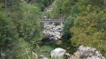
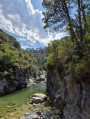
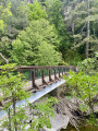
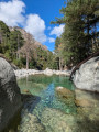
The second section takes you to the Chjarasgiolu footbridge in the Restonica Valley.
From this point, if you wish, you can then take the San Teofalu route (+ 2½ hours’ walk) to complete a circular route to the Chapel of Saint Anthony in Corte.

Details

47951803
Creation:
Last update:
Last review:
  • Walking
    Activity: Walking
  • ↔
    Distance: 2.65 mi
  • ◔
    Average duration: 2h 45 
  • ▲
    Difficulty: Difficult

  • ⚐
    Back to start: No
  • ↗
    Ascent: + 1,762 ft
  • ↘
    Descent: - 1,542 ft

  • ▲
    Highest point: 3,068 ft
  • ▼
    Lowest point: 1,335 ft
  • ⚐ Country: France
  • ⚐ City: Corte (20250)
  • ⚑
    Start: N 42.30239° / E 9.149559°
  • ⚑
    End: N 42.289274° / E 9.131783°
  • ❏
    IGN map(s): Ref. 4250OT, 4250OTR, 4251OT, 4251OTR
  • Hour-by-hour weather

Description of the walk

(S) Start on the heritage trail, between the Restonica entrance and the Pont Vieux.
Follow the heritage trail for 5 mins. Then follow the yellow markings, keeping the access to the houses on your left. You’ll reach the end of the heritage trail.
You can also start from the Baliri car park.

(1) Continue to the left. Then, at the sign for the U Tavignanu lodge, head to the right until you reach a Fork in the road.

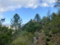
(2) Take the path to the left, which runs alongside a property enclosed by a wall. The climb to the summit is often very shaded. Climb first beneath oak trees, then in the shade of the heather. You’ll reach an exposed stretch of the climb

(3) Carry on, then continue the climb, in the shade of the pines, up to the pass.

(4) Then head left for a short, easy climb to the summit.

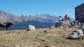
(5) You’ll be rewarded with a superb view overlooking the town of Corte and the citadel; to the left lies the Tavignanu valley, and to the right the Restonica valley. Behind you, directly ahead, a ridge runs off towards the Cappellacce sheep-farming plateau. To the left lies the summit of Monte Rotondu and, in the background, the Lombarducciu, which characterises the upper Restonica Valley.

(6) Head back down to the pass. Begin the descent towards the Restonica Valley.

(E) Arrival at the Chjarasgiolu footbridge.

There are two options for reaching Corte from the finish point (E):

- The walk can continue along the San Teofalu path (see description) via Punta di U Corbu (+2h30).
- Reach Corte via the Restonica road (3 km), either by shuttle bus or on foot (+45 mins).

Waypoints

  1. S : mi 0 - alt. 1,339 ft - Start of the heritage trail
  2. 1 : mi 0.31 - alt. 1,404 ft - End of the heritage trail
  3. 2 : mi 0.41 - alt. 1,440 ft - At the fork in the road, continue to the left
  4. 3 : mi 1.18 - alt. 2,126 ft - Ascent in open terrain
  5. 4 : mi 1.56 - alt. 2,864 ft - Pass
  6. 5 : mi 1.64 - alt. 3,068 ft - Punta di U Zurmulu
  7. 6 : mi 1.77 - alt. 2,789 ft - Descent towards the Restonica
  8. E : mi 2.65 - alt. 1,562 ft - Chjarasgiolu footbridge.

Notes

This hike is quite challenging, so don’t forget your walking poles – they’ll come in handy on both the ascent and the descent!

Worth a visit

- View from Punta di Zurmulu (5)

Reviews and comments

4.3 / 5
Based on 3 reviews

Reliability of the description
4.3 / 5
Ease of following the route
4.3 / 5
Route interest
4.3 / 5
paje18
paje18

Overall rating : 4 / 5

Date of your route : Jun 15, 2026
Reliability of the description : ★★★★☆ Good
Ease of following the route : ★★★★★ Very good
Route interest : ★★★☆☆ Average
Very busy route : No

The route is very demanding, and the descent to the bridge is… quite a challenge.
Walking poles are a good idea to help you find your way and avoid slipping.
Apart from the promontory on the way there and back, where you can enjoy a lovely view, the rest isn’t very interesting.
The return along the road isn’t very pleasant either, but it is relaxing.

Machine-translated

User 7086589

Overall rating : 5 / 5

Date of your route : Oct 20, 2025
Reliability of the description : ★★★★★ Very good
Ease of following the route : ★★★★★ Very good
Route interest : ★★★★★ Very good
Very busy route : No

A beautiful hike, pleasant and shaded on the way up. If necessary, you can easily avoid the final stretch to Zurmulu if you are tired, as the descent to the footbridge is a little steep and physically demanding! (You need to be fit and have good footwear!) We chose to walk back to Corte along the road, which is pleasant and very quiet in October...

Machine-translated

floste71
floste71

Overall rating : 4 / 5

Date of your route : Aug 19, 2024
Reliability of the description : ★★★★☆ Good
Ease of following the route : ★★★☆☆ Average
Route interest : ★★★★★ Very good
Very busy route : No

We completed both loops and then headed to the Rivisseccu footbridge, which took a total of 5.5 hours.

We recommend doing the route from Corte to the Chjarasgiolu footbridge via Punta di Zurmulu first, as it is more difficult. The final section to the tip of Zurmulu is not very well signposted, so follow the cairns. The first 20 minutes are quite steep and the last section is also downhill, so take care if you have weak knees.
The view is beautiful even in foggy weather (we didn't see the sea).

The route from the Chjarasgiolu footbridge to the Riviseccu footbridge can be done straight after and is easier.
A beautiful hike in a green and diverse landscape.

Machine-translated

Other walks in the area

For more walks, use our search engine .

The GPS track and description are the property of this route's author. Please do not copy them without permission.